
Day 0: A nice warm evening to set up camp at Hulme End for the first couple of days. My group would walk here from their start point. The sun is shining and I can relax while I wait for the boss to bring kit (tents, stoves and paperwork). Next to me were staff from Lichfield Cathederal School with their team the other side of the field.
Here is an especially interesting job. I have a single group from a school to Supervise and Assess for Silver Expedition. TN brought trackers to issue to the group. I’ve not used this one before, it seems especially neat and runs off an app on my phone.
Day 1: Meet the minibus at the start. They were late because one of the boys wasn’t ready. There are two boys and the rest were girls. Getting ready seemed straightforward, they seemed to know what they were doing. With all issued, they got away at 10.15am.
Problems arose before the first checkpoint which was about 3km from the start. They were to follow a bridlepath westward near the bottom of the map. They phoned me after 2 hours saying they were stuck. And they were – they were off the bottom of the OS map and needed interception, I could see on the tracker.. The tracker located them south west of their route so I send them SE to catch the bridlepath. In fact, they’d strayed off the bottom of their map.
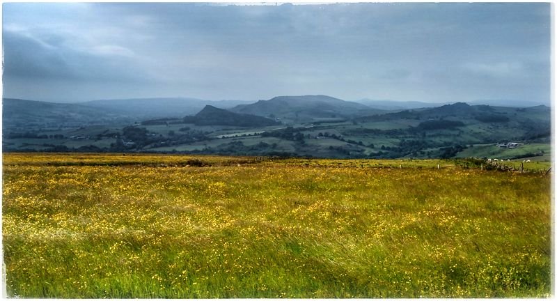
Day 2: The planned route was far too long at 27km. After yesterday’s progress it’s obvious they need less, considerably less; so I met the team in the morning and set them off planning changes. A new route can be more or less as the crow flies North East. Even so, they faced a 20km walk, though with a much earlier start. Even though the new route followed bridle path, they were back in the routine of crossing field after field. Each time they had to set direction, check where the cattle were and go. After maybe ten fields, there’d be a road or a turn. Then another ten.
Finally, a change of terrain on entering a lesser gorge Lathkill Dale. Later, they talked of their enthusiasm about this section. Many photos were taken. I waited at camp because this was the last leg, but then the phone rang. They were stuck. Apparently, their path was closed and one of the girls was in no fit state to go back. I set out to meet them.
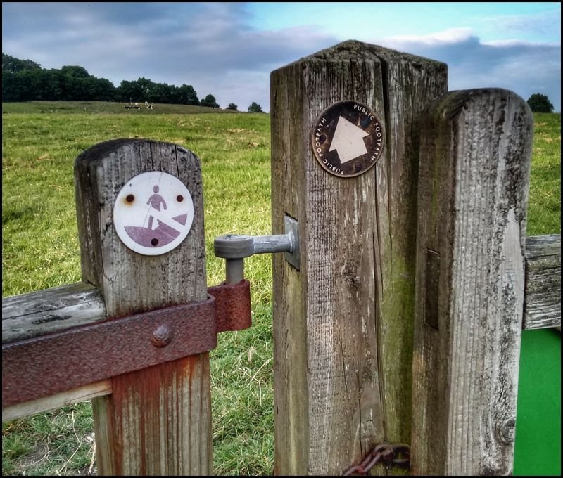
The photo shows a footpath gates with the sign indicating the end of Open Access land. The group had read this as no access. They were tired, not surprising after over ten hours of travel.
Day 3: to finish. Another radically redesigned route. They’ve come to the White Peak area, famed for upland farmland, white limestaone and cut with numerous gorges of geological interest. Their route was more fiddly field hopping with no recognisable purpose beyond running up the miles. Another day like Friday and I can’t see how they could pass. It could go either way.
Today’s new route took them down Biggin Dale onto the Manifold trail. Here is a dramatic change of scenery and a relief from endless rural field navigation. There was a chance that they could finish early but after two very long days, they all deserve it.
Going home: on the more eventful trips, I come away turning over thoughts in my mind. This time, I really felt for this group. I had spent all of my time thinking of ways to get them through to a Pass. I never wanted them to Defer, and I beleive I handled them well. They do have a pass but it hung in the balance for a few days.
