Arenig Fawr evening

10°C, dry with light high cloud.
I hiked with MapMyRide+! Distance: 13.75km, time: 04:35:00, pace: 20:00min/km, speed: 3.00km/h.

http://mapmyride.com/workout/2142590177

34089341941_2a57e13777_k

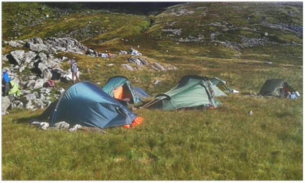
At 4pm, I decided to go. I was parked and in a good place to choose from a few options. The weather is very stable right now and it hasn’t rained for weeks. I threw some rude in the rucksack including my stove and supper. That turned out to be a very good idea. Just in case, I packed a spare torch too.
The route started simply, then a possible ascent onto the west of the ridge opened up.
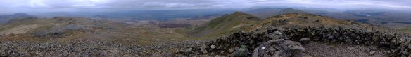
These aren’t massive mountains, so making the first top was easy enough at 700m.
I got my breath back while taking photos and then took the ridge East. The summit is visible all the way. A cairn at the top has very good shelters. There was an ideal spot to get the stove out and make cous-cous. To improve it, I sliced up some cheese and had a very pleasant meal in a rather wonderful place. Familiar mountains were visible in each direction. The Rhinogau, Cnicht, Snowdon and the Gliderau.

ML training expedition.

12°C, cloud from 50m, strong wind 40mph at 900m.​

Heavy pack was a drag on this climb. But to walk in a group, I was not left behind even though my bag was the heaviest (at 18kg).

We got to Foel Grach and I took the navigation from there to the next summit. 40mph wind and rain was quite a force away from the shelves of a wall. Paths are, however; easy to follow up there. Jenny navigated to the next summit which has a mountain rescue shelter that we recovered in for a while.
Descent to the lake also offered some respite, although the wind dropped, gusts were stronger.
Our intended camp was confirmed when we found aircraft wreckage by a small lake. We all pitched together by some crags.
I was glad to climb in and change into some dry clothes.
Night navigation: u that was hard. Wind, hill fog and bouts of rain made visibility poor at best. We had to figure where we are at any time from the slope of the land in a circle 20m around. Occasionally, you can use a arch as a landmark, or grass but that’s all. But, it is actually enough.
Two obstacles were tiredness and the visibility. If only there was a clear sky above.
I think I did okay.
Mike, the trainer thought so too. However, I have a few problems to solve:
Poor vision in rain,
Keeping warm,
Feeding in the night.

Banshee 200.

4°C, bright but rain later.
image

New tent; for wild camping. It’s similar to erect to my old faithful Tempest 300. The idea is to pack this into my 65 litre pack and use for wild camping. I shalln’t wait for the Diamond Challenge trip, with the first excuse, I’ll go. That means keep the big pack ready to go. The carry mat I used in the bivvy last year seems heavy, perhaps one of those cheap foam mats with foil on one side could be strapped to the pack.
It matters whether to lie foil up or downwards. In the bivvy, it should be upwards so you can turn over in the night without the mat sliding away.

Fun times lie ahead.

Coldest night.

-6°C clear and still.
I knew it would be cold so took precautions.

image

Pistyll Rheaedr, highest drop waterfall in Wales.

Last night I used my survival bivvy over the sleeping bag. It gives an extra layer, especially when there’s a breeze.
My Rab bivvy is full sized, enough to pull over my head (and zip closed). It also has plenty of wriggle space which is enough for a fleecy blanket. That seemed to work well. I was comfortable even when the thermometer reached -2° inside the tent.
There were a few possibilities for the coming day. Walk on the hill again, shop in Betws-y-coed, or go home. The decision was made while fixing breakfast. The campsite has outside sinks and taps. They were frozen. No water! I’m not walking without water.
Betws-y-coed has one of the finest cafes in Wales. After careful packing, I headed for a nice lunch.