.
34-40°C, no wind or cloud.

.
34-40°C, no wind or cloud.
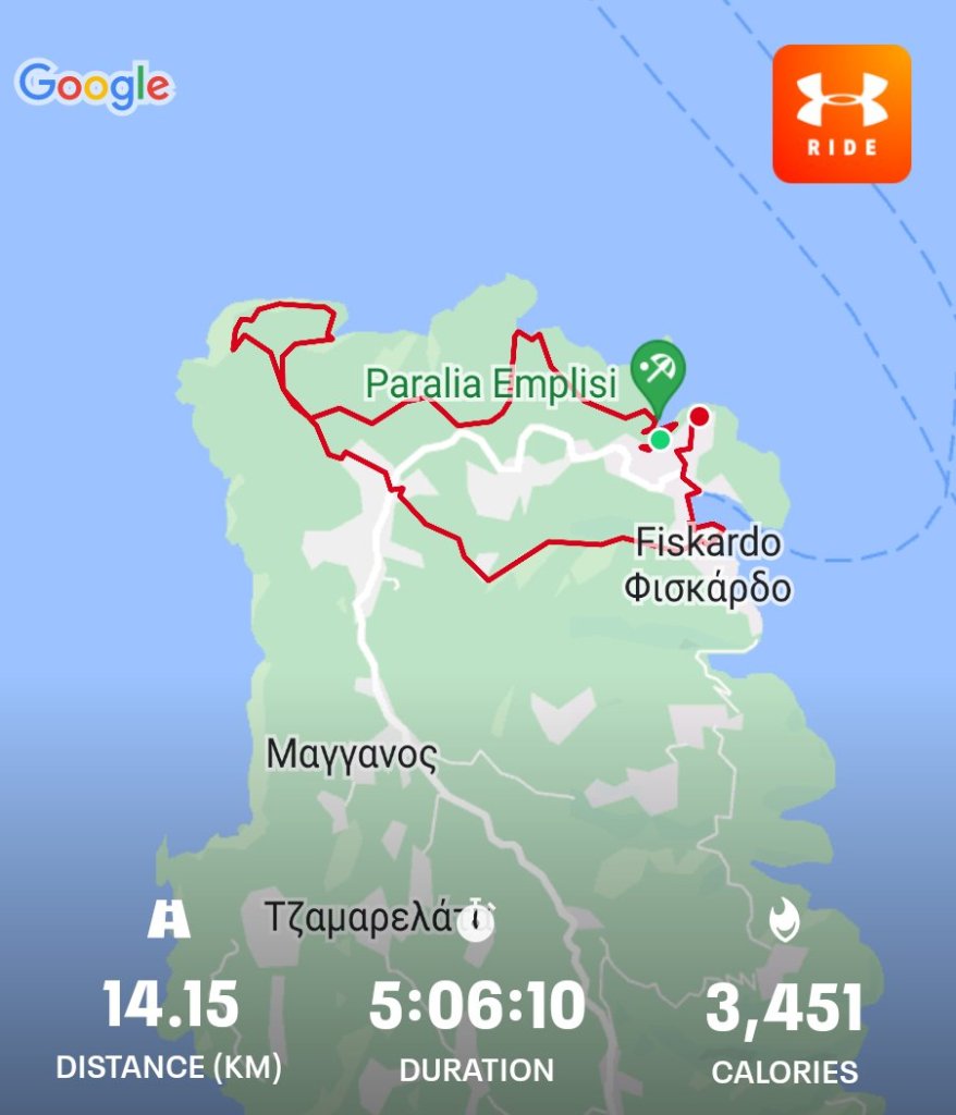
We’re working with a lot of groups, 127 kids in all. They’re doing Bronze qualifying. Here is another place I’m familiar with. The weather should be good.
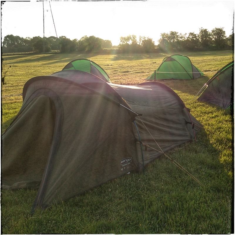
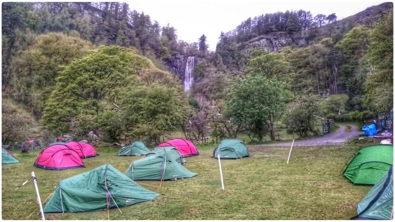
Day 0: A nice warm evening to set up camp at Hulme End for the first couple of days. My group would walk here from their start point. The sun is shining and I can relax while I wait for the boss to bring kit (tents, stoves and paperwork). Next to me were staff from Lichfield Cathederal School with their team the other side of the field.
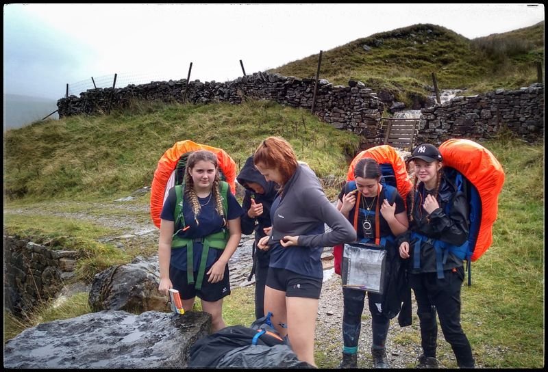
Here is an especially interesting job. I have a single group from a school to Supervise and Assess for Silver Expedition. TN brought trackers to issue to the group. I’ve not used this one before, it seems especially neat and runs off an app on my phone.
Day 1: Meet the minibus at the start. They were late because one of the boys wasn’t ready. There are two boys and the rest were girls. Getting ready seemed straightforward, they seemed to know what they were doing. With all issued, they got away at 10.15am.
Problems arose before the first checkpoint which was about 3km from the start. They were to follow a bridlepath westward near the bottom of the map. They phoned me after 2 hours saying they were stuck. And they were – they were off the bottom of the OS map and needed interception, I could see on the tracker.. The tracker located them south west of their route so I send them SE to catch the bridlepath. In fact, they’d strayed off the bottom of their map.
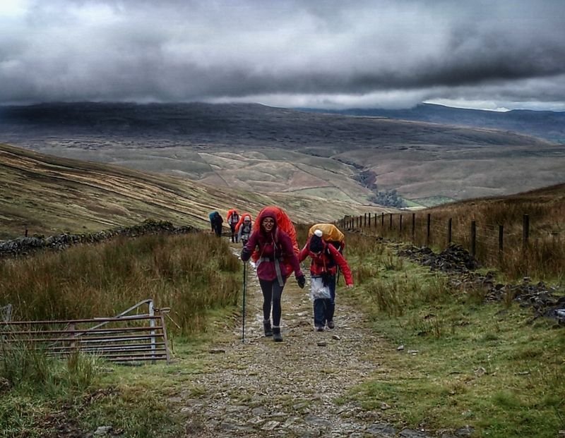
Day 2: The planned route was far too long at 27km. After yesterday’s progress it’s obvious they need less, considerably less; so I met the team in the morning and set them off planning changes. A new route can be more or less as the crow flies North East. Even so, they faced a 20km walk, though with a much earlier start. Even though the new route followed bridle path, they were back in the routine of crossing field after field. Each time they had to set direction, check where the cattle were and go. After maybe ten fields, there’d be a road or a turn. Then another ten.
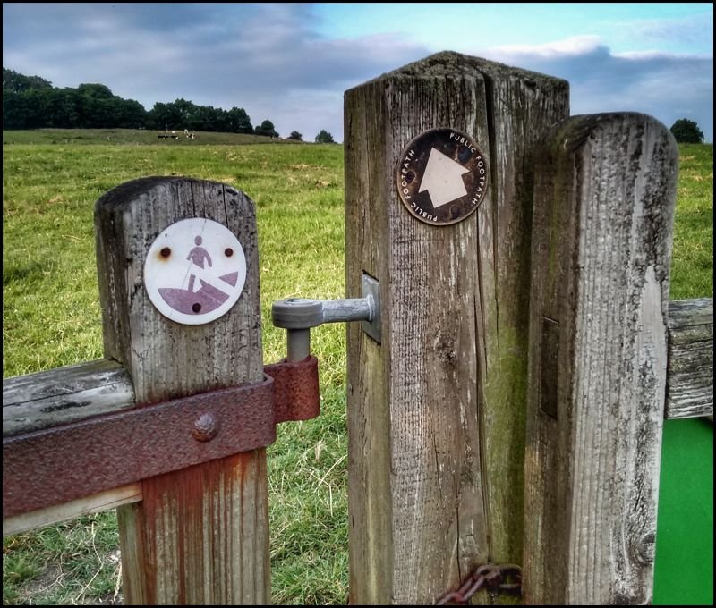
Finally, a change of terrain on entering a lesser gorge Lathkill Dale. Later, they talked of their enthusiasm about this section. Many photos were taken. I waited at camp because this was the last leg, but then the phone rang. They were stuck. Apparently, their path was closed and one of the girls was in no fit state to go back. I set out to meet them.
The photo shows a footpath gates with the sign indicating the end of Open Access land. The group had read this as no access. They were tired, not surprising after over ten hours of travel.
Day 3: to finish. Another radically redesigned route. They’ve come to the White Peak area, famed for upland farmland, white limestaone and cut with numerous gorges of geological interest. Their route was more fiddly field hopping with no recognisable purpose beyond running up the miles. Another day like Friday and I can’t see how they could pass. It could go either way.
Today’s new route took them down Biggin Dale onto the Manifold trail. Here is a dramatic change of scenery and a relief from endless rural field navigation. There was a chance that they could finish early but after two very long days, they all deserve it.
Going home: on the more eventful trips, I come away turning over thoughts in my mind. This time, I really felt for this group. I had spent all of my time thinking of ways to get them through to a Pass. I never wanted them to Defer, and I beleive I handled them well. They do have a pass but it hung in the balance for a few days.
Warm and sunny, upto 22°C, dry with a brisk southerly.
This trip marks some interesting health issues. I had my second Astra-Zenica jab the morning that I drove up here. Like last time, I had a head-ache over night and a mild aching feeling all over. On the morning I started walking, I too 2 ibuprofen.
Anyway, I pressed on without entirely losing that side-effect feeling. The route is quite long, half of it is in farmland. There was a problem on the Pennine Journey leg with herds of cattle. I got encircled in one field and had to vault over a fence. That got the adrenaline up, I headed back and along another track to rejoin the road.
It’s fortunate that I did because it soon became obvious that the next field was filled with cows, this time with calves. I’m glad that I didn’t get stuck there with only a large field of cows ony escape route.
I suspect that I’ve had a mild dose of long-covid since Christmas. It’s no more that a low-level can’t be bothered feeling. Normally, when I skip a bike ride, I’d get the agitated fizzy legs feeling; not so this year.
After this trip, the old feeling has come back. I’m stronger and feel more ambitious physically. There are reports that discuss the possibility that a vaccine can switch off long-covid
Day 1: transfer and setup. A sunny day to pick up the Gold group in the minibus and then drive to the sales, a 150 mile drive. All vehicles stopped at Charnock Richard services on the edge of Chorley. We all stayed at Broadrake bunkhouse in Chapel-en-le-Dale with a fine view of the Ribblehead Viaduct
Day 2: Acclimatisation day – Ingleborough Falls. Cold wet start with showers all day. We took 2 groups each for a circular route from Ingleborough via the falls. The aim was a refresher in navigation and of course – some dramatic waterfalls. I’m not normally impressed by waterfalls, but these were very energetic. With rivers in full spate, the water roared over every rock and even more over each cascade. So full of sediment, the fluid looked like beer. We talked about the colour and how it’s caused by tannin. One of the kids asked if it’s basically tea? You can tell when kids are bright and imaginative. These are!
Day 3: (day 1) for Silver groups). Middleton Fell.> Holme Farm. Beautiful day with a frosty start for campers. I bet those kids were cold.
Day 4: (silver 2): Holme Farm > Dent. Dull but calm weather all day. All went well but this was a late finish, I was so hungry, even before the drive back to the bunkhouse.
Day 5 (Silver 3): Dent > Widdale (finish). Heavy rain to start but it eased off by departure time at 8.
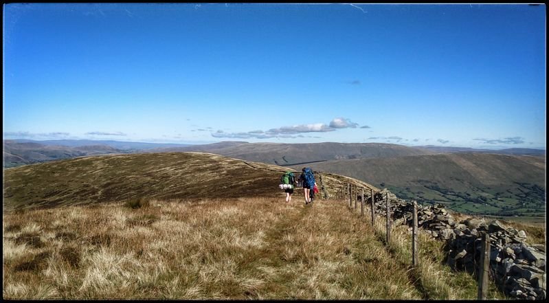
Here are my group, layering up after the climb. This is near the pass by a full gully that looked quite hazardous. I called for another ML to come and man this one while I took the crossing at the summit.
Later, another group who most were from my old tutor group arrived. They too were full of beans, and pleased to see me.
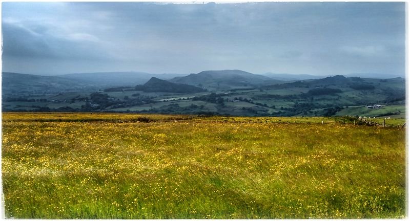
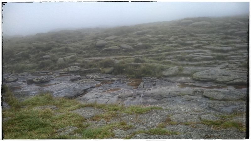
I love these places, in the hill fog more so. My spot was in a corner to hide from the chilly breeze. Here, the stone walls were covered in half a dozen types of lichen. My old tutor group team had lichens as their aim so I gave them a little tour of the varieties here. I love these bleak misty moorlands. The form of the land is laid out in layers in the fog. Perhaps caused by the contrast, the nearest ground appears the most vivid. On a clear beautiful day, your gaze is drawn into the distance. Today, you see beauty nearer to your feet.
The end of the day was the journey back to Walsall. My job was to take the Gold group back in the 9 seat minibus. I took a moment to look at myself from the outside. In the driving seat, They sat in the dark, viewing a segment of their lives through the window of their phones. The rusty sun dipped down on the right horizon and the lane lines blinked in the headlight patches. They were contented, comfortable and had passed their Gold Expedition section. I glanced across at the kids in the front seats. I looked across and smiled to myself in the dark. A moment of satisfaction for me too. Onward, the miles rolled by.
This would also be a late finish.
18°C, grey with slight drizzle.
17.0: a day filled with logistics. Google’s satnav took us round the long way to Edale. Then I had to ferry kids from Hope because the coach driver refused to drive to the carpark in Edale. We’re all baffled by his refusal since there are 2 other coaches already there.
17.2: Tuesday – a 15h30m shift on Kinder Scout. Rain and very late groups. 1 group made such a mess of nav that they didn’t get onto the hill and were found in the afternoon – back at the start.
17.3: crossing Ladybower. To a lovely little campsite at North Lees near Hathersage.
Much better day for all groups. They’re getting tired as usual. The overnight camp was basic to say the least. In my opinion, we should stay in the area, within radio range anyway. That way we can get there early and urge them away by 07.30. Their night’s sleep wasn’t enough after Kinder.
I was a little worried about one of my group’s confidence and navigation so I decided to walk halfway with them. It was here that I hit on the idea of a neat nav teaching method. I’ll explain…
If your group has a few navigators and the others trail along, then this might demonstrate how information and observations should flow through an effective group. Sit one kid down with a map; preferably in a hollow so they can’t see much. Others can then take turns giving them information until they can locate the group. Here is a field boundary, this way slopes down, that way is north etc.
I’ve only tried it a few times, but it does seem to work!
17.3: along Stannage Edge. A good geological handrail. After the road crossing, they go up Moscar Moor. It’s a fine place to set up a checkpoint I found. I sat in a hollow the bits where it rained but eventually, the groups brought the sunshine. Some got stoves out and cooked lunch. Others wanted to march through and get back first.
We finished ontime with all groups safely completed. Then logistical problems started. The coach was late again. Part of the M1 was closed, but then again- why did it go on the motorway? Nobody knew.
I was able to get off with my Year 11s easily enough in the minibus. The coach didn’t get the Y10s to school until about 9pm. Outrageous! The staff were livid. That’s the third time the same coach company let us down in a fortnight.
30°C, full sun, light wind.
We were issued with detailed plans this morning and I am working as a Supervisor along with an Assessor, we have three groups to manage. We have a uniform tower and have radios for staff only. For the first time, we issue GPS beacons. These only return a position once pinged by the expedition manager. That sounds better than some centres who monitor a continuous track.
15.1: Their routes are very similar but they were spread out over time. The extraordinary heat didn’t harm the kids’ progress as much as other schools. The Chase does offer good shelter amongst the trees. The last groups required a ping a few times and they finished 2nd to last.
15.2: most of the routes are very similar today now we have come.down from the Chase onto low farmland. The slow group from yesterday we’re even slower today. They have many many breaks.
5°C, gales and heavy rain all-day.
Thirteen girls on Silver practice. I picked them up this morning and eventually started them off in Corwen, North Wales.
DofE 5.1; I’m taking 3 silver Practice groups to Corwen. Thus turned into a very late finish after compounded problems. The worst was Storm Hannah. We got off with a day of light rain, most of the storm blew out during the morning drive. However, it still sapped the morale of my groups who them went in circles in the woods after dropping down from the Moors. Group 2 was not heard of since the moor top, their radio had failed (I’m told it got wet), and there was no phone signal. By 8pm I was stressed looking for them in the bus while shepherding the other 2 groups into camp.
I should not have had 3 groups to manage but a member of staff dropped out and wasn’t replaced.
They needed some help at camp, one tent lacked pegs for example. At about 21.30, I got away for the 45′ drive back to the staff camp at Pistll Rheadr. See note later#.
5.2: Cadair Bronwyn; head up to the summit via Cadair Berwyn to man a checkpoint.. The storm has cleared with light winds and a cloud base about 1,000m above the tops. Even so, problems arose for group 1 early. One girl returned to the start feeling ill escorted by her team. Thus, team 1 ( who combined with G2) started again to arrive 4 hours late at the summit.
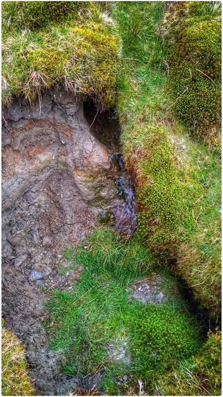
The prospect of another late finish loomed large. I redirected their route away from the 2 summits and refreshed their water supplies. The photo shows the spring I filtered from. An excellent spring I thought. Tasty water too.
To come off the hill, I escorted a walking casualty off the hill, their prime navigator as it happens. Good that they had other good navigators in the now merged team. They can’t travel as a 3 so I merged all three teams into one group of 8.
A colleague offered to drive over and see my group in, he could see how tired I was after that very late finish. I was worried about driving feeling like I did but was despirate to see them. Reluctantly, I agreed.
Apparently they didn’t arrive to camp until 8pm. We got in about 7pm along with another unwell group. That put me on the opposite side of the mountain from my own teams. Deeply unhappy about this, one of the ML guys knew about my 01.30 finish and could see how tired I was. He offered to go over to catch them, along with CH. Two MLs had to go in case a night search was necessary.
5.3: 9km to the finish on relatively low terrain, only 540m top.
#1: I’m going to camp nearby next time. This valley has no signal for any network and there is no landline or VHF reception. This troubles me profoundly. What if there was a first aid emergency in the night? We got away with this, but not again.
22°C, milky sun and light wind
Parked after a fairly short drive from home and climbed Parlock in the Forest of Bowland. I got to the summit of Fair Snape Fell for supper in the shelter.
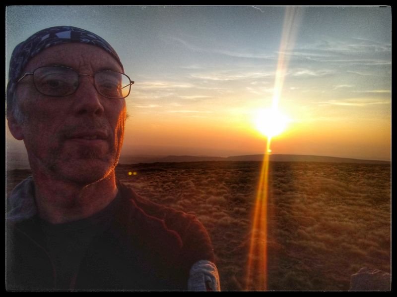
As the sun set, it approached its own reflection in the sea off the coast of Blackpool. Soon after, I headed off to find somewhere to set camp.
My little Banshee fitted out of sight in the dried up bogland. To avoid being seen, I found a shallow dip where my headtorch would not be seen.
5°C, strong SW wind with showers.
This is what DofE leaders do in the off season.
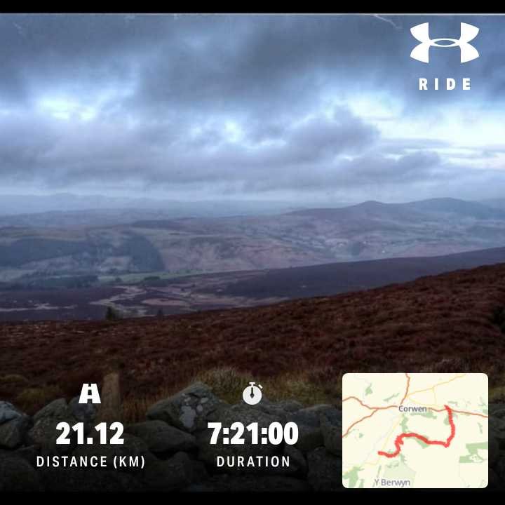
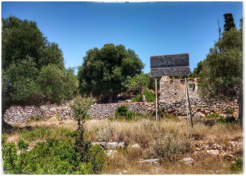
We met up in Carrog to try out a route that is intended for the silver and gold groups at Easter.
The conditions were okay, if you’re dressed correctly. Luckily, the wind was on our backs during the most exposed sections. The only problem was navigating rural land where there were no signs. In one place, the bridal path passes through a private garden. There was no indication on the closed gate that there exists a right of way. The kids will be confused and probably become lost here.
