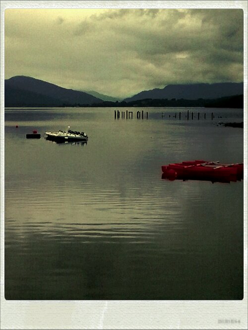
16C, good start.
Creag Meagaidh is just one summit in a horseshoe of others well over 3,000ft. They form an undulating ridge with fascinating and varied views all round. Start at 9.30, but it still took me till 15.00 to reach the title summit. Okay, so I had to take a catnap on the plateau, but still…
That felt like a very hard day. I don’t know how it happened, but I normally don’t read the time very often. But when I did, it was quite a shock that it read 2pm and I had not wet eaten lunch. Terrible, no wonder that I felt so dreadful. Why not have a sensation of hunger to make it unnecessary?
Anyway, a great day only marred buy a tricky descent through a birch forest, the path was hidden, roots were a serious tripping hazard and the rocks mossy and slippery as ice.
Category Archives: Travel
Wild camp: Bohuntine
21°C, very wet morning, lovely later.
The bothy is out of reach, the river in spate, is impassable. I did try, but the brown water is too strong and deep in the middle.
It’s been a good day, all went to plan despite a rotten start. Rain poured all night, so it looked daunting. Once I got underway, the sky cleared and great photos presented themselves.
Today I did the half day walk intended- Bouhontine and the parallel roads. Guide-books always show photos of them them in winter but they are quite clear even now, all covered in grass, heather and bracken.
The best part of the walk was the secret valley behind Bouhontine hill.
As I write, I any lying in my tent, awaiting a good night’s sleep. Last time I wildcamped, I was spooked by a bellowing stag.
Wish me luck.
Buachaille Etive Mor
14°C, rain in afternoon.
Ridge walk with 4 summits over 3,000ft, though only 2 count as Monroes. The main feature was a snaking ridge which could have revealed breathtaking views if the cloud cleared. Only the first summit was clear and it stood over Rannock Moor with layers of mountains that ran on forever.
So, today’s summits-
Stob Dearg 1022m
Stob Na Doire 1011m,
Stob Coire Altruim 941m,
Stob na Broige 956m.
The last three formed an undulating ridge which was easy to navigate, even in cloud.
Unmentionables
19C, heavy rain.
Collected some furniture from Bolton. There is the drawback of buying through ebay. The drive was not too far but it meant travelling to towns entirely unfamiliar. West Lancashire looks quite okay, not exactly “desolate” as the Tories think.
The satnav did not, however, cope well with a closed road in the town. It took me over circuitous routes, each time, back to the road closure.
The guy who sold it explained that he’d moved house recently and that his wife used it to “keep her unmentionables”.
Metric Century.
Saturday ride- MapMyRide! Distance: 67.47mi, time: 04:21:03, speed: 15.51mi/h.
http://mapmyride.com/workout/345366821
The last few days I have had the fizzy legs syndrome. At last it’s good after this ride.
The ride was long enough to test the phone’s battery booster. Tracking with my little smart phone really drains the battery, some days down to 25%, or less. Today, I got home with 96% charge. A result that bodes well for highland hiking this coming week.
Left or right.
22C, heavy showers,
CR- Distance: 35.98mi, time: 02:11:23, speed: 16.43mi/h.
http://mapmyride.com/workout/340593693
Hill walking builds up different muscles, most noticeably quads. You can feel the extra push forward over the top of the pedal stroke. Sprinting and hill climbing show the effect the most, or is it because I an lighter now?
Rode back home down a single-track lane with a couple of pedestrians blocking the lane. I called out “excuse me”.
Then I got told off! ” you need to say left or right” she said. “No, you need to stop walking down the middle of the road!”.
Really though, they need to walk on the right so they are facing traffic.
The road to Penmachno
22~18°C, wind bringing showers. Very heavy later.
This desolate land, endless seas of grass torn in places by rock and forest. I am drawn here time after time. Such melancholic open space. Endless.
Maybe one day I will camp the night in some hidden hollow so I may absorb its magic.
That little place in the photo turned out to be a cafe. Not like any ordinary cafe, more like visiting a family home. I sat with a cup of tea and chatted with the family plus visitors for nearly two hours. A conversation started by my asking for places to stay nearby. “It depends on what kind of place you are after”. I said “preferably camping, something wild”. the guy told me of bothies and showed their positions on the map.
That sea of grass I have talked about is very boggy though. Deep enough, often to get above your knees. I will have ot take care with that. Bothies means no need for the tent, but on the other hand, I may have to carry firewood.
Rhinog afternoon.
22°C-ish,clearing but rain evening.
Climbed Rhinog Fawr 724m alt (according to my phone GPS app). There were a few groups of people on the summit, mainly those who had taken the same route as I.
We all agreed that Wales was very quiet compared to usual for an end of July weekend. Anyway, after a very slow start that saw us leave at 11.30, the day just got better starting with sunshine on that summit.
Now I’m lying in the tent in the pouring rain on this, the last night before we go home.
Llanbedr beach.
26°C, no. wind, no clouds.
Moved camp. South to Llanbedr. There is a very nice flat walk around the old airfield. It’s a nature reserve with few paths. This shows in the lack of erosion of the ground, the bare sand is created by rabbits, not man. Walking through willow-herb, clouds of butterflys filled the air.
I walked west towards the sea. This stew should be a quiet stretch of beach. Dunes form more ridges than expected, but eventually the last one reveals the sea.
There were people, but not many, and they were separated by large gasp. It was a while before I noticed that they were all naked. I have walked into a naturist reserve.
So I went for a swim. No need then, to get my clothes wet.
Cwm Bycham is very still this evening. The only sounds are from livestock, their belly calls reverberate as if the sound is feeling it’s way across the rocky sides. The sound seems to probe the shard of the land as a whale might.
Downpour
21°C, thunderstorms,
Woke early to the sound of thunder, later came the downpour to beat all.
Arrow ride tracked with MapMyRide! Distance: 42.79mi, time: 02:42:39, pace: 3:48min/mi, speed: 15.78mi/h.
http://mapmyride.com/workout/335549677
I went out on the Arrow after the rain fearing that more was to come. None did, but the bike handles well enough for a summer ride.


