Hard on the hands.

15°C, Brisk SE wind, mostly sunny, entirely dry.

I rode The Jake with MapMyRide+! Distance: 72.78km, time: 04:10:50, pace: 3:27min/km, speed: 17.41km/h.

http://mapmyride.com/workout/2160239831

It’s all dried and cracked out there. Even molehills are as hard as stone. The big feature of the day is wind. A strong, dry south-easterly, which can only dry out the land more.
The vibration is hard on the hands. Suspension, at least on the front would solve this. The beach was firm too. Overall, average speed was low today. Partly that’s the conditions, you can’t ride off-road as quickly. The other part is that my fitness isn’t as good this year.

The dark side of Aughton.

11°C, light cloud, SE breeze.

Today, I walked to town the scenic route to go shopping. I crossed fields and passed a water pumping station with a view over the town. On the edge of the ridge is a modest nature reserve with gorse and wood.

All around this nature reserve is a border of Silver Birch trees. Somebody doesn’t like them. Perhaps they block their view. There is a house with plastic fake lawns. Is it their idea?
These signs weren’t cheap to make. They are printed plastic signs of the sort made professionally. There were about ten signs, on boards like the photo, and screwed onto tree trunks. All but one were gone by the time I returned an hour later.
A couple walking their dog told me about an incident nearby. They walked on a grass verge to avoid traffic. A woman in a car wagging a finger at them said: “that’s not a place to let your dog mess”. the dog hadn’t and the woman was carrying a little black bag from an earlier poop by the pooch.

Summer snow.

2°C, light wind.


Snow in summer term? I always knew it was possible, we’ve had snow in April before. It once closed schools in April too. Today’s snow was only thin, but it’s there. However, it didn’t take tong to melt in the sunshine.

Return from Cafngaw.

8°C, no wind, white cloud and dry.

I hiked with MapMyRide+! Distance: 10.35km, time: 04:16:00, pace: 24:44min/km, speed: 2.43km/h.

http://mapmyride.com/workout/2142592775

Cefngw bothy.


Up a bit late so finally woke after 7am. I blame that chocolate muesli bar from Aldi. Strong chocolate can do that. After walking for over 8 hours, I should have fallen into a solid sleep quickly. Normally, that’s what happens. I woke in the night after anxiety type dreams. I was worrying about the car in that isolated car park, away from the road. Images of broken windows and fire damage pestered my mind.

Woke late, the day was an hour old by then. At least I got the tent down quickly. Then plotted a route back that loops around the north of the mountain. There is a lake that might be good to visit but I missed it while picking the easiest route through the heather.
Once past the bwlch, the land opened out into an enormous ocean of grass, softly undulating to the northern horizon. I wonder whether Scotland has anything like this?
Curving round to the east, the land dipped towards the first signs of civilisation. A couple of farms appeared on the Llyn Arenig which flows into the reservoir by the car park.

Rather like the start, signage is poor but the public paths were clear enough on the map. I don’t like simply striding through somebody’s farm, especially with newborn lambs. I took a wide circuit around them. It’s no good to cause stress to their mums.

Arenig Fach up.

8°C,light wind and dry. Some cloud above 500m.
I hiked with MapMyRide+! Distance: 10.21km, time: 08:15:00, pace: 48:29min/km, speed: 1.24km/h.

http://mapmyride.com/workout/2142574688

Stuart at about 10.15. The first paths were a bit tricky to find. The map was clear enough but on the ground, no signs, so stiles, nothing. I have always wanted to walk the Migneint Moors, now here’s my chance. It wasn’t as boggy as I expected but kid heather was hard work. This spring has been quite dry, I’m grateful for that.
The trick here is to look well ahead to find strips of grass that run between heather fields for easier passage. It’s worth getting to a ring contours for the view ahead. Even here, grass is in big tussocks, so each stride is awkward. People with shorter legs might struggle. I wouldn’t bring a DofE group here.
34089312921_4a4f52d2bc_z

Arenig Fawr evening

10°C, dry with light high cloud.
I hiked with MapMyRide+! Distance: 13.75km, time: 04:35:00, pace: 20:00min/km, speed: 3.00km/h.

http://mapmyride.com/workout/2142590177

34089341941_2a57e13777_k

At 4pm, I decided to go. I was parked and in a good place to choose from a few options. The weather is very stable right now and it hasn’t rained for weeks. I threw some rude in the rucksack including my stove and supper. That turned out to be a very good idea. Just in case, I packed a spare torch too.
The route started simply, then a possible ascent onto the west of the ridge opened up.
These aren’t massive mountains, so making the first top was easy enough at 700m.
I got my breath back while taking photos and then took the ridge East. The summit is visible all the way. A cairn at the top has very good shelters. There was an ideal spot to get the stove out and make cous-cous. To improve it, I sliced up some cheese and had a very pleasant meal in a rather wonderful place. Familiar mountains were visible in each direction. The Rhinogau, Cnicht, Snowdon and the Gliderau.

Southport front.

11°C, sunny with strong W, dry.
I rode The Jake with MapMyRide+! Distance: 62.68km, time: 03:11:43, pace: 3:04min/km, speed: 19.62km/h.

http://mapmyride.com/workout/2127494444

Overnight rain dampened the ground somewhat. It dried up during the day.
HDR; although I like the hdr effect on photos like this, it is only an effect. The app uses a kind of bass-relief method rather than genuine multi-exposure merging to create the high dynamic range. It might be interesting to try out the techniques with my new Fuji X-10. It’s a compact camera capable to taking multiple exposure at the same instant. This way, the merge should work without any smudges caused by movement.

Cross the moss.

11°C, brisk NW, dry and sunny.
I rode The Jake with MapMyRide+! Distance: 49.14km, time: 02:35:15, pace: 3:10min/km, speed: 18.99km/h.

http://mapmyride.com/workout/2123818616

Not much improvisation on kid route today.

Also took two brisk walks totalling about 8 miles. Although there are plenty of public footpaths across farmland around here, there are few circular routes. The best routes use very little road.
I shall sleep well tonight.

Walk to recover.

19°C, bright sun building wind later.
I hiked with a medium pack:  Distance: 16.74km, time: 02:52:01, pace: 10:16min/km, speed: 5.84km/h.

http://mapmyride.com/workout/2114464646

The idea was to walk a few miles across farmland and practice DofE Bronze terrain navigation. Yesterday, I was all aching with a cold and it spread to my chest. Cycling was out of the question on this beautiful day.
Despite a few changed public rights of way, I made no navigation errors. Quite the opposite, the navigation was too easy really.
The ground is solid, soil is all hexagon cracks like in those pictures of deserts.
The route covered land formerly on a WWII airbase.fradBunker

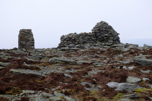
This is some kind of bunker, it has a chimney but no windows or pill-box style slits of any kind. Inside was fairly fresh water full of duck-weed (or something similar).

The next bit involved crossing the old runways by a public right of way. However, something got in the way. There is a new housing estate being built. No signs of the path were visible nor were there notices on lampposts. I dropped in the housing office. The woman there didn’t know where the path was diverted to, but was adamant that I couldn’t pass through the building site. Obviously.
I knew that but she tried to divert me along a road. I didn’t want to do that, lie path must be somewhere. She then said ‘I’d have to say the path is closed’. No it can’t be, that would be illegal.
What home is it if you don’t know but prefer to say something that is wrong.
As it turned out, I found it behind a supermarket, against her advice.
The rest of the route map very nice. There were a few fallen massive trees to clamber by.

The day’s total milage amazed me. More than Ten miles. I had imagined about six. For 2,500 calories, I felt remarkably fresh despite feeling ill yesterday. What am excellent way to recover.