Bleaklow and a crash site.

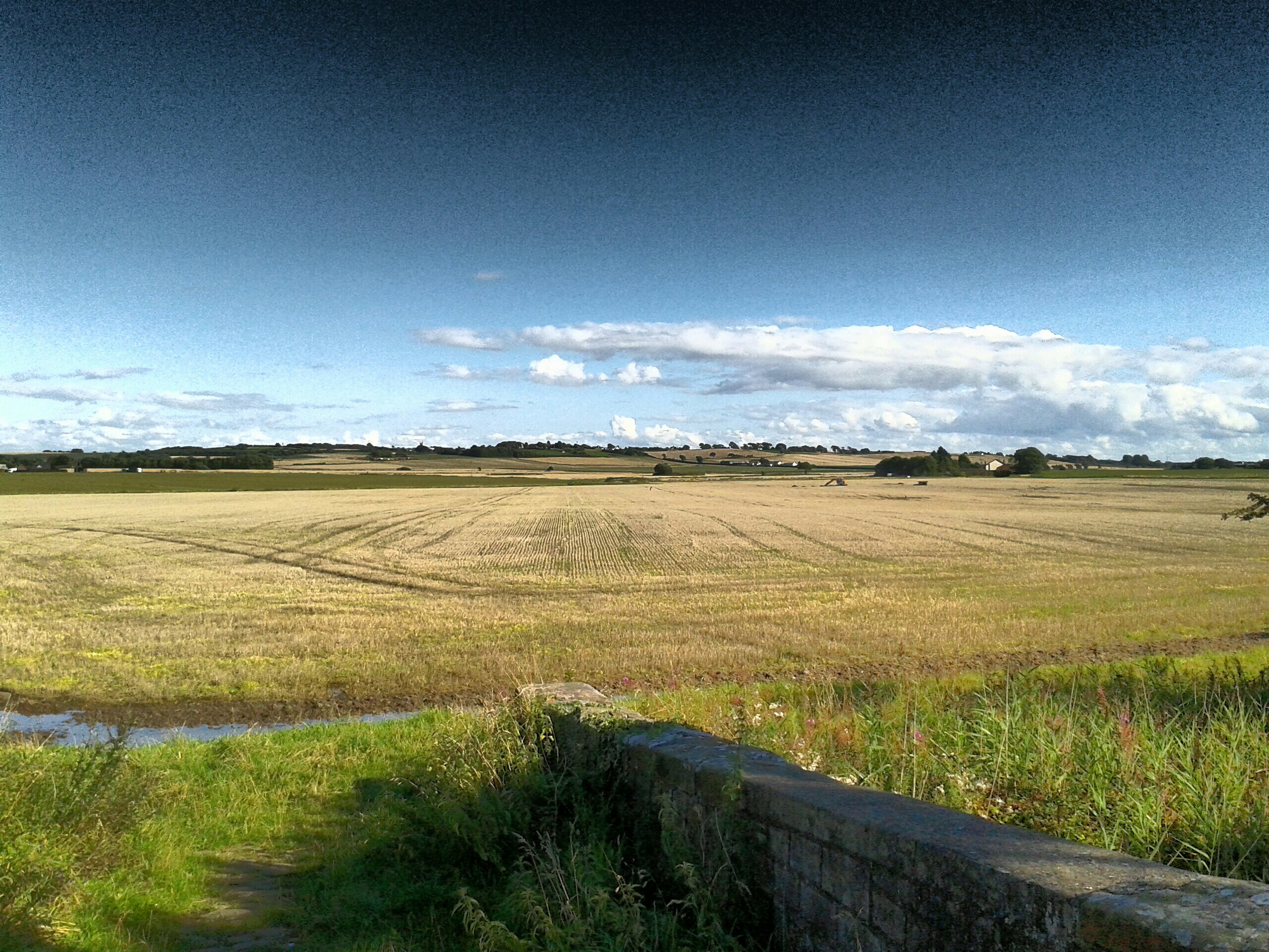
16°C, some showers, some sun. Mostly grey.

I hiked with MapMyRide+! Distance: 13.53km, time: 03:34:10, pace: 15:50min/km, speed: 3.79km/h.

http://mapmyride.com/workout/2412514553

With Carl and Chris to practice nav. techniques. My GPX track does not include the first 1/3. S). Shame because we practiced timing, pacing (including leap-frogging to find features like ponds and ring-contours. We could place ourselves within 10 meters, and estimated grid references matched OS locate each time. The whole thing was very reassuring, especially for the others because they will do the HML assessment in a few weeks. Good luck, though they may not need it. I haven’t booked my ML(s) assessment yet, I’m not ready, there are too many variables in my life right now.
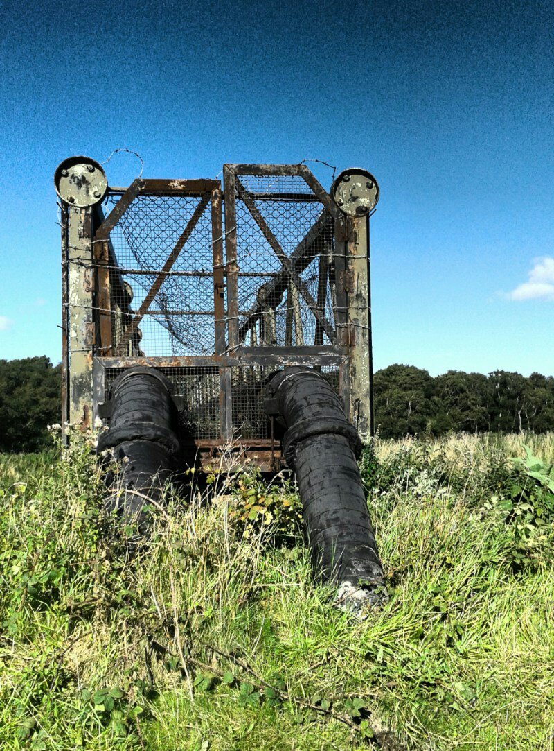
Oh, and the crash site was very interesting too. It was a B29 bomber that hit the hill in 1948. See more details here. We were all struck by how big it is. Details were noticed too, there are ripples and drips in the aluminium where the metal melted that day. We wandered about looking at various pieces of metal and mentally trying to work out what each piece was. the engines were easy, as were the undercarriage.BleaklowB29
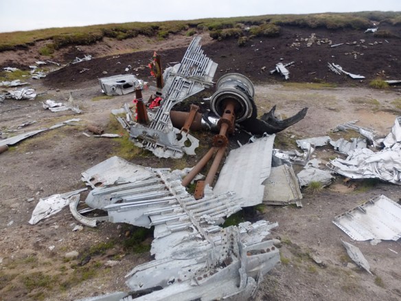
By now, we were all tired, it was getting late and I was hungry. Therefore, we chose the easiest route back to the car.

Azure sky, to ride under one.

20°C, light W breeze, deep blue sky and dry.

I rode Paddy Wagon with MapMyRide+! Distance: 55.83km, time: 02:14:53, pace: 2:25min/km, speed: 24.84km/h.​

http://mapmyride.com/workout/2404618307

Started off as a plod, but got quicker as I felt better.
This turned into a perfect day. My energy remained on tap and the pace sustained. It was the colour that blazed so vividly that impressed so much.
Beautiful day.

How do I get those down?

17°C, set fairApple tree: it’s in a poor state really. Lower branches are dead or scrawny. There are some good looking fruit at the top. I suppose a skilled arborist would have cut the tree so it would grow more favourably. It needs good, young branches lower down.​

I have cut out some poor low branches with enough stumps to climb up. Either I can reach the fruit, or I will make a scoop to pick them with.

Vescovatu

28°C, clear and sunny. 

On the last day of our trip, I chose a random route to look for a last supper. The map showed twisty lanes snaking up into the hills. They looked likely. After a convoluted drive thorough sun dappled roads we happened on a village square. There! Three likely looking venues for a meal.​

problem was, they can’t do bank cards. We gathered the last of our euro notes and hoped for the best. They had no English and we only had fragments. E did a fine job of filling in the gaps. To make up for the uncertainty, we plumped for Plat du jour and burgers for the kids.
It worked.

Artisan route, clockwise.

33°C, sunny nil breeze.

I rode Zing with MapMyRide+! Distance: 50.40km, time: 02:38:59, pace: 3:09min/km, speed: 19.02km/h.

http://mapmyride.com/workout/2375533769

Roaring got cut I’m managing hydration better now. A big drink before I go and a top up at Corbara. The loop round the back of the valley passed Zillia and Calenzana soon looked more appealing. They have newly tarmaced the road too, so progress should be quick.

Col de Salvi and Corbara

31°C, still and clear blue.

I rode Zing with MapMyRide+! Distance: 41.74km, time: 02:09:25, pace: 3:06min/km, speed: 19.35km/h.

http://mapmyride.com/workout/2368525580

Much better hydration management today. I tanked up more to start and stopped at a spring in Corbara for a top-up. Temperatures are forecast to rise slightly, whatever it does, it’s damned hot.​