DofE 13.0: Hitchin.

26°C, 2/5 cloud, 0 wind.

Camped at Henlow Bridge. Not my kind of campsite but only for 1 night. Expensive too, £26 for 1 night. That’s london prices, I didn’t get to the bureau de change to get london pounds. London currency looks the same but can’t buy as much.

13.1, met the groups at about 10am in Hitchin. We went through kit checklists by way of introduction, as usual. I know the routine now, it often involves a detailed list with the boys pressing to get going. Another routine that has been steady over the last few weeks is managing the heat. Still, many boys didn’t have enough water. 2 litres is recommend, many were on 1.5. Some had rucksacks that were only 40 litres. Eventualy, off they went ln qualifying. Today’s routes are much longer, I swapped one group’s route around to make my checkpointing easier.

The sun shone fiercely, and the air hung still. It was a hot one again. This is like being in the south of France.

13.2 Day two: Both groups had a much shorter routes which resulted in a happier mood in each team. The weather was still hot and dry- reaching 28°C in the early afternoon.

I’m now typing in light rain in a service station on the M6, (quite pleasant actually). I’ve typed up the Assessor reports and am now free tirelax on the long drive home.

DofE 10.0: Edale.

Or “I need to use the trowel”

16°C, cloudless and still.

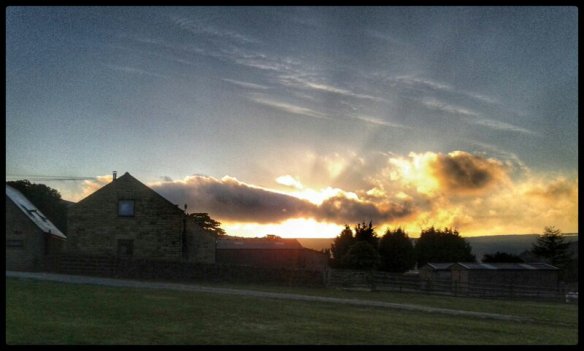
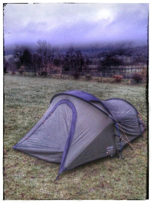
Arrived in Edale for a Gold Practice expedition. I’ve been here a few times before with QM School. Sunset is late so putting up the tent was easy. This should be fun as long as the group I get works well. At least I know the terrain.

10.1: dawn was chilly, only 9°C inside. The temperature built rapidly through hte morning. Tops were about 25°C, but it felt far hotter in direct sun. The sun is burning and dry.

Introduced to my group in Castleton car park. After the usual bag adjustments and weigh in, we set off. They immediately went the wrong way down the high street. This is a problem when dumped in a car-park after a log drive, it’s disorientating. Then we set off with the group in front. Eventually, another mistake led us to a farm which was stopped by a labourer. Secondly, as we back tracked, a woman approached who seemed quite exasperated. They get this all the time. If I get time, I will go back and figure out what went wrong.

The rest of the day was a struggle against the heat. It scorched our skin and drwgged in our throats. That was why we decided to descend on a shortened route. Oh, and one of the girls was feeling ill. At the lunch stop, she mentioned that she needed a poo. I took the opportunity to explain where and when and a bit about the use of a trowel. I bought it originally because it has a funny name:”iPood!”.

We took a break after Lord’s Seat and took votes on the remaining route. Eventually, an uncomfortable looking girl asked for my trowel and went off with it behind a wall.

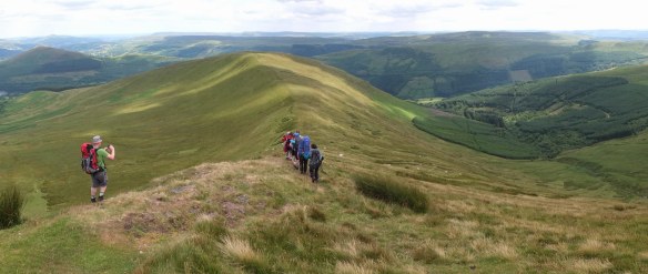
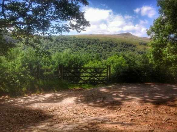
10.2: Kinder Scout: load up the pack with 7.5 litres of water and head up onto the Kinder plateau. My group have a long day in the heat. Much longer than yesterday but at least the wind is stronger to cool us down. I walked for 4 hours without a stop before I found them. They were sitting, contentedly at the furthest west point of their trip. I had walked about 12km to find them. Okay, so I did stop for a few photos and a search with the binoculars.

So far so good. They were all in good spirits but thirsty. The 5 litre tank was enough, it left 2 litres for me. The plan was to then go south east to a spring to collect more for filtering. There was not a drop anywhere, not on the plateau, nor on the gulleys. I’ve never seen Kinder like this. The streams were sandy trails, bone dry.

Eventually, I met up with another instructor who had plenty left in his talk. I was despitately thirsty by then. 3 hours without water in this heat. The sun remained fierce, not a cloud all day.

Padding along the farmland the girls pointed out a sheep stuck in a wire fence. One of the breed which have coiled up helix horns. She had her left horn caught in the bottom wire, probably while reaching for the best grass shoots. So without thinking, I took off my pack and crouched down. She didn’t panic but I was worried because the horn was snarp and her neck strong. Eventuall, pushing the wire and pulling the horn did it. She didn’t seem to realise at first but then she backed out to the relief of two lambs with her. My good deed for the day.

A very satisfying day, especially once I’d quenched my raging thirst.

10.3. Cooler start with some clouds.

My group have a funny figure-8 route but it’s easy to checkpoint. On close inspection, it’s looks fine. I met them four times over the 9 hour walk. The last one, they were so tired, some tears in fact. They were lovely on debriefing which included our goodbyes. I gave them baby-belle cheese rounds. That choice came up because they agreed that they took toomuch sweet food. Some were stuck for choice of suitable savoury food. I will look into this so I can give a better answer next time. They liked the mushroom pate I had in a tube.

DofE 5.0: Parbold

21°C, white cloud with very high pollen.

Some schools vary the rules on their expeditions. This one uses the same route for all groups on qualifying, they are in the same area as their practice and a few other oddities. However, they do respect the ‘principles of DofE’.

The kids are from the edges of liverpool, St. Helens. They’re very likable, open, relaxed and friendly. We leaders were warned lightly about them, but I was gjven a super group. They were friendly, generous and polite at all times.

In practice. I mostly supervised two groups, the first, assigned to me. The second did not handle crossing tbe cattle field well at all. They were shrieking and jumping about as they approached the herd. A larget herd of mixed bullocks, cows and calves. This was the only occasion I told them off. Eventually, i reached the group and explained what to do.

Back at camp, I received a funny back-handed compliment, “I’d rather be told-off by you than that lot“, referring to their own teachers. She was anxious about disqualification for something trivial but I reassured them. These kids are very open and upfront, in contrast to some in the outher groups from the south.

That marks the end of a 6-day week. More is to come, I get 1 day off, then work a 16-day week. Summer holidays will be a respite when I can get on wih decorating my house.

DofE 3.0: South Downs (Surrey Hills)

19°C, clear , still and dry.

264 mile drive to get here straight from work. We’ll see whether it leaves me too tired next week. That will be 16 days work without a day off. The forecast is good. This, unfortunately, this is such a noisy campsite. There is another school’s expedition finishing in the next field. Only one other leader did the same is me and arrived the night before.

Day 2: Wilson’s School, from that london (a big city in the south). A very likeable group of lads who gelled together well. We ha a good day training and a couple of fine navigators shone out. As always, the day wore on and teased out those with stamina away from those without. At all times, they were polite and calm.

The Mamores from Kinlochleven.

12°C, dry white cloud to start, rain after about 3pm.

Walk along The West Highlands Way for a short while before taking a wet turning north. Onto a bealach that connects two of the horseshoe’s summits. The route up the Glen issues soggy but with reasonable grip. Once over the edge, the full force of the wind was felt but it remained dry.
The planned route was part horseshoe and tee-bone it with two Munros. So over the col and diagonally down the other side to trace a contours behind the peak Am Bodach to skip it out. Stob Coire a Chairn (981m) was the one I wanted.

AnGearanach

Before me was a magnificent panorama, the most striking is An Gearanach which looks like a fine scramble for another day. I’d prefer not to do that one solo for safety reasons.

Return was by the same route any then along the ridge to Sgurr an Lubhair. That one is not a munro, even though the height is enough. Munros have to stand 300m above surrounding land, this one doesn’t, quite. Still, for a horseshoe ridge, the top is flatish and requires a decision using the compass to get down. Two sides are drops down dramatic cliffs so you need the right path.
Despite the hill fog, the terrain here was interesting. A very nice Lochan marked my junction. The water is distinctly turquoise with white quartzite stones below. Worth coming back, take note. I chose the descent into the glen south back to the West Highlands Way. A path contours and descends westwards. Reading the contours on the map, there appears to be a chute which turned out to be a very useful route down. It zig-zagged down on what must have been an ancient route. It was too big for a deer trail but overgrown with grasses and lacking any footprints. I think is must have fallen into disuse decades ago.

DSCF5654It was here that I encountered the first midges of the trip. I crouched down at a burn to collect and filter drinking water. I got mobbed by them. Once on the track, I turned east for the long walk back along the West Highland Way. Not having seen anybody all day, a few small groups passed going north here. One group of Germans were setting up camp in a short grass patch on the Glen.

Silver, day 3

Bright run 22°C, light wind
Carl and I took two groups of Silver for training onto a small plateaux at the eastern end of the Brecons. Our two groups were spot on with navigation through farmland and higher up on the open access land. One participant gap struggled to keep up with her group. She was badly overloaded so I elected to empty the most unnecessary kit from her backpack. She is only slightly built, but carried a very heavy bag. Even I was considerably slowed down with the handfuls I took.

The search for water: Carl took the two groups to the top and I headed off west a short way to collect water. We would get through a lot today and it’s unlikely there’s be more at the top. With my little filter, it took about 20 minutes to fill 3 litres.
SilverTraiingD3

The descent and a casualty: we all reached the bottom with few problems. Our gold group were there sitting cooling off. One girl looked wrong. Pallid, cold and clammy, she had clear signs of heat exhaustion. the group had not got enough water on the  ridge. This would be the end of her expedition but she has enough to complete her practice.

Finding the bunkhouse: I hate Satnavs. they don’t do anything to inspire confidence. This one tried repeatedly to direct me over bridges over the River Usk that were too small for the minibus.

Rhynogydd walk-out

Dense hill fog to start 11°C. Later nice sunshine with a chilly wind.

Woke at 7am, all nice and warm in the bag. I didn’t want t get up, especially now that thick hill fog had set in.
After a failed search for water, the descent near “The Clip” was easy to find. It is named Bwlch Gwynlio which takes you to the path down west to Cwm Bychan. Co-incidentally, I found water here too so turned it onto a coffee stop.

rhinoggBivvySite

My bed for the night.

Once refreshed, turn right and drop down towards Cwm Bychan, some of the route is overgrown with bracken. Annoyingly, I lost the path and strayed down from the ‘correct’ route.

Back to the familiar Cwm Bychan site. Disappointingly, nobody has taken over the campsite and it remains only a car-park for hikers.  The attraction for many casual hikers is the Roman Steps. Small family was starting out as I arrived and asked for directions. they had no map, but really, apart from the first part, they won’t need one if they stick to the slabs.
The excuse for this diversion was to find out whether the campsite has re-opened (it hasn’t). Then up the Roman Steps route which is familiar to me. The new bit is to drop down into the forest directly east. Navigation here was tricky because recent logging work has obliterated paths and their signs. I took a mixture of paths and foresters’ tracks to get to the extensive grasslands north. Every step was a ‘splosh’, hours and hours of welsh steppe. The walkout back to Trawsfynedd is very long; very long. These landscapes are heavenly.

While recovering back at camp something amazing happened. The family I met at Cwm Bychan pulled up in their car. They had my solar-battery pack. It had fallen off my backpack on the Roman steps. They felt that since I was so helpful that it was worth the slight detour to find me. I must have said where I was camping and there are only 2 sites near Trawsfynedd to try out. They had made their hike to the top of the Steps and appreciated the little arch bridge along the way. It’s a charming section which soon splits into two routes, the main path is clear enough all the way.  People are good.

Return from Cafngaw.

8°C, no wind, white cloud and dry.

I hiked with MapMyRide+! Distance: 10.35km, time: 04:16:00, pace: 24:44min/km, speed: 2.43km/h.

http://mapmyride.com/workout/2142592775

Cefngw bothy.


Up a bit late so finally woke after 7am. I blame that chocolate muesli bar from Aldi. Strong chocolate can do that. After walking for over 8 hours, I should have fallen into a solid sleep quickly. Normally, that’s what happens. I woke in the night after anxiety type dreams. I was worrying about the car in that isolated car park, away from the road. Images of broken windows and fire damage pestered my mind.

Woke late, the day was an hour old by then. At least I got the tent down quickly. Then plotted a route back that loops around the north of the mountain. There is a lake that might be good to visit but I missed it while picking the easiest route through the heather.
Once past the bwlch, the land opened out into an enormous ocean of grass, softly undulating to the northern horizon. I wonder whether Scotland has anything like this?
Curving round to the east, the land dipped towards the first signs of civilisation. A couple of farms appeared on the Llyn Arenig which flows into the reservoir by the car park.

Rather like the start, signage is poor but the public paths were clear enough on the map. I don’t like simply striding through somebody’s farm, especially with newborn lambs. I took a wide circuit around them. It’s no good to cause stress to their mums.

Arenig Fach up.

8°C,light wind and dry. Some cloud above 500m.
I hiked with MapMyRide+! Distance: 10.21km, time: 08:15:00, pace: 48:29min/km, speed: 1.24km/h.

http://mapmyride.com/workout/2142574688

Stuart at about 10.15. The first paths were a bit tricky to find. The map was clear enough but on the ground, no signs, so stiles, nothing. I have always wanted to walk the Migneint Moors, now here’s my chance. It wasn’t as boggy as I expected but kid heather was hard work. This spring has been quite dry, I’m grateful for that.
The trick here is to look well ahead to find strips of grass that run between heather fields for easier passage. It’s worth getting to a ring contours for the view ahead. Even here, grass is in big tussocks, so each stride is awkward. People with shorter legs might struggle. I wouldn’t bring a DofE group here.
34089312921_4a4f52d2bc_z