DofE 7.0, White Peak,

Warm in the sunshine, cooler later. 20°C, very, very high pollen..

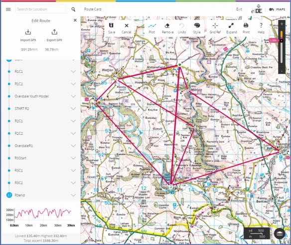
Bronze qualifying: camped in Alstonfield, as previously. I’ve worked for this school for years and this is the most capable and well behaved groups they’ve ever had.

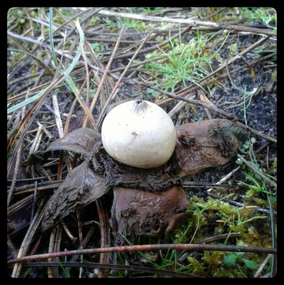
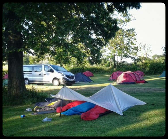
7.2, some of the girls wanted to sleep out under the clear sky. A cloudless sky is promised and the wind should drop. I can’t think of a reason to refuse. Some therefore, slept out undeer a tarp; others, in survival bags. It’s one lf those lovely romantic things to do when you are a teenager. ‘Romantic’ in the old fashioned sense of the word; not all that boy-meets-girl rubbish.

Since they were all so well behaved and we’ll organised, there were no anecdotes to collect. They’re not even the first to sleep out. Most didn’t wake during the night so didn’t see Jupiter blazing in the early morning sky.

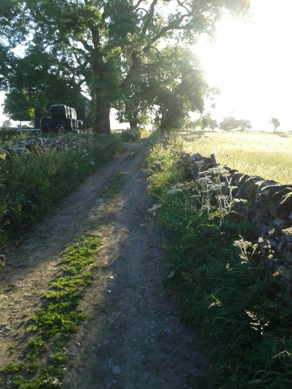
Here I am, briefing a group before setting off on day 2.

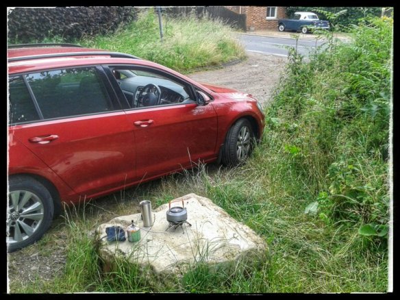
That was a good easy trip unless you count the drive home on the M6. I don’t mind tbe long stretches of 50mph, it’s the unexplained 20mph miles that were so tiring.

DofE 6.0: Surrey Hills

Good weather with mild nights and slightly less hot days. 20°C

Another long drive south to the Surrey Hills. The campsite is in clearings in woodland with dry ground. There are many groups here, probably more scouts than anything other.

We instructors have more groups to deal with than usual on this trip. Most of us have two groups which I’ve done many times before. The problem today was the difference in routes and pace of my two groups. They quickly increased separation by two miles. Maybe. Group 9 were not heard of for hours. Eventually, I came upon them by chance in a sunken lane. That’s a bad place, in shadow, in very narrow with no footpaths. Add to that the number of large 4x4s rushing about. Poor navigation led one group down this lane. There is a decent path parallel and quite close. I presume they were getting tired.

Here I am, on a checkpoint brewing up some coffee.

Day Two: much better for both groups, enough to pass clearly.

This is a trig point found in woods near the North Down way. Apparently, the trees have grown since the trig point was used because these things require a clear view of other hillsides.

While I was searching for my second group, I passed this trig point on the ridge. The heavy undergrowth and tall trees illustrate how long these posts have been here.

The day finished ontime but I didn’t see the second group until the end point. My first group were raring to go home but made a point of seeing me first. They were full of smiles and gratitude for my time with them. What a delightful group of girls. These are kids whose lives have been nice to them, they were brought up by likable people and had few traumas in their upbringing. It shows what difference all that makes. I’m back at the PRU tomorrow for the contrast.

DofE 5.0: Parbold

21°C, white cloud with very high pollen.

Some schools vary the rules on their expeditions. This one uses the same route for all groups on qualifying, they are in the same area as their practice and a few other oddities. However, they do respect the ‘principles of DofE’.

The kids are from the edges of liverpool, St. Helens. They’re very likable, open, relaxed and friendly. We leaders were warned lightly about them, but I was gjven a super group. They were friendly, generous and polite at all times.

In practice. I mostly supervised two groups, the first, assigned to me. The second did not handle crossing tbe cattle field well at all. They were shrieking and jumping about as they approached the herd. A larget herd of mixed bullocks, cows and calves. This was the only occasion I told them off. Eventually, i reached the group and explained what to do.

Back at camp, I received a funny back-handed compliment, “I’d rather be told-off by you than that lot“, referring to their own teachers. She was anxious about disqualification for something trivial but I reassured them. These kids are very open and upfront, in contrast to some in the outher groups from the south.

That marks the end of a 6-day week. More is to come, I get 1 day off, then work a 16-day week. Summer holidays will be a respite when I can get on wih decorating my house.

Early morning walk.

I walked with MapMyRide+! Distance: 11.96km, time: 01:59:57, pace: 10:02min/km, speed: 5.98km/h.
http://mapmyride.com/workout/2819841856

I woke very early this morning, up by 04.30 and invigorated after breakfast. I embarked on the wall even before coffee. Such is the effect of spring and the escape from a recent head-cold.

There were also some unwelcome colours in the canal.

Probably diesel from a barge.

By 7.30 I had done my good deed for the day. Passing a remote cottage, I spotted bank card in the road. Usually, these things are junk but this one was valid and signed. I did the obvious thing and went to the nearest house and knocked. The woman who answered looked worried at first. Perhaps she thought I was police. I was mostly wearing black. I asked by saying [his name] and she said “yes, he lives here“. His credit card was lying in the road and I reached it over. She must have realised and melted into gratitude. “Are you just out for a walk” you’re not police then?

The card was probably good for a few contactless purchased up to £30 each time before it got blocked. However, it’s worth more to hand it over and make somebody’s day instead. You don’t often get to do that.

Walk in windchill.

2°C white cloud and strong E. Windchill very significant.

I hiked with MapMyRide+! Distance: 12.95km, time: 02:27:16, pace: 11:22min/km, speed: 5.28km/h.
http://mapmyride.com/workout/2740750153

It looks as though it’s about to drop into the water.

Lancashire has a crack in it.

There are rows of these grooves, probably cut to prevent flooding in the middle of these very flat fields.

All day, that wind was a feature on this open route. Some sections were sheltered but not many. They provided some respite and reassured of in my choice of clothing. I wore the same as the Ainsdale dune route a few da p ago when it was a good 4°C colder. Today felt colder. Feeling slightly cold for a long time takes a very long time to warm up again. A factor to consider for ML assessment this summer.

Ainsdale Beach

5°C, still with unbroken blue above.

I hiked with MapMyRide+! Distance: 7.48km, time: 01:37:45, pace: 13:04min/km, speed: 4.59km/h.
http://mapmyride.com/workout/2678812423

Today’s trip is an exploration of my new hometown.

Dunes run dominantly in parallel to the rather distant shoreline. Looking out west, a wreck poked above sand flats. I should visit that next time, perhaps on the bike.
A big chunk of this area is a mature reserve. It’s mostly fenced off but is marked as Open Access land. Wavecut parts of the beach are low and smooth; I cycled on that part about a month ago. The dunes start immediately behind low cliffs.

The furthest end of the walk entered pine woodland. The going was tricky because so many trees were down. Trunks were smashed in places, doubtless by all the storms that roll in from the northern approaches.

Underfoot were some Puffballs, long past their prime but undisturbed nonetheless.

I’m going to like living here.

Return from Cafngaw.

8°C, no wind, white cloud and dry.

I hiked with MapMyRide+! Distance: 10.35km, time: 04:16:00, pace: 24:44min/km, speed: 2.43km/h.

http://mapmyride.com/workout/2142592775

Cefngw bothy.


Up a bit late so finally woke after 7am. I blame that chocolate muesli bar from Aldi. Strong chocolate can do that. After walking for over 8 hours, I should have fallen into a solid sleep quickly. Normally, that’s what happens. I woke in the night after anxiety type dreams. I was worrying about the car in that isolated car park, away from the road. Images of broken windows and fire damage pestered my mind.

Woke late, the day was an hour old by then. At least I got the tent down quickly. Then plotted a route back that loops around the north of the mountain. There is a lake that might be good to visit but I missed it while picking the easiest route through the heather.
Once past the bwlch, the land opened out into an enormous ocean of grass, softly undulating to the northern horizon. I wonder whether Scotland has anything like this?
Curving round to the east, the land dipped towards the first signs of civilisation. A couple of farms appeared on the Llyn Arenig which flows into the reservoir by the car park.

Rather like the start, signage is poor but the public paths were clear enough on the map. I don’t like simply striding through somebody’s farm, especially with newborn lambs. I took a wide circuit around them. It’s no good to cause stress to their mums.

Walk to recover.

19°C, bright sun building wind later.
I hiked with a medium pack:  Distance: 16.74km, time: 02:52:01, pace: 10:16min/km, speed: 5.84km/h.

http://mapmyride.com/workout/2114464646

The idea was to walk a few miles across farmland and practice DofE Bronze terrain navigation. Yesterday, I was all aching with a cold and it spread to my chest. Cycling was out of the question on this beautiful day.
Despite a few changed public rights of way, I made no navigation errors. Quite the opposite, the navigation was too easy really.
The ground is solid, soil is all hexagon cracks like in those pictures of deserts.
The route covered land formerly on a WWII airbase.fradBunker

This is some kind of bunker, it has a chimney but no windows or pill-box style slits of any kind. Inside was fairly fresh water full of duck-weed (or something similar).

The next bit involved crossing the old runways by a public right of way. However, something got in the way. There is a new housing estate being built. No signs of the path were visible nor were there notices on lampposts. I dropped in the housing office. The woman there didn’t know where the path was diverted to, but was adamant that I couldn’t pass through the building site. Obviously.
I knew that but she tried to divert me along a road. I didn’t want to do that, lie path must be somewhere. She then said ‘I’d have to say the path is closed’. No it can’t be, that would be illegal.
What home is it if you don’t know but prefer to say something that is wrong.
As it turned out, I found it behind a supermarket, against her advice.
The rest of the route map very nice. There were a few fallen massive trees to clamber by.

The day’s total milage amazed me. More than Ten miles. I had imagined about six. For 2,500 calories, I felt remarkably fresh despite feeling ill yesterday. What am excellent way to recover.

Bronze d2.

Grey and breezy. 14C.
Started near the day’s end checkpoint. My job is to patrol the drover’s paths and pick up any strays. It’s an easier day for me, good because I’m now getting tired. 17km walking yesterday and 77 miles on the bike Sunday. It adds up you know.​

Fallen tree in Biggin Dale.

 If I can keep it under 8 miles today, I can recover.
In contrast to yesterday, the bronze groups got through their routes much faster. We were left with time to kill at the visitor centre. So cups of tea were drank and tents laid out in the sunshine to dry. If they’re dry, the kids don’t have to take them home to dry. Win-win.

Bronze Assessment d.1

16°C bright and breezy.

White peak area: 92 girls on Assessment for Duke of Edinburgh Bronze Award.
We dropped them off at Ilam Hall just before noon. Their plan was to walk to Alstonefields for the night’s camp. They were given checkpoints that their routes had to pass through, but it was for the girls to plan and plot routes. The DofE mapping software can create an OS map printout and routecard with timings and leg distance calculated automatically. There were quite a few who handed in staff copies last minute. Others, I made them fix up impossible routes. Some had plotted paths that were parish boundaries not footpaths. One group mixed up their checkpoints and plotted a zig-zag route that totalled 19km. Our kids are very slow walkers anyway so wouldn’t make camp before dark on that route.

masterRoutecard

Master routecard that was used to start participants’ mapping. They had one of these 3 routes and plotted their own waypoints between the above checkpoints.

By noon, most groups had started fanning out on their chosen routes and us staff split up into small teams for remote supervision and assessing. I’m the only one who is qualified to go it alone which is what I did. After reading the kids’ routecards on the coach, I picked a route that crossed as many kids’ as possible. I kept on the move for the whole day on foot for flexibility.
The first group I met needed some help and then later some intervention. From 100m behind, I soon felt unhappy about their approach to a herd of cattle, cows and calves. The rule is ‘never between cow and calf’. Their approach wasn’t good, they may have crossed between cow & calf.
Anyway, after sorting then out, I set off on a parallel route and soon gained a kilometer. Good time for a lunch of sandwiches. They were baps with chilly-cheese and salad (in case you wanted to know).
Then the group mentioned above were spotted in a field attempting to cross the wall on the wrong side. Another intervention was necessary. I asked them about where they intended to go and which way the route should take them. They pointed about 180° from the correct way. After some some discussion and a few stern words, they set off east and I took the opportunity to repeat the 100m pacing exercise. They had all forgotten their stride counts, guessing from 10 to 100 for 100m. Oh dear, not encouraging.

Found this north of Thorpe Cloud beyond the shooting range. Though it looks like a railway tunnel, it’s smaller and contains nothing but rock. Above is an opening. I remain puzzled.
The next group I found were cheerful but considerably off track. At least they were heading the right way. Off they went north and I turned West to get to the gorge of Dovedale. A group down there were asking for staff to meet at a checkpoint at Ilam Rock. They wanted water. I had some, but concerned that they only got 2km at 5pm.I sent them off in the direction of their next checkpoint and went north to get more water; the idea was the catch them before the checkpoint.
Assessors agreed that they didn’t need to hit the checkpoint so I set off to catch them. They were rather relieved to hear this second change of plan.
Carl was there with a minibus which meant the end of my walk.

A mixed day for them. I clocked up 17km walking and got to groups that nobody in a minibus could have reached. Excellent for me and better for them too.