DofE 3.0: South Downs (Surrey Hills)

19°C, clear , still and dry.

264 mile drive to get here straight from work. We’ll see whether it leaves me too tired next week. That will be 16 days work without a day off. The forecast is good. This, unfortunately, this is such a noisy campsite. There is another school’s expedition finishing in the next field. Only one other leader did the same is me and arrived the night before.

Day 2: Wilson’s School, from that london (a big city in the south). A very likeable group of lads who gelled together well. We ha a good day training and a couple of fine navigators shone out. As always, the day wore on and teased out those with stamina away from those without. At all times, they were polite and calm.

DofE 2.0 North Downs

24°C, cloudless and still

I led DofE Bronze with MapMyRide+! Distance: 18.27km, time: 08:35:00, pace: 28:11min/km, speed: 2.13km/h.
http://mapmyride.com/workout/2868937525

Each day started cold, Saturday was +4.5°C and Sunday morning colder. Here, the sun happens to shine down the inside of my tent, usefully. Later, we all became hotter as the sun climbed higher in thd cloudless blue.

This little scatty object is usually overlooked. There was a spider out on the limb, right, but when she saw me, she scurried into the nest.

The expedition: The North Downs are interesting; like the White Peak, there are dry valleys and dew ponds. Most of the wild plants we saw were the same too. There were, however, some magnificent Red Kites. They’re surprisingly large with long vee shaped tails, perhaps inspiration for Star Trek spaceships. I was impressed.

Renew First Aid

22C, Clear sunny blue skies. Still day one, breezy on day two.

I learn’t more on this course in the first morning than on the entirety of the previous course three years ago. One aspect of their teaching technique was drill. They drilled into us the routine of Assess/check Airway; Breathing; Circulation and then damage checks (ABCD). There were lots of role plays (which I normally hate) but it did build up nicely.

I was kept on my toes all the way through, mainly because I’d learnt so little on the first course.

We finished not long after 5pm each day which gave us a free evening on day one. A little group of us decided to walk up to Mam Tor to watch the sun go down.

peverilCastle

The route was gorgeous (pun intended) but we were late for the sunset (20:05). Even so, there were plenty of people on the hill enjoying the beautiful evening. Moving east a little along the saddle is the descent. From here we needed lights. Our companion Karen, was a little nervous about this. I was a little annoyed that my head-torch battery had gone flat and had to rely on a hand-torch. It was plenty adequate.

From a leader’s point of view, this is where it got interesting. Karen knew the route from walks in daylight and took the lead. However, she went off track which immediately seemed wrong to me. It’s interesting because you can see how smart people make mistakes. The combination of stress and changed estimated distance was one thing. Another is that once her stress levels rose, she admitted “being frightened”, and then there is the single-minded determination to see it through. These meant that she didn’t see the over-view and take in all the available clues on that dark hillside. This whole area of compound errors is studied in heuristics.

Heuristics is something I am conscious of when leading teenagers in DofE. More of that tomorrow.

Working away.

Getting warm soon.

A six day week: Invigilation; First Aid certificate renewal; Lead DofE practice expedition, then back to Invigilation.

Colour testing the Masonary paint. It’s close, a smidge dark and blue. I’m steadily getting this done but my efforts are spread thin over too many jobs.

Next jobs, plaster skim coat, remove scraps of backing paper, hang fresh lining paper etcetera.

Painting is the most satisfying bit but the ceiling will be hard.

Early morning walk.

I walked with MapMyRide+! Distance: 11.96km, time: 01:59:57, pace: 10:02min/km, speed: 5.98km/h.
http://mapmyride.com/workout/2819841856

I woke very early this morning, up by 04.30 and invigorated after breakfast. I embarked on the wall even before coffee. Such is the effect of spring and the escape from a recent head-cold.

There were also some unwelcome colours in the canal.

Probably diesel from a barge.

By 7.30 I had done my good deed for the day. Passing a remote cottage, I spotted bank card in the road. Usually, these things are junk but this one was valid and signed. I did the obvious thing and went to the nearest house and knocked. The woman who answered looked worried at first. Perhaps she thought I was police. I was mostly wearing black. I asked by saying [his name] and she said “yes, he lives here“. His credit card was lying in the road and I reached it over. She must have realised and melted into gratitude. “Are you just out for a walk” you’re not police then?

The card was probably good for a few contactless purchased up to £30 each time before it got blocked. However, it’s worth more to hand it over and make somebody’s day instead. You don’t often get to do that.

Carneddau ring:2

8°C start, then warmth came through steadily. Mostly sunny once hill fog burnt off.

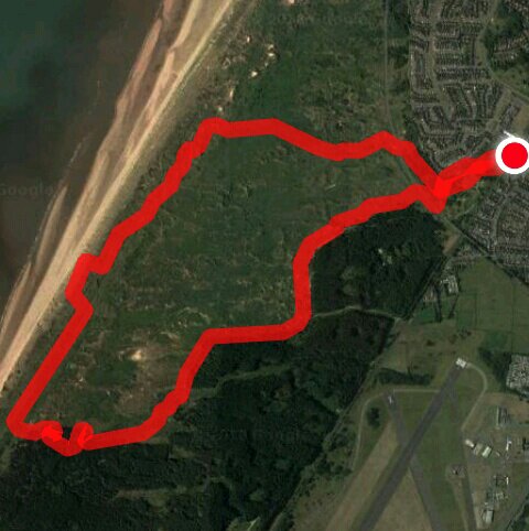
A very long day’s walk, it turned out later.

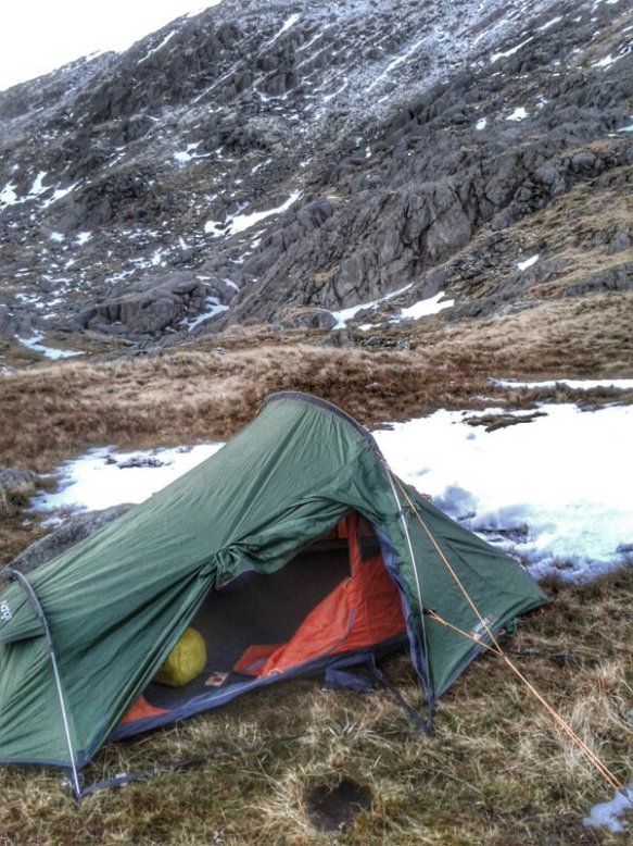
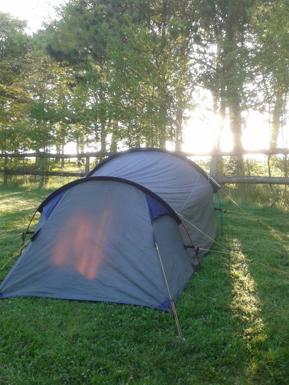
A cold night: g knew it would get cold, it reached -8°C by about 4am. I piled on all the layers g could but no more would fit in the sleeping bag. That bag liner was helpful.

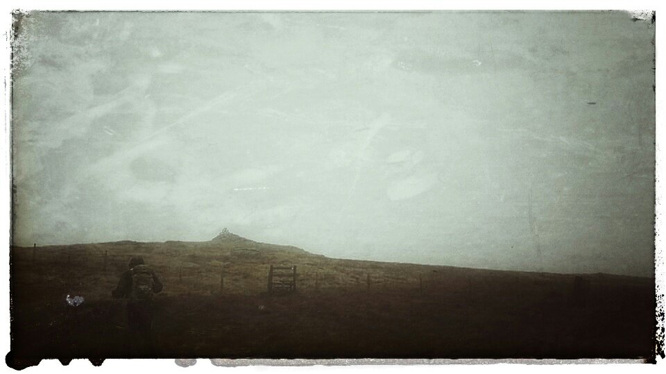
First summit. Carnedd Llewelyn 1034m in hill fog but milky sun was trying to break through. Navigation was easy enough using slope aspect and my newly repaired compass.

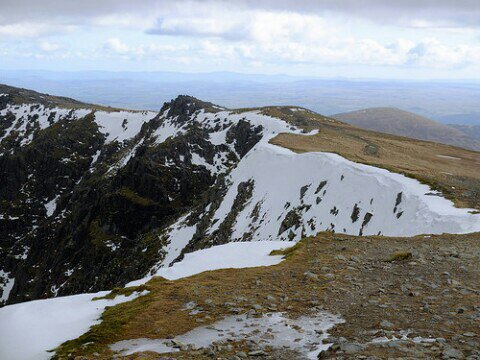
Ridges and cornices:

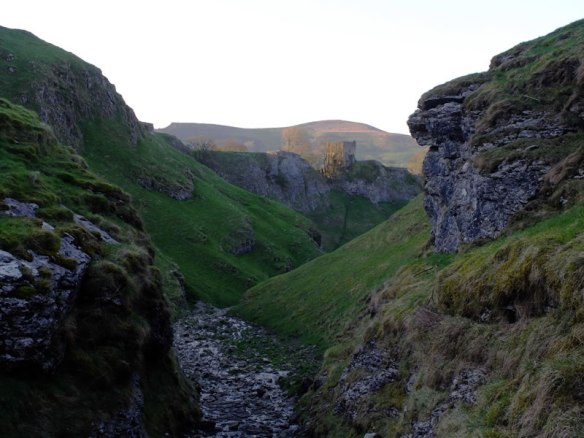
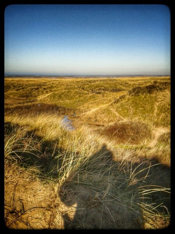
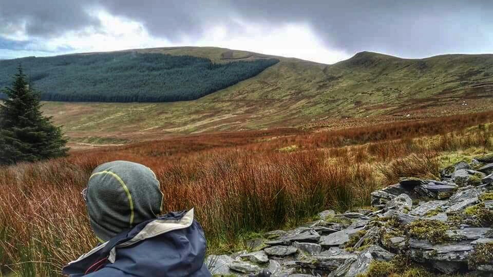
Do I need to spell out how utterly beautiful the views were? I went for a few reasons

  • Break in my legs after a long winter,
  • Get a wild camp for my Dlog,
  • Stamina exercise
  • Test my fitness,
  • Experience,

The walkout was, perhaps a little too long. However, I was driven right to the end by the urge to get back to the car before dark.

Bethesda: the route skirted the edge of the village because the ideal route is impassible. There have been no repairs to destroyed bridges on th sites Caseg forcing a detour West.

Rhaeadr Fawr (Aber Falls): I’m not normally so impressed by waterfalls but this one (two) make it onto my recommended list. There is a well made path leading in from the north for tourists. Of course, I got there by the cross-country route from the south west.

Long walkout: The rest of the route is a long slog back to the car. The paths are nice enough, and as it turns out, the setting sun cast a fine golden light over the land.

Kit to remember next time: where did I put those little micro-towels? I had the wrong kind of gas too. This stuff had no pressure in the cold.

Carneddau ring: 1

6°C start sunny patches. No wind.

Hiking in semi-winter conditions. The theme here is ‘no planning’. My first idea for a start was changed because of a closed road. There map a cross country running event that forced closures. Other people having adventures.

The next obvious car-park is far more remote near a roman road. It’s along track with very steep bits and all single-track. At the car-park, I got chatting to an elderly woman who wanted to hike there despite her recent his replacement. She keeps these years secret from her physician. I could have chatted more, but it was 12 and time to go.

I’m trying to use the Carneddau as a horseshoe. So far, the idea has worked. I’m now camped in the Lee of Carnedd Lleweddlyn by a crash site. It’s cold, the sky has cleared and temperature has plummeted. Inside the tent is +1°C. Outside must be 5 below that. No wind though. Utter peace but no animals. I miss them.

This picture is taken on Foel-Fras in the Mountain Rescue hut. Don’t worry, I only went in to brew a cuppa. Despite there being ice on the inside walls, it felt considerably warmer than outside. I headed for the lake on the east where we wild-camped on my ML training course, summer before last.

Walk in windchill.

2°C white cloud and strong E. Windchill very significant.

I hiked with MapMyRide+! Distance: 12.95km, time: 02:27:16, pace: 11:22min/km, speed: 5.28km/h.
http://mapmyride.com/workout/2740750153

It looks as though it’s about to drop into the water.

Lancashire has a crack in it.

There are rows of these grooves, probably cut to prevent flooding in the middle of these very flat fields.

All day, that wind was a feature on this open route. Some sections were sheltered but not many. They provided some respite and reassured of in my choice of clothing. I wore the same as the Ainsdale dune route a few da p ago when it was a good 4°C colder. Today felt colder. Feeling slightly cold for a long time takes a very long time to warm up again. A factor to consider for ML assessment this summer.

Ainsdale Beach

5°C, still with unbroken blue above.

I hiked with MapMyRide+! Distance: 7.48km, time: 01:37:45, pace: 13:04min/km, speed: 4.59km/h.
http://mapmyride.com/workout/2678812423

Today’s trip is an exploration of my new hometown.

Dunes run dominantly in parallel to the rather distant shoreline. Looking out west, a wreck poked above sand flats. I should visit that next time, perhaps on the bike.
A big chunk of this area is a mature reserve. It’s mostly fenced off but is marked as Open Access land. Wavecut parts of the beach are low and smooth; I cycled on that part about a month ago. The dunes start immediately behind low cliffs.

The furthest end of the walk entered pine woodland. The going was tricky because so many trees were down. Trunks were smashed in places, doubtless by all the storms that roll in from the northern approaches.

Underfoot were some Puffballs, long past their prime but undisturbed nonetheless.

I’m going to like living here.

Berwyn ridge.

7°C, brisk NW, hill fog above 600m, mostly dry and cold.
I hiked with MapMyRide+! Distance: 14.61km, time: 08:39:00, pace: 35:31min/km, speed: 1.69km/h.

http://mapmyride.com/workout/264441241

I don’t recall hiking in December before. it’s not too cold yet, though the wind-chill was strong. Our route was along a few valleys parallel to the main Bedwyn ridge.we went off track to practice navigation and route finding as two trainee mountain leaders. Once we’d visited Cadair Bronwyn the return is along an easier route in the failing light.

The photo above looks back on the route we came from. Look at the notch in the ridge, we were there. This was our lunch break and we got up to practice confidence ropeing for a while.

Heading further north onto a spur then turn West into the wind. This spur joins the main Berwyn ridge and is signposted as a Special Site of Scientific Interest. Up here the ground is fairly flat and therefore – boggy. Good stately duckboards ran north-south so the summit Cadair Bronwyn was easy. On top is a large cairn of quartzite. By now, the sky was noticeably dull grey, either rain or coming sunset. We didn’t stop.
I recognised the ridge up to Berwyn from last time even though the weather and visibility were entirely different. We saw no views down the steep scarp slope.​

Carl is always a quicker descender than I am, if fears falling less than I do. His new boots lost their new look when negotiating boggy patches near the fence-line. The worst one swallowed Carl up to the waist in thick black sticky bog gum. I was out of reach and unable to pull him out. He dragged himself out though and checked his kit. Phone, car-keys and compass, all shut inside zipped pockets. Onward.
This point we made to only necessary course correction of the day to get back to the fenceline which marks our route all afternoon.
Around the time the fence ran out, we decided on lighting up. Route finding was still relatively easy if we followed tracks in the long grass. There was such a track in front where our compasses pointed. Off we went into growing darkness.
Carl was using a 1:50k map all day. He wanted to make up for some errors on his recent HML assessment week at Plas-y-Brenin. I used the normal 1:25k that most hill walkers use. That fills in the detail missing on the 50k map. The last few hundred metres led us in error to the top of Pistyl Rheaddr falls. Not far now, after a little back tracking.
Finally, the car number plate glowed in the head-torch lights. 8 hours 35 minutes, a Quality Mountain Day for the log book.