The Mamores from Kinlochleven.

12°C, dry white cloud to start, rain after about 3pm.

Walk along The West Highlands Way for a short while before taking a wet turning north. Onto a bealach that connects two of the horseshoe’s summits. The route up the Glen issues soggy but with reasonable grip. Once over the edge, the full force of the wind was felt but it remained dry.
The planned route was part horseshoe and tee-bone it with two Munros. So over the col and diagonally down the other side to trace a contours behind the peak Am Bodach to skip it out. Stob Coire a Chairn (981m) was the one I wanted.
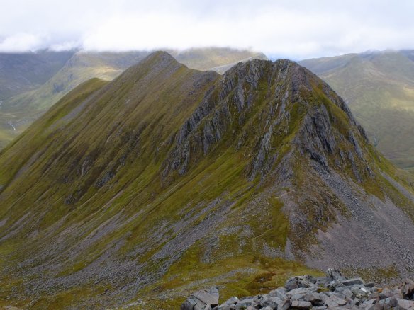
AnGearanach

Before me was a magnificent panorama, the most striking is An Gearanach which looks like a fine scramble for another day. I’d prefer not to do that one solo for safety reasons.

Return was by the same route any then along the ridge to Sgurr an Lubhair. That one is not a munro, even though the height is enough. Munros have to stand 300m above surrounding land, this one doesn’t, quite. Still, for a horseshoe ridge, the top is flatish and requires a decision using the compass to get down. Two sides are drops down dramatic cliffs so you need the right path.
Despite the hill fog, the terrain here was interesting. A very nice Lochan marked my junction. The water is distinctly turquoise with white quartzite stones below. Worth coming back, take note. I chose the descent into the glen south back to the West Highlands Way. A path contours and descends westwards. Reading the contours on the map, there appears to be a chute which turned out to be a very useful route down. It zig-zagged down on what must have been an ancient route. It was too big for a deer trail but overgrown with grasses and lacking any footprints. I think is must have fallen into disuse decades ago.
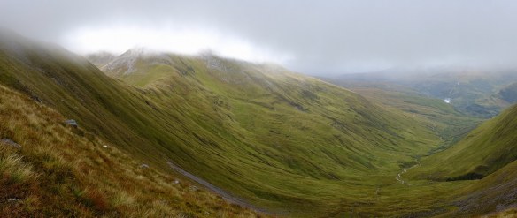
DSCF5654It was here that I encountered the first midges of the trip. I crouched down at a burn to collect and filter drinking water. I got mobbed by them. Once on the track, I turned east for the long walk back along the West Highland Way. Not having seen anybody all day, a few small groups passed going north here. One group of Germans were setting up camp in a short grass patch on the Glen.
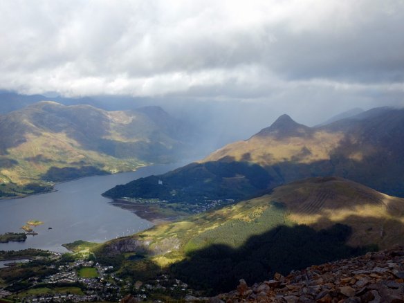
Sgorr Dearg, 1024m

13°C, brisk SW Bringing showers late afternoon.

Part of the Ballachulish horseshoe. Met a group of guys from around north Manchester getting ready for a walk. I asked where they were going to go. They showed me on a route card, so I said yes to their invite.
I was delighted after a somewhat sluggish start. Those leaden clouds were quite off-putting.
The guys were all retired from work and lifelong fell runners. Their experience bodes well.

We waked up the first half of the Ballachulish horseshoe. The group decision was to turn back before the second Munro because of the risk of failing light and building rain​. Anyway, it was an excellent day out and kick-started my trip after a slow morning’s start.

Bleaklow and a crash site.

16°C, some showers, some sun. Mostly grey.

I hiked with MapMyRide+! Distance: 13.53km, time: 03:34:10, pace: 15:50min/km, speed: 3.79km/h.

http://mapmyride.com/workout/2412514553

With Carl and Chris to practice nav. techniques. My GPX track does not include the first 1/3. S). Shame because we practiced timing, pacing (including leap-frogging to find features like ponds and ring-contours. We could place ourselves within 10 meters, and estimated grid references matched OS locate each time. The whole thing was very reassuring, especially for the others because they will do the HML assessment in a few weeks. Good luck, though they may not need it. I haven’t booked my ML(s) assessment yet, I’m not ready, there are too many variables in my life right now.
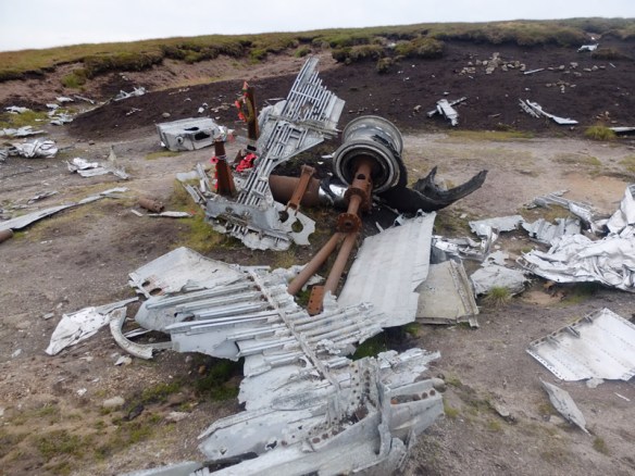
Oh, and the crash site was very interesting too. It was a B29 bomber that hit the hill in 1948. See more details here. We were all struck by how big it is. Details were noticed too, there are ripples and drips in the aluminium where the metal melted that day. We wandered about looking at various pieces of metal and mentally trying to work out what each piece was. the engines were easy, as were the undercarriage.BleaklowB29
By now, we were all tired, it was getting late and I was hungry. Therefore, we chose the easiest route back to the car.

A Muvrella

30°C, light wind, 0 cloud.
mountain day in the Corsican mountains.
starting from Refuge de Bonifatio.

I hiked with MapMyRide+! Distance: 16.88km, time: 14:28:00, pace: 51:25min/km, speed: 1.17km/h.

http://mapmyride.com/workout/2365889798
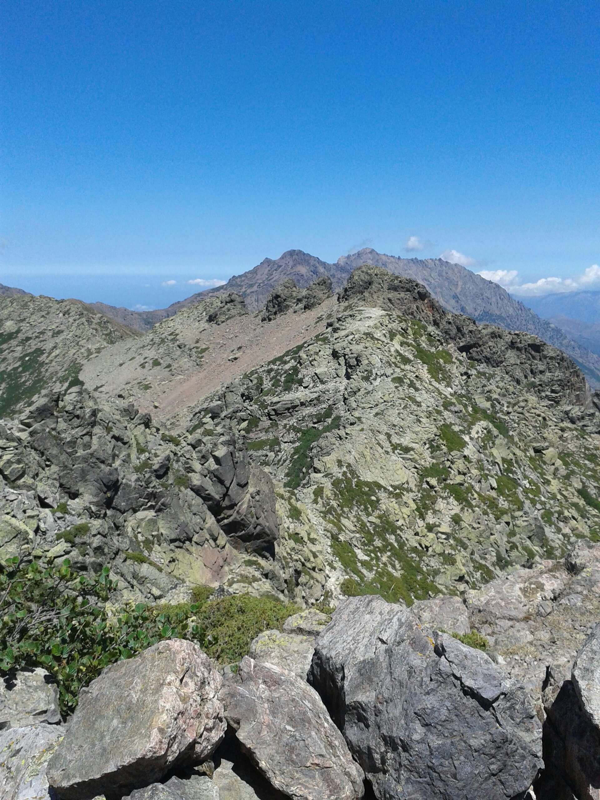
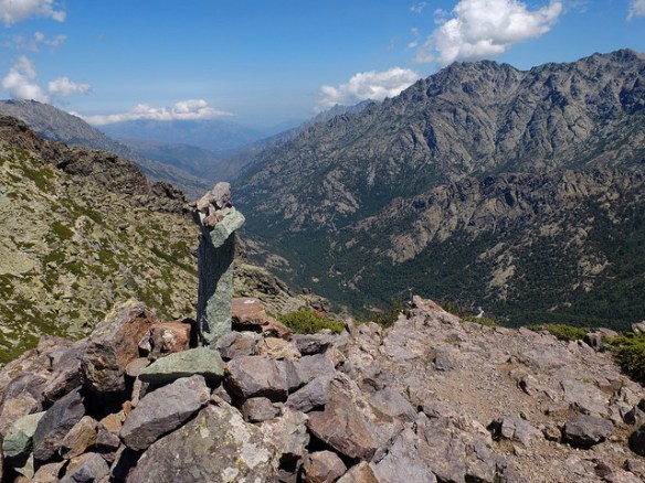
Anyway, the mountain. Every mountain has a character. This one has tricky scrambling near the summit with a few sides with exposure.  The Ridge approach is sharp blocks but secure footing. I tried to find a decent that that cut out a loop as recommended in the walking book. I couldn’t find it. Finally, after some false routes down steep descents, I happened upon a amounts round the south which was much easier. Those explorations cost me an hour.

Mountains provide a mix of extreme beauty, exhilarating views and danger. Travelling solo forces every decision to include safely and risk consideration. The rocks are sometimes sharp, sometimes loose and sometimes shielded by lance like thorns. Every step scattered turquoise tailed lizards.

Once above the tree line, aspen that is, alpine meadows are ready to find. Here, they are bursting with tiny flowers in blue, white and yellow. The granite is green here, and it’s lichen.
It’s a remote mountain sometimes used as a diversion by GR20 walkers.
Although the mountains opposite had patches of snow, my side was very hot in ascent. That was fine until I ran out of water. My voice was dry and I kept a sharp lookout for heat exhaustion. I know this from a child, you get fuzzy and start to shiver despite the heat. I have to admit, I was quite worried. Eventually, the last suspension bridge indicated that Caruzzou is near. That means food and plentiful potable water.
Everybody looked fresh and comfortable at the refuge. Their day was no more than 1/3 of mine, though they carried heavier packs. I could easily manage the whole trail, all fourteen days. That group we met in the supermarket completed in 14 days with no rest days. I’d want to take in excursions like A Murvella.
Supervising, I see groups who want to be first into camp. My aims are not like that. I want to be last in. I want to spend as much time soaking up the mountains. If I get to camp by five, I think I should have spent more time on the hill. As long as I get to camp in twilight, then it’s been a good day.

This route to A Muvrella was the equivalent of nearly three GR20 stages.

A friendly french guy was travelling in the opposite direction to me and he was happy to chat. I was looking for the junction of paths at that point and he was quite helpful. He joked that I would do my climb and catch him over the col. He explained that he was slow.
35611724163_0be3321739_z

For the second time, I arrived at Caruzzou just after six. Up to four hours without adequate water left me desperate; I feared heat exhaustion. The shivers hadn’t begun, but my coordination was failing. I could hardly talk, hours of dust and a dry throat made eating the taboleh a real effort too. It would drink water to wash each mouthful down. I wish I’d ordered soup though.

I drank and drank then filled up the bottles some more. Feeling come back to my legs and the clock ticked by. It was time to go. 2 1/2 hours to the bottom and the sun was eyeing up the horizon with mal-intent. Although good lights were in the pack, it would be nice to get to the car before complete darkness. Off I went. Once moving, the legs worked properly to my relief. The French guy in grey was approaching, wow; he said he was slow!36282760441_8d619eb5c9_z

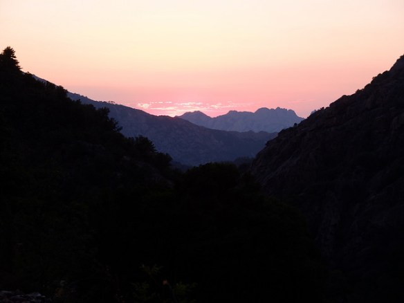
The Valley lines up well with the sunset, so the light falling in clearings in the trees was magical. Yet another magical sight, you can’t tire of these.

I reached the car by about 21:45 and only needed to use the lights to find my keys.
A perfect day that I shall never forget.

Return to Occi

28°C, still and bright sun

I hiked with MapMyRide+! Distance: 5.88km, time: 01:00:07, pace: 10:14min/km, speed: 5.86km/h.

http://mapmyride.com/workout/2357750897

Drove to the panoramic to walk up to the ruined village. It only took 17′ to get there.
From there, the drover’s path leads south and a narrow path takes you up to the summit.
The top is easily reached by following clear paths. The macchi is very scratchy which is deterrent to exploration. You can’t just wade through like Welsh bracken. At least the grip underfoot is good.
Anyway, I spent time on the rocky summit, even this modest summit offers impressive views.

Scrambling on Tryfan.

19°C, warm and muggy, then thunderstorms. Very heavy rain all afternoon.
I hiked and scrambled up Tryfan with MapMyRide+! Distance: 4.90km, time: 05:40:00, pace: 69:23min/km, speed: 0.86km/h.

http://mapmyride.com/workout/2341404458

Tryfan’s north ridge was the aim for the day. The route was scrambling all the way with one or two exposed sections (that could be side-stepped). The rocks were all secure for grip and very few moved or sounded insecure. What a fine route.

We also passed the cannon stone about 2/3 the way up. Here was our first photo opportunity. The rock itself has a very coarse grain but was somewhat polished by the numbers of people who’d gone before.

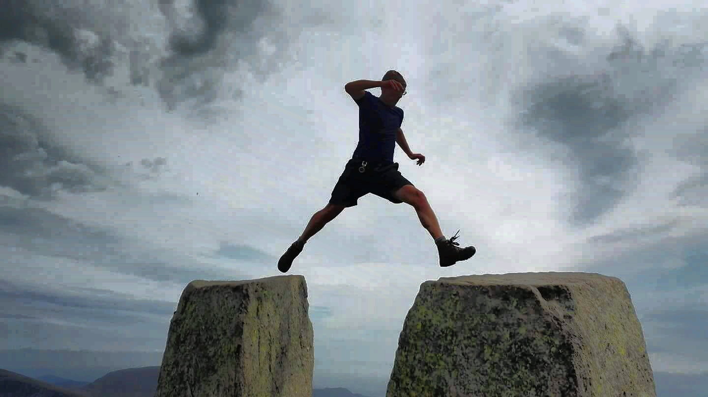
Finally got the standard shot on Adam & Eve, I was the last of three to make the jump, and possibly the most nervous.
We scurried off the peak when the deep booms got louder. Thunder was approaching. The odd flash struck ground miles to the south. A few hundred metres down and large drops of warm water fell around us. It would continue, in waves. Two groups led by Plas-y-Brenin leaders passed by heading down. This point we, decided to abandon Bristly Ridge and the Cantilever. The groups seemed to be mostly girls, none of whom looked cheerful. They were having Type Two fun. Type 2 is the kind of fun you feel after the event. Type 1 is obviously the fun you have at the time. They listened intently.

The day ended at about 5h 50 in heavy but warm rain. We were all soaked with gurgling noises coming from our boots. All the footpaths had turned into small rivers. at least the grip on rocks was still good.

Gold’s last day.

20°C, light breeze and sunshine.

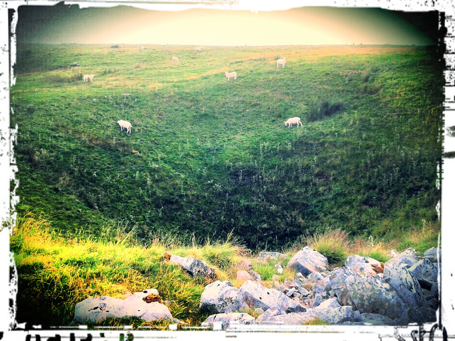
Two groups of Gold remained to complete. They had routes south towards the Rhondda Valley, limestone country. Time allowed us to consider cutting the day short. I elected to intercept the second group and bring them to the finish via a shortcut. Rolling grasslands were pockmarked by shake-holes. They look like large bomb craters that have long grown over. Oh, except one which was filled with junk. Flytippers had dumped rubbish there.​
Once again, I got a phone call to say the second golds had not even gained access land. They had to be picked up. The outcome didn’t look good for that group.

Silver, day 3

Bright run 22°C, light wind
Carl and I took two groups of Silver for training onto a small plateaux at the eastern end of the Brecons. Our two groups were spot on with navigation through farmland and higher up on the open access land. One participant gap struggled to keep up with her group. She was badly overloaded so I elected to empty the most unnecessary kit from her backpack. She is only slightly built, but carried a very heavy bag. Even I was considerably slowed down with the handfuls I took.

The search for water: Carl took the two groups to the top and I headed off west a short way to collect water. We would get through a lot today and it’s unlikely there’s be more at the top. With my little filter, it took about 20 minutes to fill 3 litres.
SilverTraiingD3

The descent and a casualty: we all reached the bottom with few problems. Our gold group were there sitting cooling off. One girl looked wrong. Pallid, cold and clammy, she had clear signs of heat exhaustion. the group had not got enough water on the  ridge. This would be the end of her expedition but she has enough to complete her practice.

Finding the bunkhouse: I hate Satnavs. they don’t do anything to inspire confidence. This one tried repeatedly to direct me over bridges over the River Usk that were too small for the minibus.

Brecon Beacons (day 2).

14°C, rain all day. Some heavy.

late start with much to do in the morning.  It turned into a QMD. I stopped the clock at 6h 50m.when I got back to the minibus.

late finish but not as bad as last night.
Carl and I dropped the Silver trainers off and I set off to Pen-y-Fan summit to intercept the two Gold groups. Incidentally, I had a fright on the way up when my map blew away. Fortunately, I had the bag off at the time and could set off in rapid pursuit. It hadn’t gone very far, much to my relief.
The summit was easy enough with a sandstone staircase for the last bit. There is a substantial cairn at the top with a plaque.

Other schools were using the ridge for their Gold Practice runs too. Group after group headed east from an independent Girls’ school near London. They seemed so confident and upbeat in the harsh weather. One of their guys on the checkpoint thought he’d seen a group of four go by so after sandwiches, I headed east. I was quite anxious that I’d miss them and it would be a wasted journey when Carl might have appreciated help with the training group.

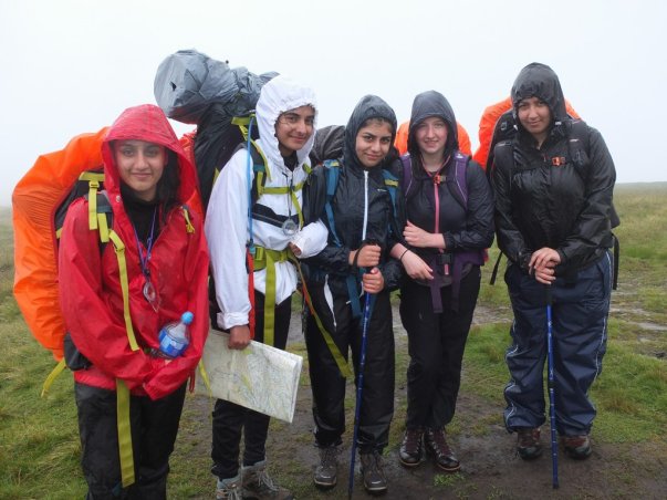
Behind Cribyn, I found them. They were happy but cold. Only 2 had gloves, 1 a hat and 3 no waterproof trousers. Abi was especially cold in her cotton tee-shirt. Lend out 2 pairs of gloves and a merino base layer to them. I was so pleased to see them and be able to help out.

This gold group thought that the other Gold group can’t be far behind. Two of those had packs weighing in at 20kg  which made their likely position beyond the first summit. So, off I went.
The phone rang to say that Gold group 2 weren’t even on access land. They had problems. It was better for me to intercept one of the Silver groups approaching Fan-y-Big. About turn and go east again!

SilvFanYbig

Silver Practice group’s first ever mountain summit.

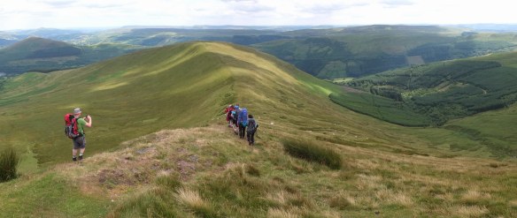
This silver group were on the Bwlch before Fan-y-big and in good condition. Not far in front, Gold were on the summit so I could catch them. From a distance, they were visible in the hill fog making the correct descent near cliffs in the mist. A very capable group, apart from their kit.

Both groups made good descents once I’d finished the photo shoot.

Once again, I marched west, this time to catch the 2 Silver training groups on Pen-y-Fan. However, they’d returned forcing me to find a route down on the next ridge. there is a fabulous path across the north face of Cribyn.