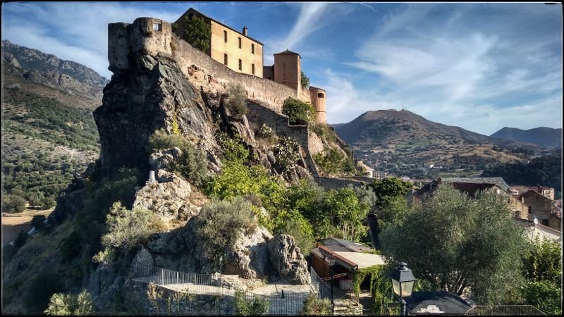
Monday: Refuge de Carrozzu to d’Ascu Stagnu.
6km (3 3/4 miles),
Ascent 860m (2280ft),
Descent 710m (2330ft),
5hrs 30mins by the book
It took me more like 7h 30m. The climb out of Carrozzu was a familiar one, the same that I used to climb a’Muvrella a few years ago. There was the cable bridge crossing over the river and several chain climbs over smooth bone-like granite slabs. The col (Bocca a Muvrella) was perhaps a little less spectacular because of the hazy air.
To the right, the west, was a slot in the rock where the sea was visible so I headed there for a phone signal. It worked too, but only over a small area. Check-in complete, I headed south.
The route takes in two Bocca with the second overlooking Ascu, the ski chalet. Broken rocks and scattered scree made the path less clear which would matter more if there were not GR20 red/white flags painted in strategic places. The high point of the day was the second Bocca.
I sat for a while enjoying the panorama when a Corsican guy came down from a’Muvrella. We managed to chat in very broken Frenglish.
Even from Bocca i a Stagni, the descent looked steep, we stood almost on top of the ski resort, but 1,000m above. The descent would be long and tricky requiring constant concentration. It must have been well over 2 hours before we popped out of the lower aspen woods into the refuge area. That was a tough descent.
7h 30 walking with a few light rain showers (I didn’t expect those). The ground never became properly wet. Rain returned later while I was loafing about in the tent. I had some sleep to catch up on, 2 ½ hours on the first night, plus 6 hours.
Tuesday: Asco to Refuge de Tighjettu.
9km, 1250m ascent,
1230m descent
8 hours by the book.
These are the times to U Vallone, but I stopped at Tighjettu. It took me 11h40m.
Another of the toughest days. The long climb in a curving valley caused some considerable confusion on my part. More of that later. The climb was excellent with a good mix of forest, open scree and steep shelves of granite slabs. Before that was a gully with chains. Those chains are brilliant, especially when carrying a heavy pack; I’d estimate 17kg. I’m getting used to the swinging momentum from this backpack and I know when to tighten up straps for the scrambles.
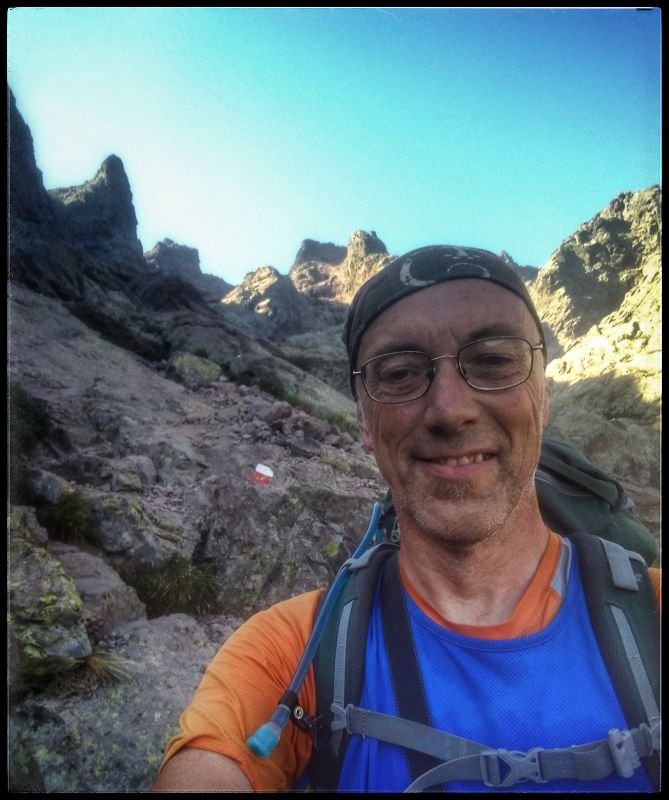
Now on terrain I didn’t know, the desire to take photos came back. The walk took on a new interest. I took zoom shots and panoramas. I even figured a much better way to strap the camera on so it didn’t snag my legs on the steepest scrambles. Those tricky step-ups require suppleness to get the best foot placement. With this incremental increase in freedom, I could climb with more confidence. Eventually, I topped out on Bocca Cinto at 2,202m (but didn’t know it). The IGN map said I was at Bocca PUNTA?? Beautiful but distracted by wrong location. There were neatly abandoned packs from people who were up Monte Cinto. The time was 2pm, too late for me to go up. Two Belgian walkers came back from there and I consulted with them. The dreadlock guy was adamant that I was on Borba, 100%>.
The routes have been changed since the closure of Cirque de Solitude, I knew that and accepted their judgement. That meant a traverse of the Sth slope of Punta Cruchetta to the next col – Bocca Cruchetta. Okay, the route seemed to be working again despite the vaguer tracks. The scramble up to the 2nd Bocca was especially tight.
Here were more magnificent panoramas, the west coast was laid out behind layers and layers of mountains disappearing in aerial perspective. In front/below lay a steep zig-zag descent. The Belgians had already dropped me and scooted down. Progress for me was reduced by that pack’s weight. I should be patient.
As the valley eased, the passage over Roche Moutoné became more difficult. There were too many treacherous fall-offs and false turns for me. Suddenly, a woman appeared who seemed to find the flags more easily than I. As soon as… she vanished again. She was Czech and had lived in Scotland. She also headed for Tighjettu so I wanted to keep her in sight. Her track finding seemed easy.
Each time the trail looked easier, a barrier arose. Then the refuge was visible, then it wasn’t. The GR20 was taunting me today.
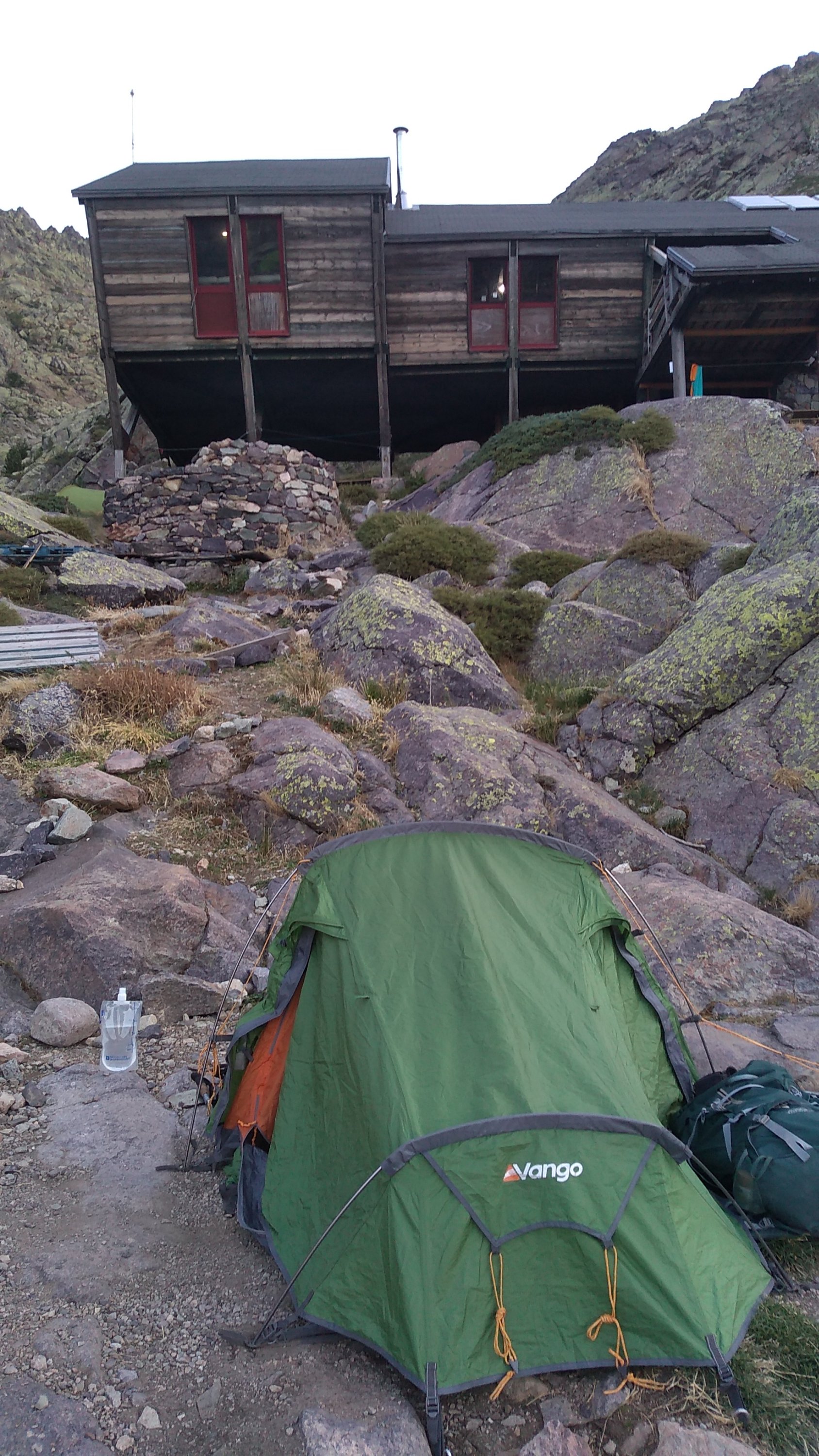
Tighjettu was one of my favourite refuges. A large wooden hut built on stilts with showers and facilities below. The staff were the coolest. Folk music was played and I was served by a tall, young black woman. I love the atmosphere in these places, the light, the objects accumulated like the flags; Russian, Israeli and others. The showers were cold but so what? This was also the first time I’d used a Turkish style toilet, no problem there, in fact- I scored a bull’s-eye first time! There are plenty of rocks to use where you can’t get a peg in for the tent.
I recorded 11h40m for this stage also.
Wednesday: Tighettu to Castel Di Vergio.
Distance: 9½ miles 15km,
Ascent 850m,
Descent 870m,
Time 6 hours,
By now, I knew the routine. Get up at 05.30 to see the many who were about to leave. They seemed so efficient, all packed and finishing breakfast. I had no intention of departing before dawn (06.30). The legs complained anyway, they wanted a coffee stop at U Vallone only a short distance south. I had a breakfast ordered which stood on the table with my name on paper.
Breakfast was a basket of Biscotti, jams and a jug of coffee. Hardly my usual, but hey… The others spread jam on the Biscotti and dipped it in the black coffee. It works well enough but didn’t seem enough for me. U Vallone lay not too far ahead, they’d be serving by the time I passed through.
The trail south was over quite bouldery terrain in parallel to the river. 40mins. Again, another atmospheric refuge appeared. To top-up breakfast, I had an omelette with a decent coffee.
Now the route curves right to the west and uphill through aspen woods. I took a wrong turn loosing the track on a loose bank. Them the Czech woman (Margoretta) appeared above having caught up. She’d made the same mistake and did a u-turn. I cut across and regained the red/white flags. We walked together for a while but a tasty river appeared for a water top-up. With 2 litres bagged, and shirt washed, I resumed. This is the life, I feel part of the mountain now.
Though a slog, upwards over scrambles, gullys and Roche, the altitude gained towards the Boccu. Today was supposed to be easy, said the book.
Once the Boccu was gained, I sat by the wooden sign bolted to a bolder. A chance to recover before the final push to to next refuge, and the next coffee at Ciottulu. Clouds filtered between the spikey summits north-west. A clear trail led across the scree for a nice excursion (that I didn’t have time to take). The Parisian lad was there too along with Czech Margoretta. He’s an easy chap to chat to with his mild American accent. He and M took off first on the descent which was laid out clearly down the valley side. A large herd of goats bongled in the valley floor, the sound travelling unhindered.
The rest of the day would be easy but long. I caught up with M before a river crossing. People were swimming in the pools and lying in the sun, stripped to trunks or bikinis. M agreed to stop to cool our feet. An older french couple were a pleasure to chat to, I shared out chocolate biscuits and went round the Germans laid out drying on the smooth rock. Big grins of gratitude paid me back.
That’s all it takes to gain travelling partners. The five of us walked on enjoying flowing conversation. Over a new looking bridge, the Bergerie du Radule appeared abandoned though a group were setting up camp in a clearing, so I don’t know. GR flags led us past along the west side of the valley into woodland.
Oncoming! A Corsican mule rider ordered us clear of him and his dogs. I didn’t know whether he was warning us about the dogs or did he think we were french?!
Conversation centres on education and comparing German school systems with the UK’s. Suddenly we were on a road, civilisation! The time was after 9pm so we dumped bags in Vergio’s camping field and headed into the ski chalets for a restaurant meal. The camp shop was shut anyway by now. Table for 5 and good food was most welcome. The Germans bought white wine, remarkably generous of them; thankyou guys. I was having the time of my life.
Their field was flat and easy to pitch. Fences around are sturdy enough to kegone aheadp boar out but not foxes, the sign said. They’re ideal for drying washed clothes too. I sank deeply into my mat and deeply into sleep.
Thursday: Vergio to Refuge de Manganu
Distance :17km (10½ miles)
Ascent: 670m,
Descent: 475m,
Time: 5h 45min. By the book.
As before, many were up and packed by the time I got up at 5.45am. day 5 promised to be easier with a forest walk leading to a Bocca with a less rugged view. Nice, but not so fearsome. There semed to be more walkers looking a little tardy about starting off. I went on, once more not sure exactly where the start is. There was a sign behing a carpark pointing right to I took the track. This led parallel to a fence and down. The sound of a pig farm grew more distinct. There was lots of rubbish by the fence, mostly beer bottles. But the path became indistinct. The Pigs were squealing buy now, then a strange image. In front a large grey pig was limping back towards the farm towards a broken fence. She was limping on one front leg. That and the louder squealing was disturbing but I tried reassuring myselfr that it was feeding time. I felt sorry for that pig as I turned round to regain the start.
I’d fallen for the Franch habit of pointing signs for straight-on, they have them pointing right (in the UK, straight-on points up).
Now on the right track and comforted by red/white flags I plodded on in the filtered sunshine. Then a path crossed which is always an opportunity to check the map. As I was puzzling out the direction, the german lads appeared. Their sister had gone ahead. Fortune smiled on me at this pint because I was about to make a mistake and was corrected. The turn took us uphill but not out of the trees.
The landscape developed wonderfully during this longer walk. I sat myself on another Bocca while I made sandwiches and chatted with some others. They spoke clear English but we’re not native speakers, one was Quebeci and the other Portuguese. English is often a common language though I met no other English people. This was a place for some nice panoramic photos.
After the ridge comes Lake Mino surrounded by sweet pasture. It was hot but didn’t look it. A spring is marked on the map though it ran very slowly. A French guy showed me a clever trick for getting chaotic water dribbling into the narrow neck of a drinks bladder. Hold your hand over the spring spout, then angle your THB so it works as a spout. It works!
I explored a little round the back of the lake but there was no source there. Cattle wandered about the short grass and a group of horse riders arrived. Some families picnicked and must have had a lovely time.
Back on the trail, I saw the Belgians as I took another rest. I must be tired, I took another rest under a magnificent tree and tended to my boots. The sole is starting to detach and some stitching has frayed. This will be their last journey.
The next refuge had a cowboy feel to it. Wooden fences and mules for transport. The boss was loading huge boxes of beer tins from a mule. He looked like Sea Sick Steve, the folk singer with his huge beard. What a dude! Margoretta was there with the german lads. They were pulling out, one has a knee injury. The woman seen with them yesterday, who I enjoyed talking with, had gone ahead. She’s possibly going for a double-stage.
Across the plain we could see Manganu, my target for the day. An elderly fell-runner bounced past making it look easy as I drank coffee with M & The German lads.
I spend 9 hours according to my stopwatch. That does include rests, taking photos and collecting water.
Friday: leave the GR20. That was the best week of my life!