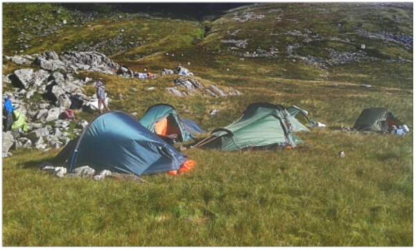
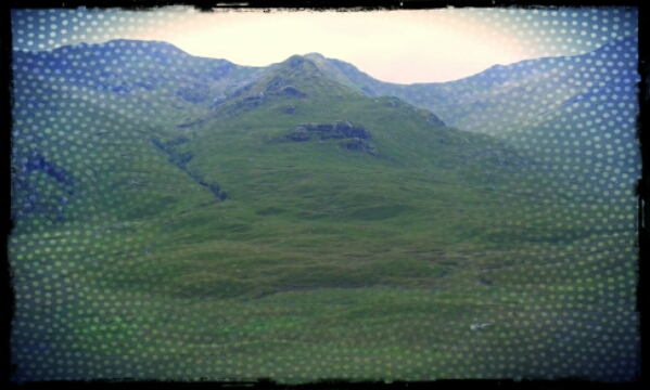
Rhinogydd Bivvy night.

17°C, fair breeze in fair weather.

It took all morning for the rain to clear so I waited patiently. It doesn’t matter because my plan was not to descend the mountain today. I will stay up there. After some experimentation with packing my 45 litre day bag, I decided to go ahead with the smaller bag.
My expedition pack in in for repair so can’t carry the little tent, even that won’t fit. However, the bivvy will. The sleeping bag and stuff fits inside a 45 litre pack with a tight squeeze. By lunchtime, that rain eased off.

The start was across a waterlogged farmland and onto the hill. My route took a glancing path aside the range and then onto a bwlch (col). Suddenly, the sun shone and two possible routes presented themselves. Since I am by myself, I took the safer looking ascent to the west. Once on the ridge, the unique Rhinogg landscape laid out before me. The Rhinoggydd is part of what geologists call The Harlech Dome. It’s an ancient, Pre-cambrian sedimentary deposit which has pushed up to the surface. The rocks are hard and well consolidated for sedimentary rock types, a product of their very great age. Erosion has left us with rounded terraces, ice shattered rocks and layers of mixed grain beds. It was on one of these terraces that I opened out my bivvy bag. One small bolder overhand slightly, ideal shelter for my boots should it rain (it didn’t)
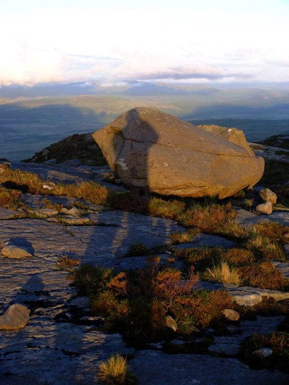
rhinoggSunset

Back to the sunset

As soon as the sun was down, the sky clouded over. The night was warm inside the bivvy and I carefully unzipped the bag to look out. Above was spread the twinkling universe and a planet that may have been Jupiter.

It took ages to get to sleep, and then ages to wake up in the morning. I was cosey in teh bed and dawn was thick hill-fog. Eventually, hunger for breakfast got me up at about 7 am.
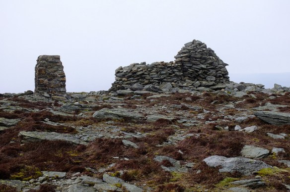
Foel Boethe warmup.

17°C, set fair with a brisk SW breeze

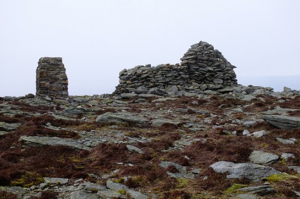
Medium pack walking in fine conditions. Footpaths are better signed this end of the range. The X-shelter on the map is literally a stone wall in the shape of an `X`. It`s in an odd place, I can`t see why there since there are summits nearby that may need shelter for mountain walkers. Perhaps it`s not for them. Perhaps it’s for the people who maintain the county boundary fences.34089312921_4a4f52d2bc_z

There was some faffing about on the descent, in one field, gorse overgrew a stile which was not visible until I had climbed over the fence. Relief that it was not my navigational error that hid the stile.

This was a very satisfying walk in easy conditions. The summits are not especially high but in a sea of rolling grasslands, the views were still very grand.

Return from Cafngaw.

8°C, no wind, white cloud and dry.

I hiked with MapMyRide+! Distance: 10.35km, time: 04:16:00, pace: 24:44min/km, speed: 2.43km/h.

http://mapmyride.com/workout/2142592775

Cefngw bothy.


Up a bit late so finally woke after 7am. I blame that chocolate muesli bar from Aldi. Strong chocolate can do that. After walking for over 8 hours, I should have fallen into a solid sleep quickly. Normally, that’s what happens. I woke in the night after anxiety type dreams. I was worrying about the car in that isolated car park, away from the road. Images of broken windows and fire damage pestered my mind.

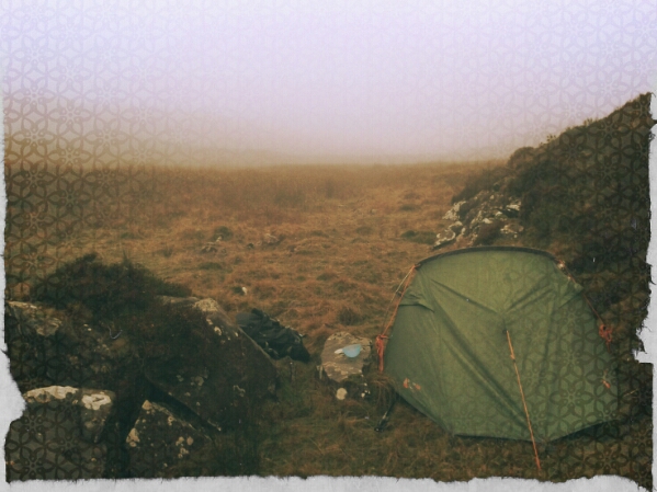
Woke late, the day was an hour old by then. At least I got the tent down quickly. Then plotted a route back that loops around the north of the mountain. There is a lake that might be good to visit but I missed it while picking the easiest route through the heather.
Once past the bwlch, the land opened out into an enormous ocean of grass, softly undulating to the northern horizon. I wonder whether Scotland has anything like this?
Curving round to the east, the land dipped towards the first signs of civilisation. A couple of farms appeared on the Llyn Arenig which flows into the reservoir by the car park.

Rather like the start, signage is poor but the public paths were clear enough on the map. I don’t like simply striding through somebody’s farm, especially with newborn lambs. I took a wide circuit around them. It’s no good to cause stress to their mums.

Arenig Fach up.

8°C,light wind and dry. Some cloud above 500m.
I hiked with MapMyRide+! Distance: 10.21km, time: 08:15:00, pace: 48:29min/km, speed: 1.24km/h.

http://mapmyride.com/workout/2142574688

Stuart at about 10.15. The first paths were a bit tricky to find. The map was clear enough but on the ground, no signs, so stiles, nothing. I have always wanted to walk the Migneint Moors, now here’s my chance. It wasn’t as boggy as I expected but kid heather was hard work. This spring has been quite dry, I’m grateful for that.
The trick here is to look well ahead to find strips of grass that run between heather fields for easier passage. It’s worth getting to a ring contours for the view ahead. Even here, grass is in big tussocks, so each stride is awkward. People with shorter legs might struggle. I wouldn’t bring a DofE group here.
34089312921_4a4f52d2bc_z

Arenig Fawr evening

10°C, dry with light high cloud.
I hiked with MapMyRide+! Distance: 13.75km, time: 04:35:00, pace: 20:00min/km, speed: 3.00km/h.

http://mapmyride.com/workout/2142590177

34089341941_2a57e13777_k

At 4pm, I decided to go. I was parked and in a good place to choose from a few options. The weather is very stable right now and it hasn’t rained for weeks. I threw some rude in the rucksack including my stove and supper. That turned out to be a very good idea. Just in case, I packed a spare torch too.
The route started simply, then a possible ascent onto the west of the ridge opened up.
These aren’t massive mountains, so making the first top was easy enough at 700m.
I got my breath back while taking photos and then took the ridge East. The summit is visible all the way. A cairn at the top has very good shelters. There was an ideal spot to get the stove out and make cous-cous. To improve it, I sliced up some cheese and had a very pleasant meal in a rather wonderful place. Familiar mountains were visible in each direction. The Rhinogau, Cnicht, Snowdon and the Gliderau.

Kinder downfall

10.20am Grey start with hill fog visible above 400m. heavy rain later.kinderdownfall

Walked with Chris along the southern edge of Kinderscout plateau. Once on the plateau, we took a diversion to see a WWII crash site then returned to our main route.

The intention was to see Kinder downfall after a night of rain. We even considered the possibility that the downfall would blow upwards. The waterfall is at the head of quite an angular valley facing the oncoming wind. As it turned out, visibility was so poor, <50m, we could not see any water although heard it clearly.

Rain started around the time we descended becoming quite heavy as we popped out of the cloud base.
I had a flask of hot water waiting at the car. The choice was soup, coffee or tea in the form of sachets or infusion bags. the kit list was about right. I had normal walking trousers plus thermals under. Even when the rain started, I didn’t feel such a strong urge to put the waterproof overtrousers on.
Note for future: (1),this worked really well. the water had kept hot for 8 hours. If I were to take a flask on the walk, it should be a bit smaller than this one. I’ll keep it for sharing.
(2),I barely used my new camera, but it’s better to take a light camera and not use it rather than a heavy one and not use that. One problem, it has a strong magnetic field. It deflects the compass by a good 30°C. It’s awkward taking compass readings at arm’s length.

3: Carned y Gribeau and broken bridges.:

9°C. fog and no wind, no change from yesterday.

Wild-camp-> end: Woke to more fog and the sound of grouse. The night was utterly silent apart from the gurgling of the spring. Occasional soft drizzle and the odd waft in the calm air.

Back to the fenceline and head north. Back at L. Edno was a big pile of rubbish caught in a fence. The day before, made a note of this and returned to clear as much as possible. My storage was limited because I had my own rubbish, but I got the worst of it.
Next, walk north along the fences again. Net a fell runner heading south who seemed a bit troubled by the navigation. I know the conditions are tricky, but all he has to do is follow the fence line. His route round Edno is unnecessary, and probably slippery.
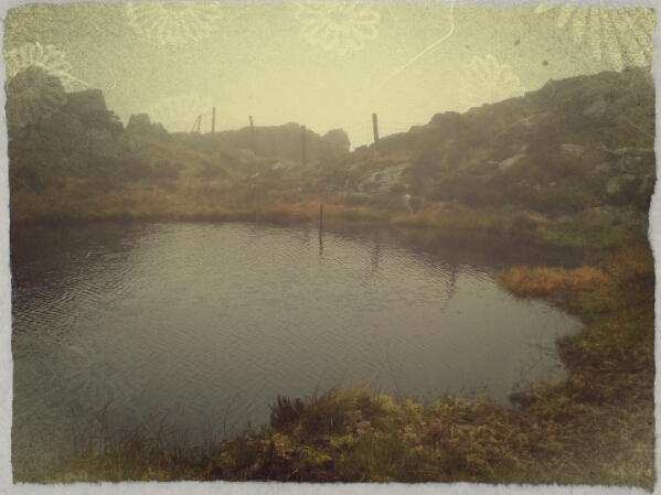
I continued passed the bwlch onto Carned y Gribeau. There was a brief moment of clear air which urged me on. The summit has a nice little lake which made a good place to shelter and eat.​
 For a small lake, it was amazingly deep. Even at the edge, I could plunge a fully extended walking pole.

The descent was aimed for the footbridges at SH673560. the ground in that area was horrible to walk on, lots of plunge holes and hidden streams. It was a struggle to get there only to find the bridges long destroyed and deeply rusted. Take note, they are clearly marked on the OS map, but not on Harvey’s.

Eventually, back at the car, I was glad to get my wet boots off and dip in the lake to wash my feet. You have to treat wet feet as soon as you can to prevent unspeakable problems later.

2:Wild camp in the Molwynion

11°C, hill fog above 300m. Light SW.
By the time I broke camp at Hadfod y Llan, and re-packing my expedition bag, it was 11am.
I parked by Llyn Gwynant and started the day’s walk. The first part was through dense forest. Autumn looks different here, colours on the ground are very vivid. Even in the forest, bracken was almost fluorescent. I should have stopped to take more photos but the day’s walk is long.
Wild-camp after a 5 ½ hour walk in hill-fog. START: Llyn Gwynant then walk up the woodland to the hills (SE). Hillfog above 300m, no wind so no change.

Pitched at the top of Cwm Edno.

Lots of micro-nav Llyn llagi was invisible though I could hear it. I actually found the turn to make the gully onto the plateau. I missed it last time in clear summer air. I managed to pass Llyn yr Adair without seeing that either. Heading east, eventually I met the fenceline to confirm my position. There is a real complex of hollows, valleys mounds and mountains here. An area worth more exploration.
Northwards eventually, I got to Llyn Edno, my intended camp. To avoid the cool breeze, I headed down to Cwm Edno and found an ideal spot next to a spring.

ML training expedition.

12°C, cloud from 50m, strong wind 40mph at 900m.​

Heavy pack was a drag on this climb. But to walk in a group, I was not left behind even though my bag was the heaviest (at 18kg).

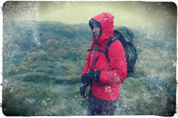
We got to Foel Grach and I took the navigation from there to the next summit. 40mph wind and rain was quite a force away from the shelves of a wall. Paths are, however; easy to follow up there. Jenny navigated to the next summit which has a mountain rescue shelter that we recovered in for a while.
Descent to the lake also offered some respite, although the wind dropped, gusts were stronger.
Our intended camp was confirmed when we found aircraft wreckage by a small lake. We all pitched together by some crags.
I was glad to climb in and change into some dry clothes.
Night navigation: u that was hard. Wind, hill fog and bouts of rain made visibility poor at best. We had to figure where we are at any time from the slope of the land in a circle 20m around. Occasionally, you can use a arch as a landmark, or grass but that’s all. But, it is actually enough.
Two obstacles were tiredness and the visibility. If only there was a clear sky above.
I think I did okay.
Mike, the trainer thought so too. However, I have a few problems to solve:
Poor vision in rain,
Keeping warm,
Feeding in the night.

Cluanie Ridge

Creag a’Mhain, (m), 947m,
Druim Shionnach (m), 987m;
Aonach air Crith, (m), 1021m;
Maol Chin-dearg, (m), 981m;
Sgurr an Doire Leatham, (m), 1010m;

Started with cloud at 800m with some breaks. After tricky path finding up Drochaid an Ullit Ghubhais it got easier, though steep. Once on the ridge, paths were easy to find despite no visibility. Concentration was needed to keep a track on location. Ahead lay a string of summits and bealachs. With visibility no more than 30m, other techniques were necessary to keep your position in mind. At 12.30, I pulled the storm-bivvy bag out and climbed in to read the map and eat sandwiches. These things are amazingly warm, even by myself.

On the next summit, a guy appeared out of the mist heading my way. He was James, a real Munro bagger. He had 90 odd and was keen to get as many as possible today. He suggested we walk the whole ridge together to his car and he could drop me back at Cluanie Inn. That’s not much more than my planned walk and I’d get 7 munros ‘ticked off’.​

Part of the ridge, from the road.

Finally, the skies started to break on approach to the last climb. The bonus munro would be free of hill fog. Better than that, the light sharpened revealing fine views south into the deep Glen and even out to sea. Skye could be seen and possibly, Rum.
Feeling tired and thirsty, I hoped for an easy descent. But no, the rounded boulders underfoot would require concentration all the way down from 900m to the river. On another day, that would have been fun. I will have to come back.