18°.C, breeze W, sunshine.
I rode Paddy Wagon with MapMyRide+! Distance: 49.45km, time: 01:54:22, pace: 2:19min/km, speed: 25.94km/h.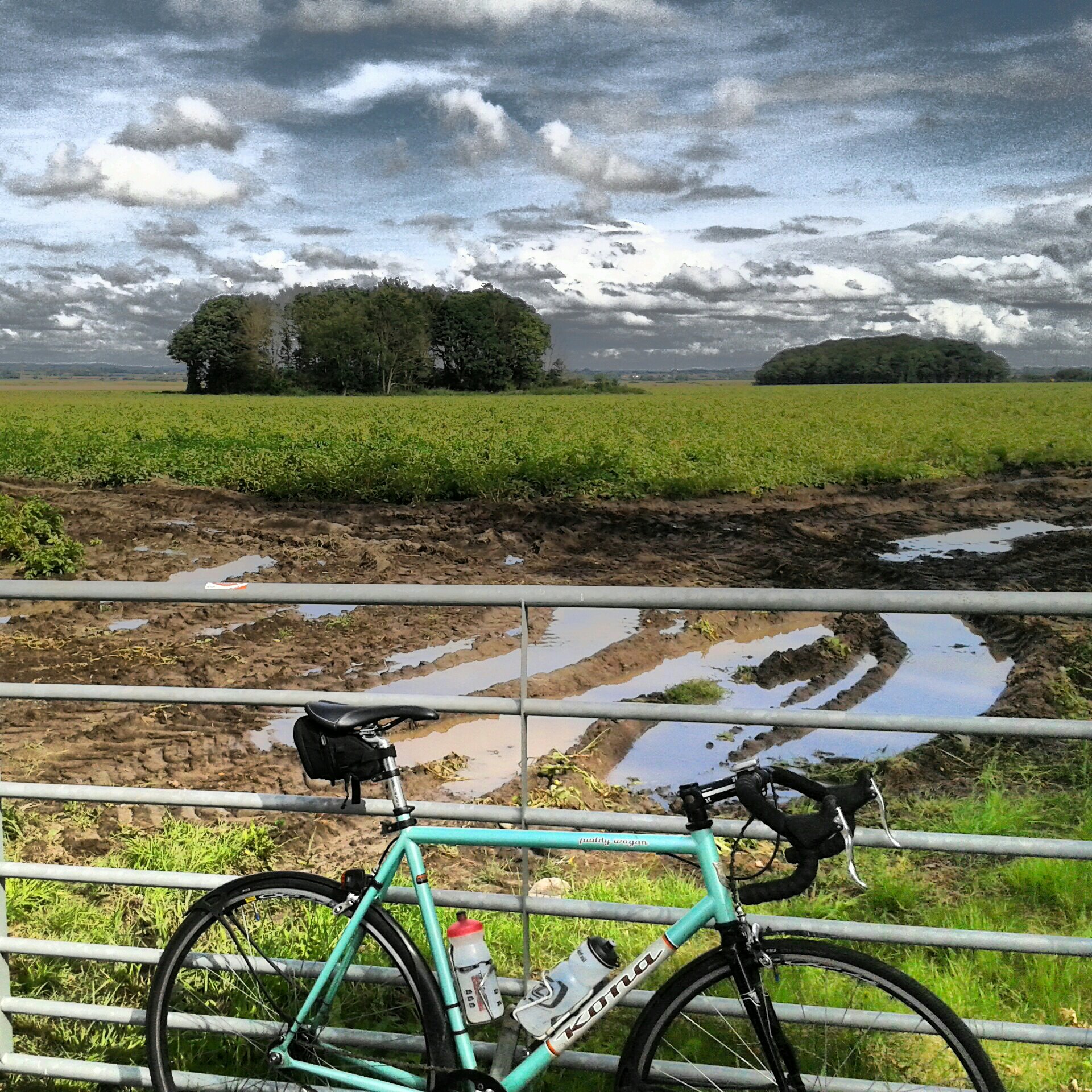
http://mapmyride.com/workout/2382292640
A refreshing ride along familiar roads.

18°.C, breeze W, sunshine.
I rode Paddy Wagon with MapMyRide+! Distance: 49.45km, time: 01:54:22, pace: 2:19min/km, speed: 25.94km/h.
http://mapmyride.com/workout/2382292640
A refreshing ride along familiar roads.
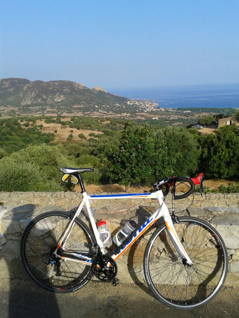
33°C, sunny nil breeze.
I rode Zing with MapMyRide+! Distance: 50.40km, time: 02:38:59, pace: 3:09min/km, speed: 19.02km/h.
http://mapmyride.com/workout/2375533769
Roaring got cut I’m managing hydration better now. A big drink before I go and a top up at Corbara. The loop round the back of the valley passed Zillia and Calenzana soon looked more appealing. They have newly tarmaced the road too, so progress should be quick.
34°C, hot sun.
I rode Zing with MapMyRide+! Distance: 27.49km, time: 01:18:48, pace: 2:52min/km, speed: 20.94km/h.
http://mapmyride.com/workout/2373286736
Set off early into to rising run. This works well because much of the climbing is in shade here.
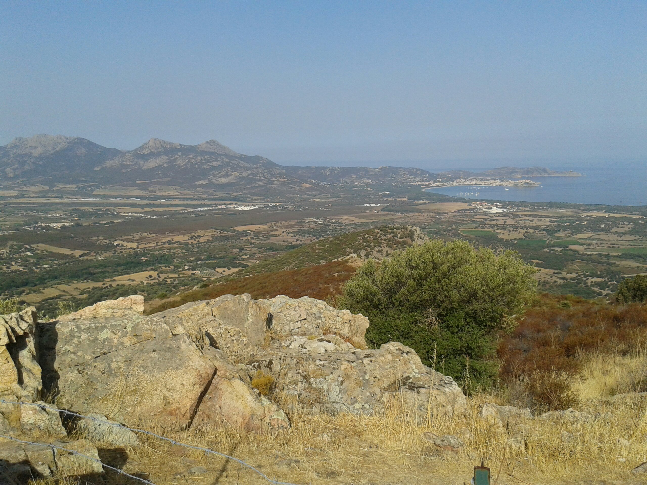
31°C, still and clear blue.
I rode Zing with MapMyRide+! Distance: 41.74km, time: 02:09:25, pace: 3:06min/km, speed: 19.35km/h.
http://mapmyride.com/workout/2368525580
Much better hydration management today. I tanked up more to start and stopped at a spring in Corbara for a top-up. Temperatures are forecast to rise slightly, whatever it does, it’s damned hot.
30°C, light wind, 0 cloud.
mountain day in the Corsican mountains.
starting from Refuge de Bonifatio.
I hiked with MapMyRide+! Distance: 16.88km, time: 14:28:00, pace: 51:25min/km, speed: 1.17km/h.
http://mapmyride.com/workout/2365889798
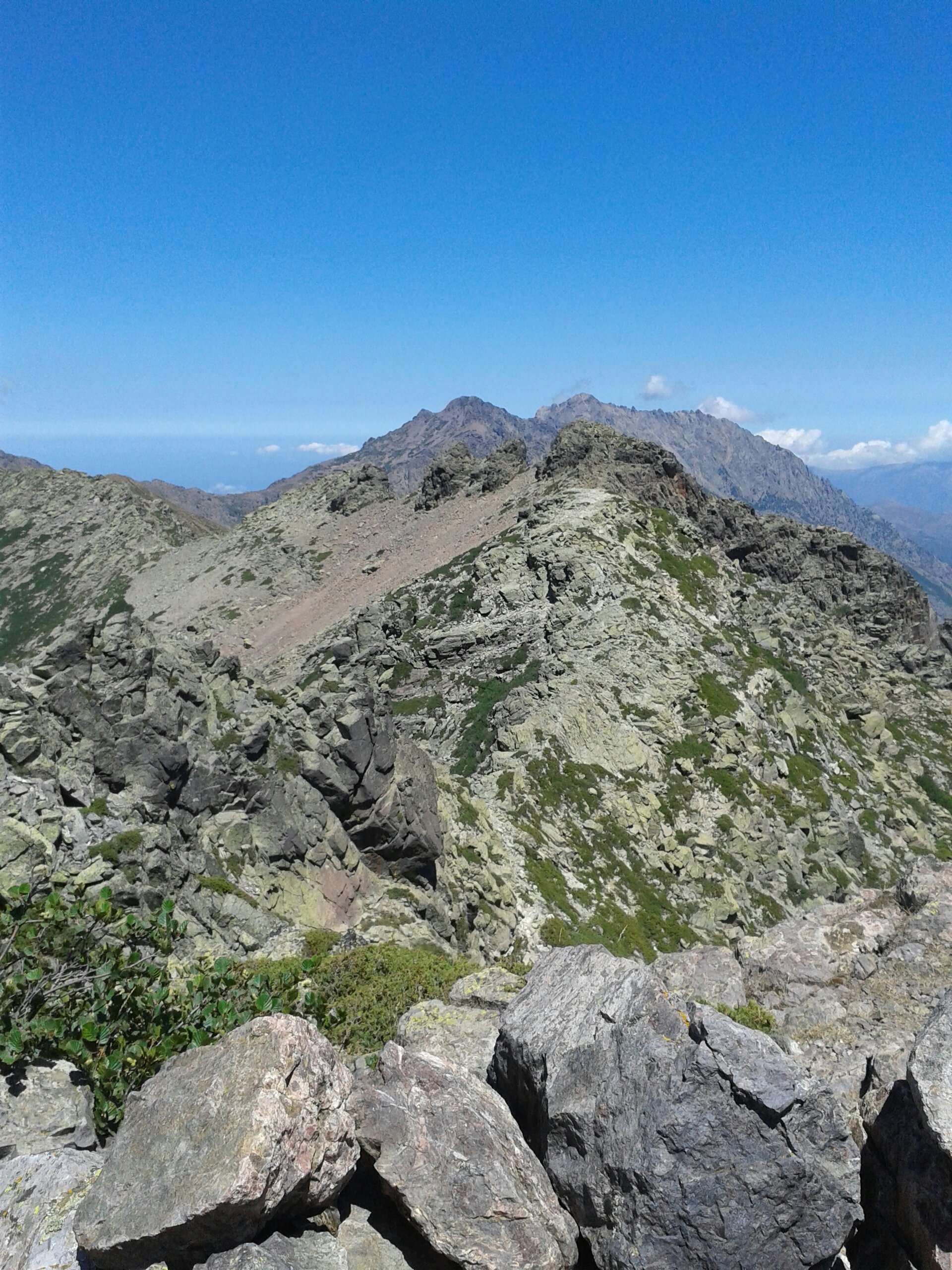
Anyway, the mountain. Every mountain has a character. This one has tricky scrambling near the summit with a few sides with exposure. The Ridge approach is sharp blocks but secure footing. I tried to find a decent that that cut out a loop as recommended in the walking book. I couldn’t find it. Finally, after some false routes down steep descents, I happened upon a amounts round the south which was much easier. Those explorations cost me an hour.
Mountains provide a mix of extreme beauty, exhilarating views and danger. Travelling solo forces every decision to include safely and risk consideration. The rocks are sometimes sharp, sometimes loose and sometimes shielded by lance like thorns. Every step scattered turquoise tailed lizards.
Once above the tree line, aspen that is, alpine meadows are ready to find. Here, they are bursting with tiny flowers in blue, white and yellow. The granite is green here, and it’s lichen.
It’s a remote mountain sometimes used as a diversion by GR20 walkers.
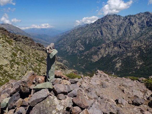
Although the mountains opposite had patches of snow, my side was very hot in ascent. That was fine until I ran out of water. My voice was dry and I kept a sharp lookout for heat exhaustion. I know this from a child, you get fuzzy and start to shiver despite the heat. I have to admit, I was quite worried. Eventually, the last suspension bridge indicated that Caruzzou is near. That means food and plentiful potable water.
Everybody looked fresh and comfortable at the refuge. Their day was no more than 1/3 of mine, though they carried heavier packs. I could easily manage the whole trail, all fourteen days. That group we met in the supermarket completed in 14 days with no rest days. I’d want to take in excursions like A Murvella.
Supervising, I see groups who want to be first into camp. My aims are not like that. I want to be last in. I want to spend as much time soaking up the mountains. If I get to camp by five, I think I should have spent more time on the hill. As long as I get to camp in twilight, then it’s been a good day.
This route to A Muvrella was the equivalent of nearly three GR20 stages.
A friendly french guy was travelling in the opposite direction to me and he was happy to chat. I was looking for the junction of paths at that point and he was quite helpful. He joked that I would do my climb and catch him over the col. He explained that he was slow.
For the second time, I arrived at Caruzzou just after six. Up to four hours without adequate water left me desperate; I feared heat exhaustion. The shivers hadn’t begun, but my coordination was failing. I could hardly talk, hours of dust and a dry throat made eating the taboleh a real effort too. It would drink water to wash each mouthful down. I wish I’d ordered soup though.
I drank and drank then filled up the bottles some more. Feeling come back to my legs and the clock ticked by. It was time to go. 2 1/2 hours to the bottom and the sun was eyeing up the horizon with mal-intent. Although good lights were in the pack, it would be nice to get to the car before complete darkness. Off I went. Once moving, the legs worked properly to my relief. The French guy in grey was approaching, wow; he said he was slow!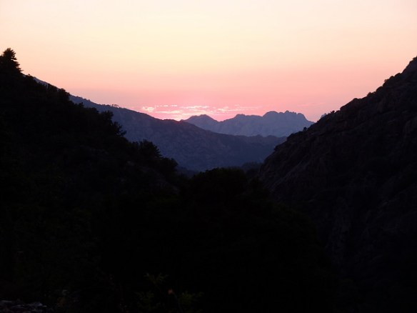
The Valley lines up well with the sunset, so the light falling in clearings in the trees was magical. Yet another magical sight, you can’t tire of these.
I reached the car by about 21:45 and only needed to use the lights to find my keys.
A perfect day that I shall never forget.
33°C, brisk westerly, 0 cloud
I rode Zing with MapMyRide+! Distance: 27.60km, time: 01:22:27, pace: 2:59min/km, speed: 20.08km/h.
http://mapmyride.com/workout/2360194439
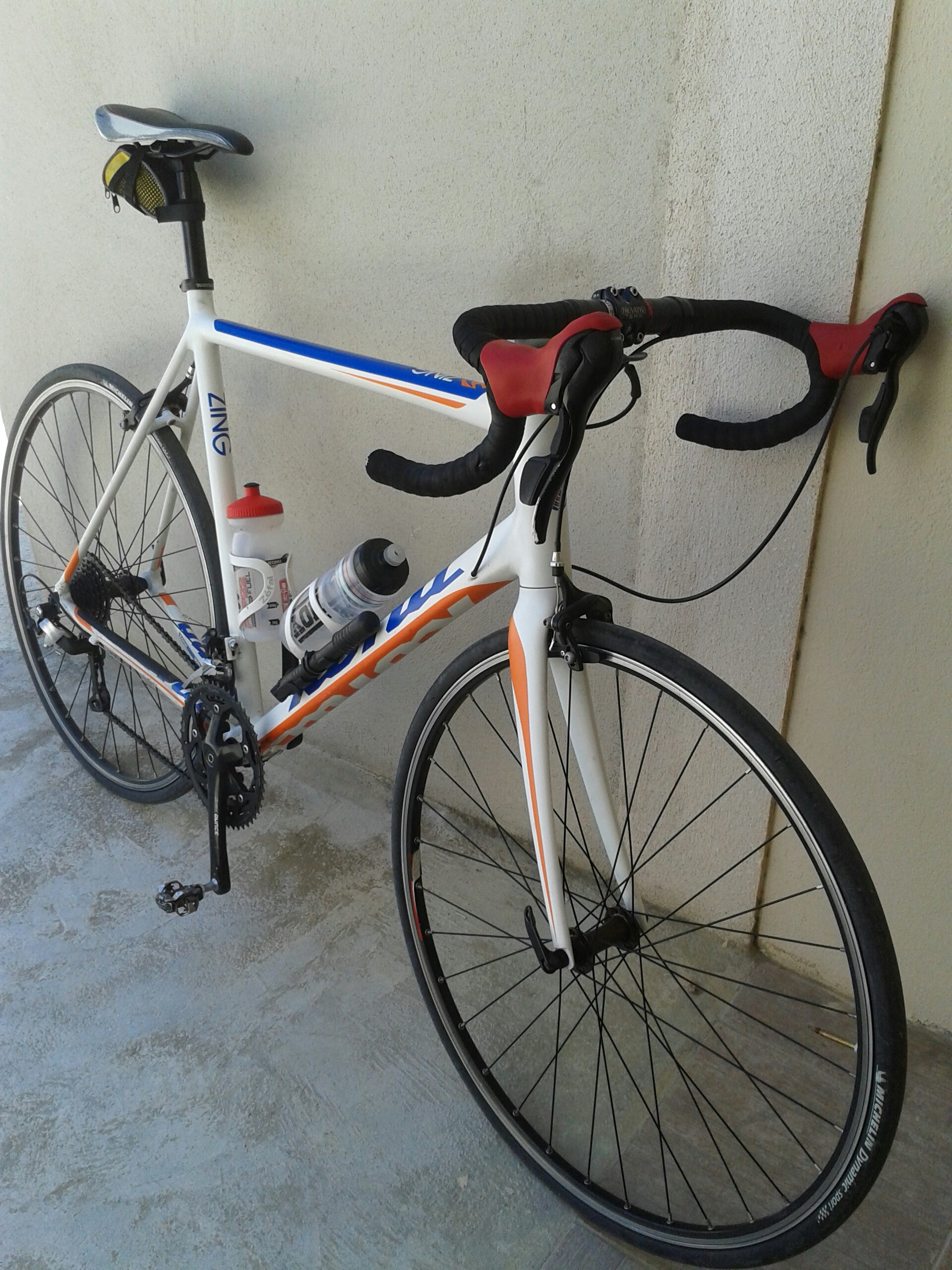
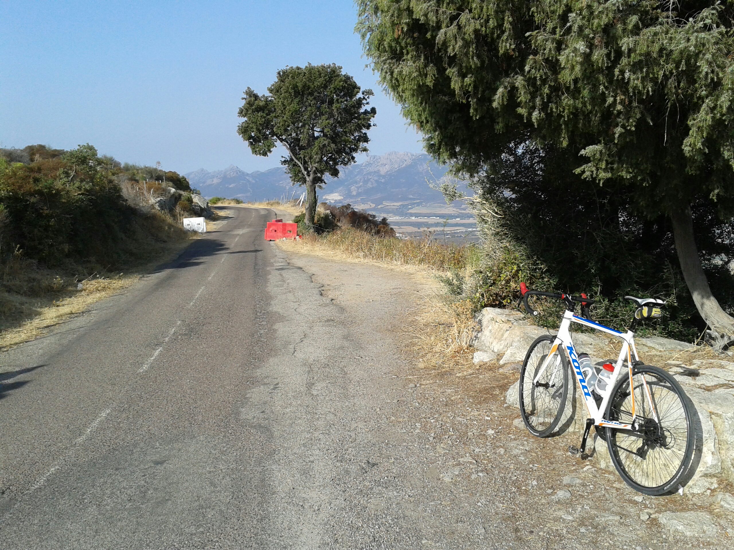
I’ve rented a bike for the second week. It’s a Kona Zing, an aluminium road bike of about the same age as my Jake. However, it has some B’Twin kit fitted. I suspect that a B’twin bike was cannibalised for parts after a crash. I bet it was the same bike I rented last time. The Kona frame is far superior though. It’s lighter and feels better climbing= and fast cornering on descents.
Nice route anyway, a familiar one from a few years ago, just to test the setup.
28°C, still and bright sun
I hiked with MapMyRide+! Distance: 5.88km, time: 01:00:07, pace: 10:14min/km, speed: 5.86km/h.
http://mapmyride.com/workout/2357750897
Drove to the panoramic to walk up to the ruined village. It only took 17′ to get there.
From there, the drover’s path leads south and a narrow path takes you up to the summit.
The top is easily reached by following clear paths. The macchi is very scratchy which is deterrent to exploration. You can’t just wade through like Welsh bracken. At least the grip underfoot is good.
Anyway, I spent time on the rocky summit, even this modest summit offers impressive views.
I hiked with a light pack with MapMyRide+! Distance: 12.31km, time: 02:04:53, pace: 10:09min/km, speed: 5.91km/h.
http://mapmyride.com/workout/2351290559
stopwatch says 3H 15m, the gps page over 3 hours. Maybe the terrain interfered with the signal because it said ‘paused’, ‘unpaused’ all the time
Anyway, it was hot, very hot: 35°C moderated by very strong wind.
Apologiesddy Wagon with MapMyRide+! Distance: 33.39km, time: 01:13:39, pace: 2:12min/km, speed: 27.20km/h.
http://mapmyride.com/workout/2346604988
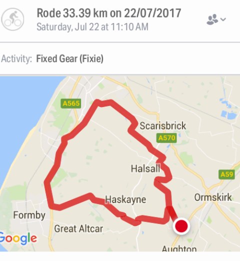
Apologies for the title. I saw the oddest thing on the Formby Bypass. Two police bikes pushing south with blue lights. Another tore down the other side, also south but on the wrong side of the road. Then he did a sharp u-turn. A bit too sharp, his foot caught under the rear wheel and almost dragged him off. A moment of unprofessional conduct.
18°C grey sky S wind.
I rode Racelite with MapMyRide+! Distance: 37.83km, time: 01:35:49, pace: 2:32min/km, speed: 23.69km/h.
http://mapmyride.com/workout/2344632842
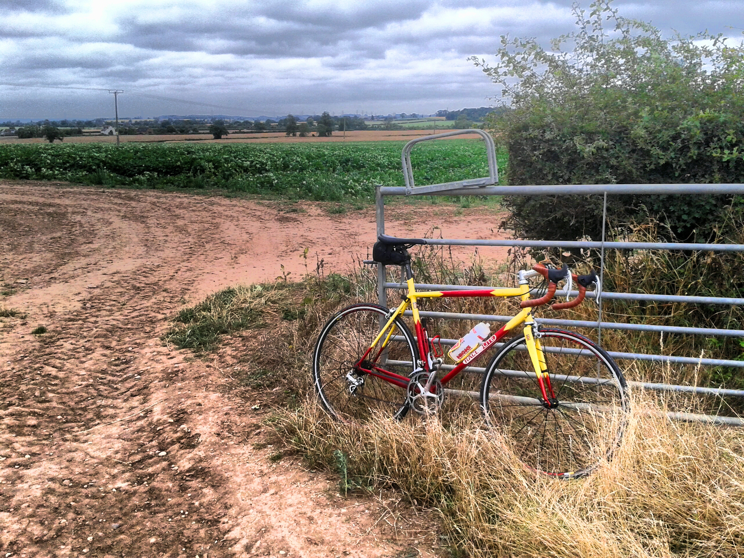
I have some fizz in my legs. This wonderful feeling has returned since leaving that workplace. It’s amazing how much stress can bring you down.
