10°C, rain most of the day. Milky mist with some patches of sun.
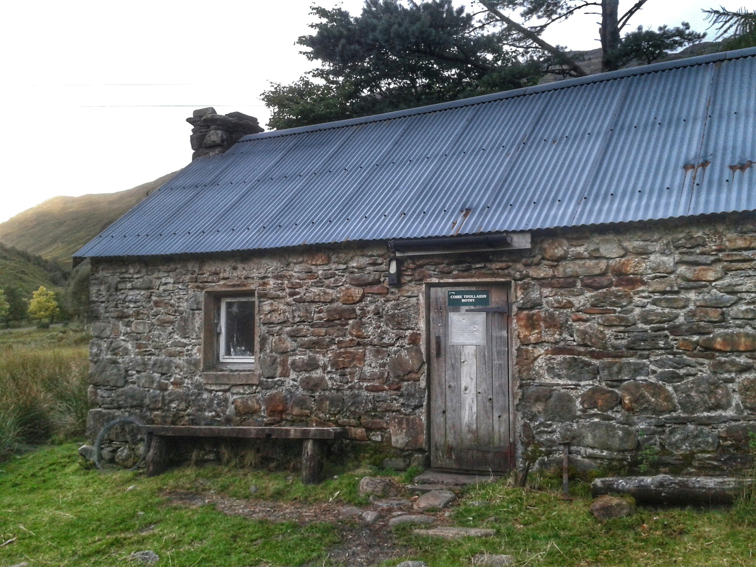
Corryhully bothy is ideal for this route. In effect, I went straight out this morning onto the hill. Nevertheless, two hours went by before I reached the first summit. At only 6°C up there, there was no reason to stay long apart from hunger. A few hollows offered shelter enough to eat sandwiches.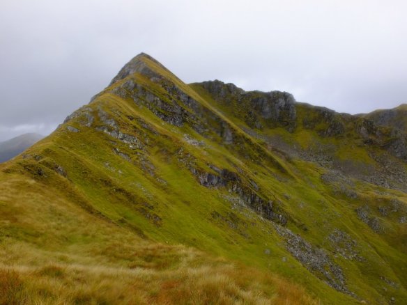
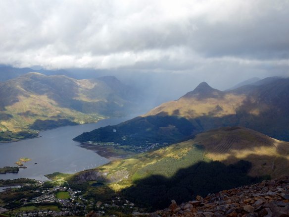
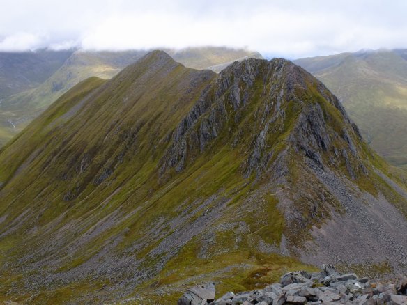
The next few tops are all north. It turned into a ridge walk after the next summit, Stob Coire nan Cearc (887m).
As such, there was much to enjoy, despite the rain.
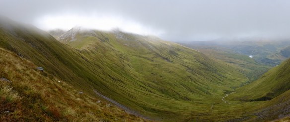
The most spectacular bit was a step in steeply inclined rock that looked impassible from a distance. My mind raced for escape routes should that step in the very narrow ridge defeat me. Each of those steps is about 10m of rock. From the bealach where I took the photo, they looked vertical. They were very steep up close too, but a clear scramble was obvious. The apex of the triangle in the photo is not the summit, for that look right to the crinkly skyline- it’s there by the cliffs. I love that feeling when walking on a ridge where your peripheral vision is down a huge drop in height to the glens below. There is more of that feeling after the summit and the ridge curls round to the right. More fine views and an opportunity to read the route down in the grassy topology. At first, the descent looks like a spur but it’s actually more a low wide whale-back that climbs up to more summits. The idea then is to find a route down into the glen as close to it’s head as possible. The further forward you go, the more climbing out of the glen to the bealach and back down again. It’s a compromise between descent and return ascent. Near the top of the glen are some nasty looking steps and minor cliffs that meant a diversion north into the valley to find a safe route down. Also, the further north you meet the river, the bigger it will be. Side streams join every 200 metres to engorge the river very rapidly- that means a more difficult river crossing. River crossings can be dangerous (and nobody knows I’m here). Braiding in rivers really can help, they divide the river into several streams that are much easier to cross.
Oh, and that col! It map so mucky, all boggy between slippery boulders. That was hard and quite dispiriting at a time of failing light and indistinct paths.. Oh well, it’s all down from here.
Even the fords are currently verging on dangerous. The last one, at least, cleaned my boots.
The walk took 9 hours and at times, was the a slog. The climb was steep but the return was so difficult.
Today’s rain filled all burns and fords with roaring yellow torrents. Every possible pathway was a stream, others were buried in ponds.
A very wet day. I’m now lying in my bunk with most of my clothes drying by the fire in this bothy. There are busy voles above and the roar of water outside. The rivers are now all in spate.

 It was here that I encountered the first midges of the trip. I crouched down at a burn to collect and filter drinking water. I got mobbed by them. Once on the track, I turned east for the long walk back along the West Highland Way. Not having seen anybody all day, a few small groups passed going north here. One group of Germans were setting up camp in a short grass patch on the Glen.