Walk in windchill.

2°C white cloud and strong E. Windchill very significant.

I hiked with MapMyRide+! Distance: 12.95km, time: 02:27:16, pace: 11:22min/km, speed: 5.28km/h.
http://mapmyride.com/workout/2740750153

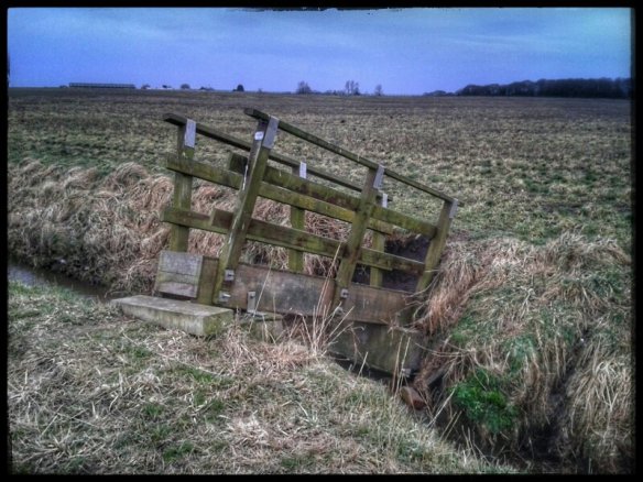
It looks as though it’s about to drop into the water.

Lancashire has a crack in it.

There are rows of these grooves, probably cut to prevent flooding in the middle of these very flat fields.

All day, that wind was a feature on this open route. Some sections were sheltered but not many. They provided some respite and reassured of in my choice of clothing. I wore the same as the Ainsdale dune route a few da p ago when it was a good 4°C colder. Today felt colder. Feeling slightly cold for a long time takes a very long time to warm up again. A factor to consider for ML assessment this summer.

Drying mud.

17°C, sun and negligible wind. Dry.

I rode CX with MapMyRide+! Distance: 18.4mi, time: 01:47:20, pace: 5:51min/mi, speed: 10.3mi/h.
http://mapmyride.com/workout/931767171
Better weather brings dry air and warm sun. Each day sees the ground becoming dryer and firmer.
I alternated rides this week on the CX and fixed bikes. Each is getting faster.
Today, the canals were less busy, only a few lonely anglers and couples walking dogs. Between them, I built up the speed reaching 17mph along some towpaths. It still requires considerable concentration, but there is less squelching around in black mud and nervously negotiating bridge cobbles.

image

The bike has thin mud at the back, but some of it smells of dog shit.

Meanwhile, the rest of the country basks in sunshine.

I rode CX with MapMyRide+! Distance: 18.4mi, time: 01:47:20, pace: 5:51min/mi, speed: 10.3mi/h.
http://mapmyride.com/workout/931767171
Plod around some canal towpaths in figure-8 routes. On one bridge, a family stopped while dad fixed the lad’s puncture. That was his role for the day.
The mud is more viscous now and the thorns seemed to soften. Anyway, no punctures today either.

Muddy good ride.

I rode CX with MapMyRide+! Distance: 22.1mi, time: 02:30:15, pace: 6:5min/mi, speed: 8.8mi/h.
http://mapmyride.com/workout/927048337
Slow recovery ride along canals and paths. Largely repeated the route up to Wychnor and found it waterlogged in places, but not the same places as last time.
No punctures. 🙂

image

This part of the canal runs next to the river Trent, overspill pours into the river to the left of this photo. Nearby fields are also flooded.

Icey crust below, canal woodpeckers above.

4°C, SW brisk, rain/sleet.
Rode CX with MapMyRide+! Distance: 21.4mi, time: 02:25:57, pace: 6:50min/mi, speed: 8.8mi/h.
http://mapmyride.com/workout/882936239
Eventful short ride.
Took the reverse canal route from Friday, my own tyre tracks are still there. The tyres broke a crispy thin ice on puddles and mud. After only 3 miles though, two punctures, both thorns. I then went to a cafe to warm up and patch the tubes.
image
Another cyclist suggested Slime Tubes, it’s got to be worth trying.
Later, headed towards Cannock Chase through Armitage. That’s where the rain started.

Then, something strange. Riding under a low bridge, I had to duck down against the bars. But on emerging, suddenly ouch a stiff back- I pulled a muscle. That decided it, turn home. That’s when the sleet came down and wind picked up. So I put my head down and slogged on. Woodpeckers must live near canals, one sounded very close. There were also many dogs to give way to. Will it get too busy to use these routes in the summer?
With a wind like this, there should be a good draw on the fire at home. Though the miles are low, I looked forward to a warm log fire.

The patches held.

Canal gloop.

I rode CX with MapMyRide+! Distance: 18.9mi, time: 02:15:16, pace: 7:10min/mi, speed: 8.4mi/h.
http://mapmyride.com/workout/881230961
Yesterday’s rain is soaking slowly into saturated ground. It’s deepest by gates and stiles where walkers have trod. These cycling shoes didn’t let me down. The only skid was on a wooden bridge all covered in slimy moss.

image
The best bit was along a bridle path towards Wychnor. It looks like cattle land, though none were visible. Most of it was wet but rideable. Crossing points were deep mud, which on flat ground is more stable.
Weather looks unfavourable tomorrow.
Only 18 miles but it felt like more.