Leaving the GR 20

Bergerie de Vaccaighja to Corté

21.5km (13½ miles)
Ascent 300m (985ft)
Descent 1,420m (4,660ft)
7h 30m

With a heavy heart, I have to leave the trail and make my way East to collect family from Bastia airport on Sunday morning.

Descend to Corte: a long escape route, over 12 hours walking. Edinburgh Dave left too after a cold night. It was only 7°C at dawn and he slept in a sleeping bag liner only.

The Belgian lads also left here with bad knees; the German guys went down yesterday with an injury, and I with a deadline. The route is long but a refuge split the route in two.

We saw the Belgians showering in a waterfall just after the Alien trunk. It curved over on its side, of great bulk that reminded me of the film by Ridley Scott – Alien.

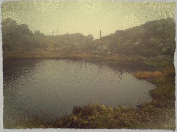
The route went on forever, it seemed. Open scrub turned into mature laricio forest turned into deep gorges. A few glimpses of Corté enabled a check-in phonecall before the signal was lost.

Dave and I set targets for rests, the Refuge and then a bridge by s spring source. The Refuge a Sega formed a perfect lunch stop. Approaching, there was a grim sight. Men were skinning a boar hung on a wooden frame. We still have a natural flowing conversation which included some quite personal stuff, relationships, family and stuff. Mostly, I lead from the front. Part of my mind was dealing with the sadness of leaving paradise. At times, a knot formed in my throat. At times, it needed a grip.

The campsite is on the trail side of Corté and we grabbed pizza while they were still serving. I had a folded pizza – Calzone. Notice a pattern there? Arrive in the dark and quickly order food before it’s too late.

The campground is flat but the pegs needed a twist to get in the hard, dry ground. It was more like drilling.

Saturday would be a day to enjoy the town and eat well. In the square, restaurants competed with 3-course meals for €15. I did well here. I estimate that 8 burnt off 5lbs during my days on the hill.

Afternoon, I set off for the train initially following bad directions from Google Maps. I asked a local in the end. The station was across the road but G. Maps wanted to send me around an industrial estate. The Belgian lads were there already with tickets to Vizavona.

Notice another pattern coming up. I sat on the train with a Belgian student and 2 athletic looking German guys who were probably about 20 years old. The Belgian lad was only 18 or 19 but was interested in the UK university system.

At the camp near Poreta Airport, the two German boys arrived not long after me. There seems to be an overlapping moving community operating here. We latch on to familiar faces like stepping stones. Such is journeying. All of this prevents the feeling of loneliness getting a lookin.

Berwyn hills: a pre season recce.

5°C, strong SW wind with showers.

This is what DofE leaders do in the off season.


We met up in Carrog to try out a route that is intended for the silver and gold groups at Easter.

The conditions were okay, if you’re dressed correctly. Luckily, the wind was on our backs during the most exposed sections. The only problem was navigating rural land where there were no signs. In one place, the bridal path passes through a private garden. There was no indication on the closed gate that there exists a right of way. The kids will be confused and probably become lost here.

3: Carned y Gribeau and broken bridges.:

9°C. fog and no wind, no change from yesterday.

Wild-camp-> end: Woke to more fog and the sound of grouse. The night was utterly silent apart from the gurgling of the spring. Occasional soft drizzle and the odd waft in the calm air.

Back to the fenceline and head north. Back at L. Edno was a big pile of rubbish caught in a fence. The day before, made a note of this and returned to clear as much as possible. My storage was limited because I had my own rubbish, but I got the worst of it.
Next, walk north along the fences again. Net a fell runner heading south who seemed a bit troubled by the navigation. I know the conditions are tricky, but all he has to do is follow the fence line. His route round Edno is unnecessary, and probably slippery.
I continued passed the bwlch onto Carned y Gribeau. There was a brief moment of clear air which urged me on. The summit has a nice little lake which made a good place to shelter and eat.​
 For a small lake, it was amazingly deep. Even at the edge, I could plunge a fully extended walking pole.

The descent was aimed for the footbridges at SH673560. the ground in that area was horrible to walk on, lots of plunge holes and hidden streams. It was a struggle to get there only to find the bridges long destroyed and deeply rusted. Take note, they are clearly marked on the OS map, but not on Harvey’s.

Eventually, back at the car, I was glad to get my wet boots off and dip in the lake to wash my feet. You have to treat wet feet as soon as you can to prevent unspeakable problems later.

Hill and Moorland:3 (result).

6~ 8°C, light W. Sunny with only 1 shower.
it seemed to go well on the hill today. No mistakes and additional skills were cleared easily. The kit check was fine, I even showed off my water filter.
The tension of last night was relieved in this morning’s briefing. The assessor regarded my errors as repaired after I identified them.
So the day went ahead. My tension reduced. Until the hour before final debrief that is.
Last outing: north Carneddau again. Another rolling grassland, this is Hill and Moorland after all. My navigation legs were fairly easy and error free so I could relax and enjoy myself again.
image

Continue reading

QMD: Cadair Berwyn.

0 to –8°C. April northerly. Mostly clear sky.
Full mountain day, after packing up camp, I heard the car rumble by, my colleagues had arrived. We convened a meeting around an outside table to decide which route.
Choices ranged from 7 to 12 miles. The big one got the go-ahead. Initially, there is a climb out of the valley along well maintained paths. Meltwater ran down and exposed ice on top of slate. Slate can be slippery at the best of times, but with ice!?
Before the first kilometer, it was apparent that we’d headed up the wrong valley. We wanted north and faced West. Oops.
I proposed that we take a quad bike track over the spur and intercept the path. Good.
Route mended, white summits poked above the grassy ridge.
From this point, the walk became fantastic. Fantastic in the sense that we strode out into a wonderland of snow and ice sculptures. Crunchy snow like this offers good grip and filled over those hollows between tussocks.
image

The higher we got, the more fantastic the scene became. Wind was the sculptor here, and it had been very creative. Grid wire fences had long crystal growths of water ice, razor sharp and pointing downwind. Either the ice grew quickly, or the north wind had remained this way for days.
Worrying about time, we decided to skip Cadair Bronwyn and descent from the Bwlch before.

image

Ice waffles.

The walk out was a considerable distance along sheep filled valleys.
Getting dark, we made camp at about 6pm. I was tired, partially my own fault. I didn’t eat enough. My boots repeatedly unlaced, the laces had iced up and slid loose.

Falls of Glomach,

13°C, SW breeze that brought heavy rain later.
Rainy day walk; it’s quite logical to use a wet day to walk low level to waterfall. This one is supposed to be the highest single drop in Scotland.The walk starts after a 6 mile drive up a single-track road. There follows a Glen walk and the waterfall is up a side Glen. The side Glen is steep but to only 150m. This is also the stage where the rain started.
Beforehand, in the valley is a track that is easy walking for about 7km along a Glen that is very attractive. You can admire the clarity of the glacial features, drumlins, nunateks and various moraines.
Then you can look forward to see the most enormous Highland cattle. The adults must weigh over 2 tons, and they had calfs. Admittedly, the calfs were probably 1 year olds. But still, their curiosity was strong, as was my desire to take a wide detour.
Eventually, I got to the falls after climbing over gneiss boulders. Their grip was plenty despite the water everywhere. More frogs too.
On the return, the herd of cattle had become two, but the divisions were easier to find this time.

I have found another mountain to add to the ‘must climb’ list: Benn Bhan, in the Applecross region. It has 4 fantastic looking spurs that loom out of hill fog in an intoxicating way.

Part 2: Maol Chean-dearg, 933m.

Rain cleared before dawn. 12°C, building breeze.
Woke before 6 and fixed breakfast. Re-packing the bag took a while but I made time for sweeping out the bothy.
My sleep in the night was good but had a strange interruption. From deep sleep, my mind was penetrative by a sound. At first like an approaching steam train, all thundering and chuffing. The sound got closer to the bothy, the thundering deeper and deeper. And an unearthly grunting and chuffing. It was a herd of deer, maybe in stampede. I have been spooked by deer before, at Glenfinnan for example. Still wary of them.
Anyway, back to my ‘adventure’. I left the bothy at 8am and got to the bealach by 10. The climb only took an hour and a half. It starts over brittle, sharp quartzite. More quartzite, loose and steep, then to more friendly sandstone. Quartzite seems less likely to be consolidated by organic matter, and much looser on steep slopes. The summit is found after several ledges of pillow like sandstone. It has the best cairn I have seen. It has six shelters arranged like an asterisk.
The summit was a bit cold to spend long there. The strong wind saw to that.I met and chatted to few people on the way down, but I was definitely the first up.
Something caught my eye on the way back to collect my stash. The Mountain opposite. It lifted from the same bealach as MCd. But the curves, textures and shapes in the quartzite captivated me. The way the inclined layers blended into the bealach reminded me of those fascinating forms you can find in comes. I will have to spend a day with this mountain.
On the walk out, I took my time. The loch beneath the day’s summit has beaches. I couldn’t resist washing my feet in it’s pure, clear waters. Lovely.
The day drew to a close with improving skies and stronger wind.

Part 1: Sgurr Rhuadh, 966m.

Bright sun and stiff breeze to start. Ended with rain set-in and building wind. 12C,
I lie alone in a bothy with roaring wind outside. Here’s what I have done:
Sgurr Rhuadh, a fairly remote munro that requires a long walk-in. Thus, I hatched a plan, make the summit from Torridon, and stop in a bothy. Then wake up and climb Maol Cheam Dearg, from there, return to Torridon.
I committed to the approach from the north because I stashed my heavier kit under an overhanging sandstone boulder. So my route had to be an out and back. So far so good.
Despite there being no indication on the map, or the guidebook, there actually is a decent path up the ridge to the summit. I found it on the way down.
image
Today’s walk was characterised by sharp, brittle clinking quartzite boulders. They are more slippery than they look. It’s not the quartzite at fault, it’s lichen. Oh, and frogs everywhere. Big ones, tiny ones but all with similar colouring. The colour scheme is the same idea, at some are more black than others. All keen to jump out of my way, all elbows and knees.
Eventually, I made it to the bothy. On the way stood an isolated sentinel stone, bright white with lichen. In that light, the owns in the structure could have been crafted by a 1960’s sculptor. It is far older than that. The bothy is an old crofters house, now owned by the estate and used as a mountain hut by the Mountain Bothy Association.
image
Nevertheless, it looks like a good place to make up ghost stories. A few trees have been planted nearby, and as I plodded to towards, I was convinced that they were people by the house.
The place was empty. In good condition outside, even the windows were tidy. Inside was all wood clad, in dark brown. These places are very sparse, Capel  any furniture, not even bunks. You have to choose room and sleep on the floor. I picked upstairs facing the river.
Now to settle in and find how well I have packed.

Beinn Alligin.

13°C, milky overcast and zero wind.
2 munros, Sgurr Mor, 986m, and  Tom na Gruagaich, 922.m. The Horns (Na Rathaoan) is a Corbet.
Start 9.00 and back at camp at 19.15 including walk in and out time.
The horns of Beinn Alligin: started off at 9am, and walked to the start-point. It was a mistake, because the hour that took, was time off the summits.
Anyway.
The ‘Horns’ are pinnacles which are fun scrambling places. I  went up the first one and part of the last one.
image
After these, the two Munros loom ahead. The  are not that hard, it’s just something about their ‘mood’ that is intimidating. The whole mountain group is old red sandstone, a good snag for walking. The grip is always good and there are springs not far below. That was the only problem I had, the last summit was a much because of thirst. Oh, and the midges.
The still air was perfect for midges, even at 1000m altitude. I had to eat my food pacing about to stop them building up.

To Torridon.

13C, low cloud but not much rain.
More driving: but yesterday was all driving too. To break it up, I hoped for a walk. AND I found one. It was near Loch Cluanie. There is a fine ridge that puts you between three Monroes. The name, Am Bathach. At the northern end is a bealach which looks like a good place to bivvy. There are banded rocks, probably gneiss, which appear to offer the right amount of shelter.
The ridge itself offered that effect where you can see the distant ground in you peripheral vision moving strangely behind the ground beneath your feet. You’d have to see it to know what I mean.
With all these choices, three summits and two escapes down, a decision had to be made.
Right at the last minute, I took the one recommended in my guide book.
Scotland has had unusual amounts of summer rain this year and much of it remains in the boggy ground. The return was very squelchy.
With a late start, I didn’t get down until 18.30 and faced a long drive to Torridon. So I ate at the Cluanie Inn. There I listened to an American girl talking to some drunk old gents about Ben Nevis. She must be planning to climb it tomorrow.