2: Kilchoan in Ardnamurchan

13°C, SSE breeze but sunny now after heavy showers.

Day 1: Arrived at the most wonderful campsite. In front of me are superb views of the Sound of Mull and to the right, Mull itself. Left, I can see Ben Hiant. By morning, there were Sea Eagles perched on a small islet not far from shore. I’m told that Sea Otters live nearby too.

That’s Ben Hiant on the left, Sound of Mull in front.

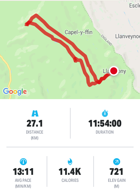
Day 2: Ben Hiant, 540m. Figures- total walk time 5h 52m (including stops). Total ascent 572m and descent 587.

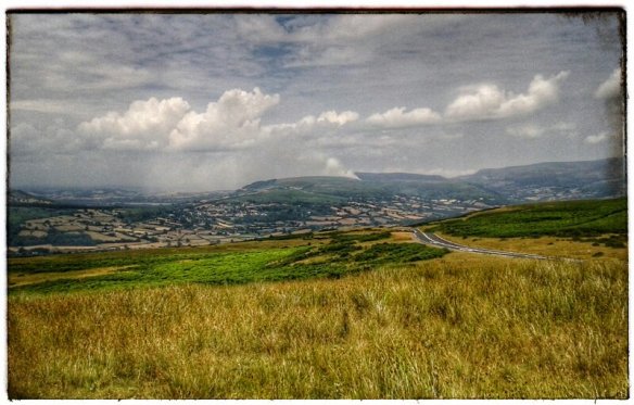
This is not a huge mountain so some creativity with the route was suitable. Its a complex mount with layers of gneiss, basaltic lava and dolerite. All the action happened around 60mya when the atlantic started to open up. Just as interesting was animal life today. Firstly, a wide circuit around a field of cattle and in return, red deer took wide circuits around me. He herds were small, 7 and 2 individuals. He larger herd stood near the top watching me as I ate sandwiches. Either they wanted to travel my way, or they fancied a raspberry jam butty.

By the end, I was ready for a nap. If the day was a little warmer, finding a spot on the hill for a snooze would have been perfect.

Day 3: Sanna and the Eukaryte Ring.

Two parts, first, visit the lighthouse at Point of Ardnamuchan. Surprisinly, this lighthouse marks the most westerlt place on the UK mainland. The edge of the world feeing was enhanced by the squally downpours hat struck every half hour. There is quite a nice geology and lighthouse museum on the site.

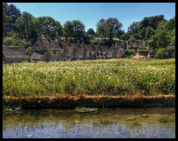
Part 2, walk from Portuairk to Sanna. Here is a string of ideal white sand beaches and smooth basalt rocks. When i got there, the whote vista was empty so that panoramic pictures should come out well. There are houses here that have money spent on them in recent years, some traditional Scottish cottages have modern attachments: charcoal wooden cladding (whatever that’s called); dark metal windows that reach high into the eves. I bet they’re second homes.

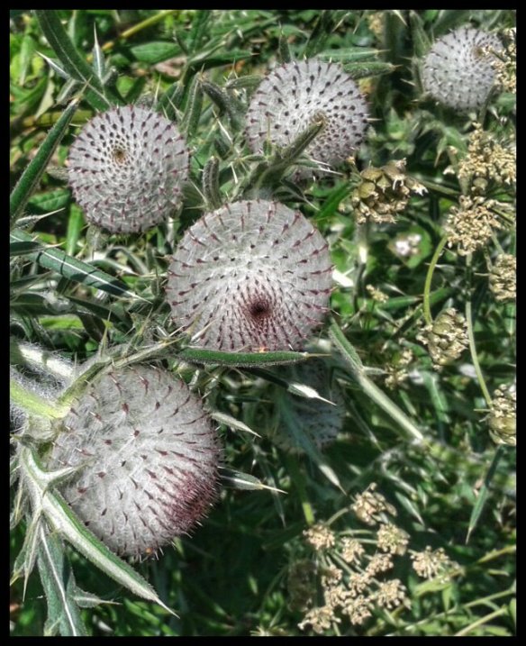
From Sanna, you get easy access to the ring dyke system. Its an almost perfect and complete circle with a breach just east of the village. I say ‘village’ but it’s no more than a loose cluster of houses on the raised beach behind dunes. There is no focus to the houses, no corner shop or a church or anything like that. Anyway, I decided to walk a little way to get a view just inside the ring. It looks loke a meteor crater, flat inside with a slight rise in the middle. I climbed up onto part of the rim to look both at the view and the rocks themselves. The rocks were grey, crystaline with large black crystals embedded. Most pieces are weathered on at least one side. I searched for one with the biggest crystals. Most are very rounded as are the outcrops which are easy to walk on.

The ring is cut, in places by deep gulleys and I decided to descend in one of these. On one side was a suitable looking pebble which I picked up. Then the oddest thing: beneath this loose precarious pebhle was an ants’ nest. This pebble covered their egg chamber. How could such an easily disturbed little stone cover the most important part of their nest? They frantically carried eggs away as I carefully replaced the little pebble back as it was.

Anyway, the north coast is very nice, fine views of the inner Hebrides and world class beaches.

I shall relocate tomorrow, I dont know to where yet.

1: Bridge of Orchy.

27°C, highest in Glasgow. Better in highlands. 0 cloud or wind.

Very long drive, too long. The M6 was closed between Preston and Lancaster. That pushed all the traffic onto local A roads which immediately stopped.

Normally, on this trip, I go to Glen Coe but it’s too late. Besides, I have an idea for some hills tomorrow, some unfinished business. I’m eyeing up Beinn Dhotaih and some other summits behind.

Friday: some Munros. Started cloudy with summits obscured. 21°C, humid and milky haze. Set off in goood time 08.30. It took an nour toreach the bealach by Beinn Dorian. From here on its off track down the glen in front and turnn north to reach the next bealach. Another turn here and head up the grassy banks of Beinn Achaladair. (1016m). On the approach was the silhouette of a couple from Fife who were very friendly, they even offered me a lift back to the car if I wanted out before Chreachan. I didnt, I have all day and sunset is still late.the summits had cleared and views of distant land was clear, if a little milky. The photos should be good with some post processing.

Beinn a Chreachain was the highlight of the day although short lived as cloud drew in. The stiles of cloud passed on both sides but didn’t release any rain. From here, the desce t has to be north east which does add considerably to the day’s milage. I tried cutting the corner in Gleann Cailliche but am still unsure whether this practice actually saves any energy; the point is to avoid dropping any more height than necessary. Eventually, another track which offers better speed but it’s short lived. There is, for no apparent reason, a turning circle at its end half way up the valley. To get back, here are 2 cols to cross which explains the high climb figure for the day.

Figures: total time 12h 42m, ascent 2047m, decent 2003m,

Heavy thundery showers are promised for Saturday so I’m moving west to the coast tomorrow. The secret to a good trip in Scotland is to escape bad weather by moving to the sea. We’ve had a very hot and dry summer and this could mark the end of it.

Fat Bike on the beach.

20°C grey start, humid and warm.

I rode a Trek fat bike with MapMyRide+! Distance: 34.76km, time: 02:16:58, pace: 3:56min/km, speed: 15.23km/h.
http://mapmyride.com/workout/3037169839

The idea of tbe ride on this bike was to look for a shipwreck on Ainsdale beach. I saw it from tbe dunes last winter. As I rode, my eyes scanned the sandbanks, but nothing. Either the sands have moved or we need a neap tide to reveal it.

Nevermind my boy, it was still a good ride. Despite the front suspension, my wrists were sore. My riding losition was too upright with too much weight on my hands. On the road, the handling was odd, mainly because of the heavy tyres. Those tyres caused another effect, strange forces pushed tbrough the bars at higher speeds. Probably a gyroscope effect with those heavy flywheels spinning. Most noticeable on corners or road camber, most odd. This bike has SRAM hydralic disc brakes and they’re amazing, perhaps a little sharp, but very stong on descents.

By lunchtime, I’d reached home and wasshed the salt off with a hosepipe. To return, I took the canal. This was interesting because of the comparison with the same familiar journey on the cross bike. Although the huge tyres cushioed over bumps and troughs, the precision tracking on a cyclo-cross bike is preferable in my view.

If I were to buy a fat bike, I might skip the front suspension as unnecessary. More likely, I wouldn’t buy one at all, it’s cheaper in practice to rent one from Leisurelakes; this only cost £15 for the day. How many days would I need to rent before it’s better to buy? No longer in the market to buy, I may rent one again, but frankly, I’m in no hurry.

Old Man of Coniston

21°C white cloud and humid.

I hiked with MapMyRide+! Distance: 14.05km, time: 06:02:00, pace: 25:46min/km, speed: 2.33km/h.
http://mapmyride.com/workout/3033621601

The atmosphere dominated the day. Not today, those boring photos of blazing sun, blue sky and distant vistas. Clouds spilled over the mountain ridge like an overflowing dam.

I really like this photo, it sums up the day very well. In rthe distance is the summit of Old Man.

I met a guy who offered to take my photo and he turned out to be a good walking companion. Coincidentally he comes from the same home town as I. After a few hours, we teamed up with a Dutch couple who came out for a walk; er, without a map.

I got a QMD out of this which felt fine at the time but I felt my legs complaining this morning.

14/ Man verses Lakes: marshalling.

20°C, white cloud.

14.1: A late start means a late finish just as night is falling. It’s the problem with the tides determinig the start time for this race. The first stage was over the sands at Silverdale to Grange Over Sands where we all were briefed. The event was a marathon called Man Verses Lakes.

It’s quite differet working with adults, I’m used to children with 13 DofE trips this season. Most of the racers were grateful for my words of encouragement and jelly-babies. I gave them factual information, height to the top, remaining distance and the like.

14:2 eating breakfast, shall I climb Old Man Of Coniston? The cloud base is quite low and there has been soft drizzle overnight; but on the other hand, I have come all this way.

Today’s ride 2: Cafe Velo

21°C, 0 cloud but light W breeze.

I rode fixed with MapMyRide+! Distance: 51.55km, time: 01:58:38, pace: 2:18min/km, speed: 26.07km/h.
http://mapmyride.com/workout/3027257854

Back at home, the garden held some pleasant surprises for me, water lilys are in flower and some others that I don’t know names of.

This is the second ride of the day. Today is the first day of my 6 week summer holiday so some celebration is due. The first one was all about collecting my car but included a visit to the Beach Machines.

Back on two wheels I went over to Leisure Lakes, the bike shop there hires bikes so I had a query that has lurked in the back of my mind for a few years. Fat bikes are a kind of simplified mountain bike with enormous tractor tyres. Now, I live by the coast with long beaches that stretch out to a distant sea. There is a perfect land to ride out and explore on big balloon tyres. For £15 I can have one for a whole day. It’s booked for tuesday.

DofE 13.0: Hitchin.

26°C, 2/5 cloud, 0 wind.

Camped at Henlow Bridge. Not my kind of campsite but only for 1 night. Expensive too, £26 for 1 night. That’s london prices, I didn’t get to the bureau de change to get london pounds. London currency looks the same but can’t buy as much.

13.1, met the groups at about 10am in Hitchin. We went through kit checklists by way of introduction, as usual. I know the routine now, it often involves a detailed list with the boys pressing to get going. Another routine that has been steady over the last few weeks is managing the heat. Still, many boys didn’t have enough water. 2 litres is recommend, many were on 1.5. Some had rucksacks that were only 40 litres. Eventualy, off they went ln qualifying. Today’s routes are much longer, I swapped one group’s route around to make my checkpointing easier.

The sun shone fiercely, and the air hung still. It was a hot one again. This is like being in the south of France.

13.2 Day two: Both groups had a much shorter routes which resulted in a happier mood in each team. The weather was still hot and dry- reaching 28°C in the early afternoon.

I’m now typing in light rain in a service station on the M6, (quite pleasant actually). I’ve typed up the Assessor reports and am now free tirelax on the long drive home.

Seafront machines and weirdos

19°C, 0 cloud, no wind either.

I rode fixed with MapMyRide+! Distance: 53.45km, time: 02:03:18, pace: 2:18min/km, speed: 26.01km/h.
http://mapmyride.com/workout/3015838321

As routine, rode out to the seafront machines and I wasn’t the only one there. A guy with a pot and bright yellow shorts was swinging his arms. It’s something people do who are new to exercise. It pot was big.

He mouthed something of a greeting to me as I parked the bike. He can’t talk. Then, he pointed to himself and drew 58 in the sand. Then, turned to me so I drew 53. He looked of up and down approvingly. Strange enough?

Then I rode out towards my house. Somebody was sleeping in the sand. They looked as if they’d been there all night. Seaside towns attract all sorts of people from the fringes of society.

After I came out of my house, some smartly dressed people let themselves through my gate. They asked me some uncomfortable questions about my bike ride, ‘was there an event?’. They handed over a leaflet and invited me to some hall. Creepy. Religious people are sooo creepy.

At least I’ve watered the plants and collected my parcels.

DofE 12: Brecon Beacons.

24°C, sunny with fair clouds, light breeze.

Back to the Beacons, with different groups this time; however, most I’ve met or taught before. Yes, it’s my old school DofE again. My job was to drive the Gold groups to their start location so they can walk to their first campsite in llanthony Priory.

Gold_2018QMHS

12.0: Monday, The problems came fairly soon.. We were instructed to drop them off and then drive to the staff campsite; later, we would checkpoint the groups. A small problem pointed to a larger problem with this scheme. The idea of Practice is to practice the training and simulate the qualifying expedition. But their training was a year ago so they were practising a skill-set they had every reason to be rusty with. Instead of driving to the staff camp, I went to the gold’s first checkpoint it was only 2.8 km away over a ridge. Neither group showed up, not even after 2 1/2 hours. Something was wrong and I had no way to contact them, nor with base. No phone signal or shortwave radio reception in this valley. My anxiety level shot up; if something happened, it would be me that has to explain my decisions to the judge.

I decided to drive off and find better reception. I caught Group 1 over the radio who could relay messages to Group A over the ridge. Bothgroups had made mistakes in woodland. They’ve done this before. Remember when this group needed rescuing in the dark? Here they were again, going the wrong way in woodland, again.

I decided to drive back to base camp since I was out solo and worried. Was I carrying paperwork that the Silver groups needed etcetera. Going back felt wrong too, my instinct said that I can leave them but should have contact every two hours. I’ve brought 8 teenage girls well over 100 miles from their school and dropped them in a field unfamiliar to them. What if something happened? I tried the radio once more, then Aneeka’s voice! She gave a location, and she could relay messages from the other group on the hill that I could not directly hear. Contact!

Relieved but not satisfied, I drove away to base and the other staff. I raised my concerns around the theme that our duty of care is the same as for year 9s’. As a staff decision, my plan won the debate…

12.2 Tuesday: . So Today, I walked most of their stage to teach navigation to the higher Gold level carrying a list of skills to try out. My total walk time was just shy of 11 hours including the return walk. We covered many techniques, pacing, bearings, and others. At the north end, the ridges opened into a plateau so I left the groups at a trig point there to make their descents. One group took longer because their nav. decision required more reading of the contours. The other group chickened-out of cutting the corner over grassland, “what if we get lost?”. They seen nervous about walking on the compass. Eventually, they went from the trig-point.

Here, the second part of my day started. I picked one group’s route and followed it back to the minibus. I did discover some tricky navigation points such as woodland and a path that started in dense bracken. In an ideal world, we leaders would walk the kids’ routes beforehand. Thus, it turned into A Long Day; I got back to the bus at 21.15.

Look at that, 11,400 calories in one walk, one day. I didn’t even feel that tired. That means it was mostly fat burning rather than sugars.

Sitting in the grass were the Silver practice groups, they were in low spirits and looking rather shocked.. Exhaustion, blisters and excessive distance brought on by gross errors in nav.. Their mistakes had added 5km to their walk. Their instructor, in despair, moved them back in the minibus to resume the route on a correct course only to see them wander off in error again. What’s going on.

12.3, Wednesday, today’s route over the mountain meant there were fewer places to set up checkpoints. Still, I want contact every 2 hours, though a position fix by text will do. I didn’t get such a fix for over 4 restless hours. Faint female voices did echo around the valley in the humid, still air. Then the radio crackled and though unintelligible at first, the tone was enough to make voices recognisable.

I have a particular affinity with these groups; it was they who needed rescuing on Gradbach Woods a few years ago when they became benighted. I’ve posted about that day here years ago. Eventually, my colleague radioed to say they arrived at the minibus while I was patrolling the hill opposite looking for them. Actually, they were in good spirits, the new girl E in particular had taken control and pushed them on. What a fabulous kid, she had the most horrific looking blister but determination enough to press on regardless and kept spirits up amongst the others.

12.4, last day, a Thursday. Still roaring hot, we could see fires on one of the mountains. Today’s routes take them along hills to the south, limestone country. Qualifying exped will be in the Yorkshire Dales. Here is some taster of the ground they will encounter up north. Soldiers were on manouvers which was funny when one ran out in the road by us, looked at a footlath sign and ran away again. He carried a rifle daubed with fluorescent orange. It was the way he ran that looked comical.

DofE 11.0: Cotswold hills.

28°C, no wind and the prospect of 30° tomorrow, close feeling too.

Working for a provider that’s new to me: BXM. It’s not too far to drive here, but for the first part of the M5 which was very slow..

11.1: day one, quite a lot to get used to but the people are excellent. They’re friendly and enthusiastic, I hope to make a good impression. The kids seem young but they’re pleasent enough. I have two groups to manage but this time we chose them by the similarity of their routes and we have two groups each to manage. The top temperature today is very high, probably 30°C.

11.2: My groups got up at a reasonable reasonable time despite refusing to last evening.

The day went well and grew hot. Tarmac melted in places. Our response is to encourage groups to slow down, we aimed for 2kph. And we offered water at every opportunity.

Look at these! They’re thistles, not a variety seen us north.