DofE 14: Yorkshire Dales.

14°C, rain and gales. Gusts up to 40mph.

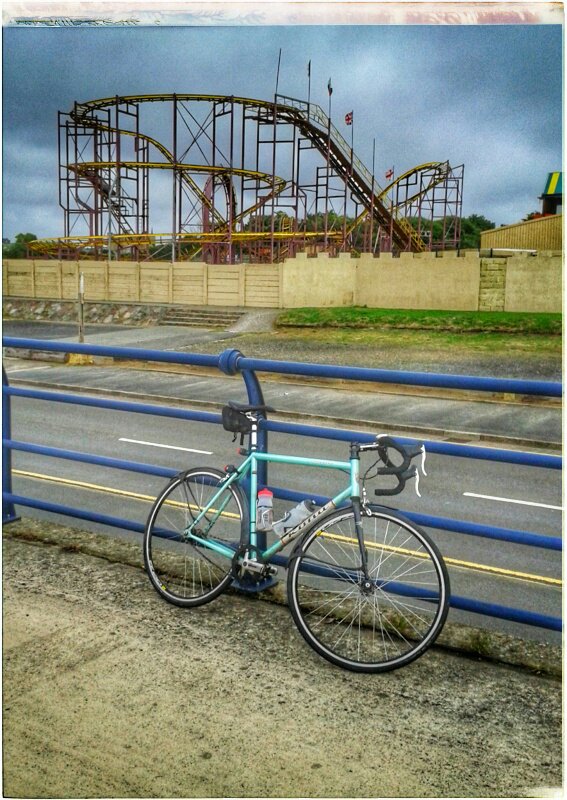
14.0 Arrived about 11.30am for a Gold Qualifying expedition. The minibusses wouldn’t arrive for at least 2 hours so I went up Whenside for the fun of it. People were up there half way through the Yorkshire 3 Peaks challenge. The group at this summit were in good spirits and all stopped for a cigarette. Did they do this on each summit?

Afterwards, we spent the afternoon organising the kids and routes. I did not sleep well. Perhaps I should have stayed the night in my tent.

(Formerly) hurricane Helene struck us in the night. This morning the full force revealed itself further. Now it’s known as Storm Ali.

14.1 Tuesday: I’m managing 2 groups and each had a decent ascent onto Whernside (a 736m English mountain). The gales built up rapidly over the hours. I walked north from the Ribbleside Viaduct. The gusts grew fierce and the showers heavier. Group 1 sounds distressed on the ridge because of the wind. Pete, our asessor waited on the summit and between us, we saw both groups. All of them were quite dispondant, soaked and battered by blasts. I let them off the final summit (Blea Moor). They’re delightful kids and deserve encouragement.

14.2: Wednesday and a big storm comes. They’ve named it now: ‘Ali’. I can see it rolling in the other side of the valley, it will be here in 15mins. Trees here are thrashing like that scene in Harry Potter. 10 minutes sunshine remain while the car rocks side to side.

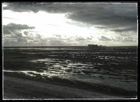
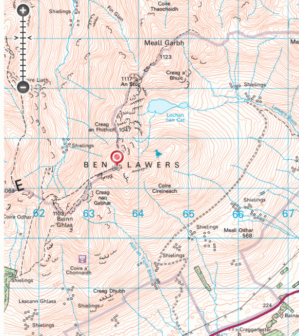
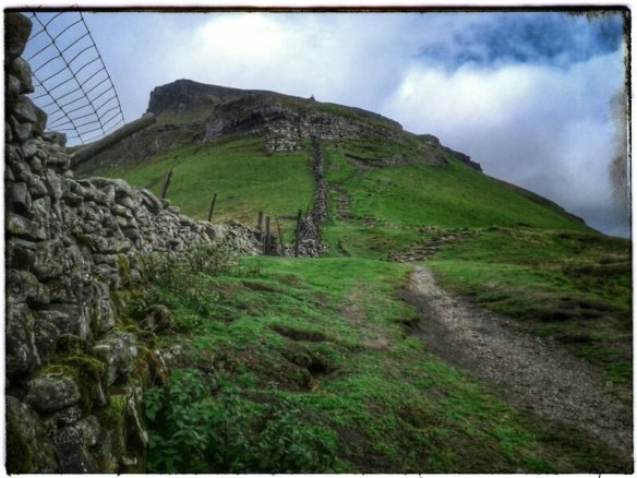
First rain started at 11.19am. Eventualy, both groups passed through. Group A had a pretty miserable lunchbreak in the woods during heavy rain. The others arrived in a brief sunny spell. The wind roared and we staggered drunkenly. Across the road, Open Access land flanks of Ingleborough. This is a lenghy sea of grass with shakeholes everywhere. I took off to Clapham to backtrack from the east. The climb up from “A Pennine Jouney” was fabulous. It’s a less well trodden route which is worth a trip. The gorge tapers to a narrow funnel with overhanging black cliffs and an ominous dark cave on the left.

I spent some hours on the traverse. I passed one shakehole with a tent in it, another had scrap metal. The land is pockmarked like an ancient battlefield. All the time, the rain drove on, and visibility was poor. Navigation was fine but I missed my colleague in the downpour.eventually, I dropped down via Maybury in failing light. One group was still on the moors he said. We met up hoping to walk up from Clapham. Neither of us could really understand why they were so slow. One factor is their late start time, they begain walking at 08.30. 07.30 would be a more reasonable beginning.

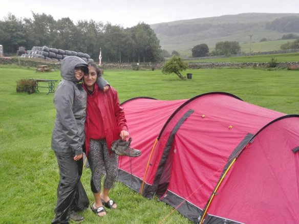
Finally, the rest of our staff team arrived in the minibus to rescue the four girls and with plans to get pub food for us. Today is a late one.

14.3 the wind has dropped but heavy rain is due this afternoon. routes are low level giving us time to recover.

The kids are getting better. They’re snacking more which maintains a more constant energy level. They need to drink more and start the day earlier. Last year, groups set off at 7am. If they prepare bags in the evening, and organise the stuff in tents, then the morning will happen more smoothly. There is more to expeditions than walking and pitching tents.

14.4: Pen-y-Ghent. (last day). Another storm arrives today; the morning starts chilly at 5°C and a strenghtening breeze. By lunch, heavy showers and gale force gusts to 40mph, more at height. My job was to man the checkpoint on the summit. On reaching the shoulder, before the scramble section, the wind ran full force over the pass.

The shelter at the top is just like the one at the top of Whernside, two semi-circles with seats to hide from the blast.

Two old guys arrived soon after me and we had a nice natter. Each carried big flasks of tea which from which they gave me cups. Warm tea was very welcome. To keep warm, I walked the ridge to looking for reception, or my groups. The groups came first but on the windward side of the wall. My message to suggest the downwind side never got through. Oh well, they were in good sprits even after the hailstorm.

Group Two arrived not long after, cold, wet but also contented. It was their last day, a fact that kept them going. Thats quite a lift from Tuesday when they asked about quitting. Each day, they made incremental improvements that made the harsh conditions bearable. This week is the worst DofE weather we have ever had: two named storms and yellow weather warnings.

Debrief was great in the storm shelter and all participants were obviously relieved and quite pleased with themselves.

This was a poignant time for me too. I’ve led these groups through bronze, silver and now- Gold. They even discussed which royal they’d like to receive their presentation from.

For me, I’m satisfied that I could spend tbe day on a mountain in harsh conditions and remain comfortable.

Wallpaper.

15°C, dramatic clouds, strong W.

I rode Mustang with MapMyRide+! Distance: 25.95km, time: 01:15:45, pace: 2:55min/km, speed: 20.55km/h.
http://mapmyride.com/workout/3131713657

Home: it’s been a long, slow job.

The last roll of wallpaper is up now. It was an awkward corner with a window sill, a curved vertical and a tight corner. All those made getting rid of wrinkles really tricky. I hope the renaming ripples will pull out as the paper dries. Let’s see tomorrow.

Mobile phone.

I’ve come back from my hiking trip in Scotland annoyed with my phone. I have an old 3G Samsung Mini 3III.

There are two main problems:

1/ the screen is unreadable in summer sunshine,

2/ sometimes, the notification sounds and switches on the screen. Sometimes, it does this every 4 seconds, sometimes even when the phone is switched off. Doing that, the battery is used up in just a few hours even when the phone is left on flight mode.

While I was away, the phone used half the monthly data on Google Services. That’s presumably some kind of software update. It did this while on flight mode with synch switched off.

This phone is about 4 years old, so it may be time to replace it. The criteria for choosing a phone has changed since:

  1. brighter screen,
  2. Longer battery life
  3. Bigger screen
  4. Better camera
  5. More RAM
  6. 4G.

The solution could be: a Motorola G6.

  • Double battery life,
  • 3Gb RAM,
  • 32Gb internal storage,
  • 13Mp camera
  • MiniSD slot,
  • No bloatware,
  • I don’t know how bright the screen will be. This is a serious concern; often, I can’t use my phone in bright sunlight.

Next bit, pick a contract. Either get another SIM only contract and buy the phone. The other choice is a monthly contract that dovers the cost of the phone. Initially, I decided on the latter. Once I went through the registration, it was revealed that I’d have to pay more because I’m not a new customer. This is annoying because that penalises me for customer loyalty. At that point, I backed out and left the shop empty handed.

Let down by a pump.

16°C, gloomy drizzle and blustery SW

I rode Kona Jake with MapMyRide+! Distance: 31.86km, time: 01:32:04, pace: 2:53min/km, speed: 20.76km/h.
http://mapmyride.com/workout/3087552775

Once I got off the track, it was obvious that the tyres were too soft. Topping up the pressure should be easy, right? The first two attempts left me with a flat tyre. Unscrewing the pump head also unscrewed and removed the valve. Annoying. Eventually, I got it in and it held some pressure, but no more than 20psi.

Its horrible riding with only 20psi, the rear wheel squelches and skids from side to side. It doesn’t feel safe at all.

Tried blnowing up a road bike tyre with the pump and it worked just fine. That probably means the problem all along was the valve is too short on this rim.

Tartleton oil patch

17°C, 3/5 sun brisk SSW dry.

I rode Racelite with MapMyRide+! Distance: 52.54km, time: 02:11:13, pace: 2:30min/km, speed: 24.02km/h.
http://mapmyride.com/workout/3086065537

A normal ride on the summer bike and a familiar route. At the lights in Tartleton, a puddle of yellow liquid. It didn’t smell but was viciously slippery after getting it on the tyres. What was it, it didn’t smell of diesel so maybe a vegetable oil?

I phoned the police about it, that liquid was dangerous if you are on two wheels.

The machines and drizzle.

17°C, drizzle and onshore breeze.

I rode Paddy Wagon with MapMyRide+! Distance: 44.31km, time: 01:50:20, pace: 2:29min/km, speed: 24.10km/h.
http://mapmyride.com/workout/3078674872

Same route as last time but with claggy weather. The biggest difference was my energy, I was quite enfeebled. The machines felt heavier and I couldn’t do so many repetitions.

This next photo is puzzling, it looks like the grim reaper out on the mud flats.

I rode Jake with MapMyRide+! Distance: 6.29km, time: 25:40, pace: 4:05min/km, speed: 14.71km/h.
http://mapmyride.com/workout/3079817260

A quick evening ride to watch the sun go down. The sand flats go out miles into a big sky.

That was satisfying.

And to return.

More rain, 14°C, followed by rain again.

Leaving Scotland is easier when the weather is bad, more so when the outlook is also poor.

With the tent packed (wet) by 7.30, I was ready. The most remarkable point to note of the trip is the lack of midges. I finished happy with my fitness, the dragging feeling from the first few days had gone. I came down from Lawers tired but not worryingly so. Physical tiredness can be a satisfying feeling. Every year I think to myself how fit I could be if I did hikes like these every week.

To review, I just counted up my Munro bag, it’s now 51 summits. The total for all, Corbets and so on is around double that figure. I have a cracked tent pole to fix and wet smelly kit to wash. The only annoyance has been my mobile phone. I’ll post about that separately.

Here is the almost traditional Tebay melancholy shot. I took this picture as an interval from my sketchbook. The trip is complete in the sense that I want to go back, hence the melancholy mentioed at the top.

3: Breadalbane

12°C, rain, much of it heavy with brisk SW.

Moved to the Trossachs, this gives me a new area to explore and a shorter drive home than Ardnamuchan. The Ben Lawers range was recommended by the Fife couple. It may be that I don’t get onto the range of Munros immediately north of here because of the weather. Often in previous years, I have used the return journey to look for ideas for future trips. Maybe this stop will work the same.

Found a campsite on the shore of Loch Tay. This area seems more geared towards caravans and even this site is dominated by those hideous things. This place is a bit of a come-down after the fine views at the last site. Perhaps the hill-fog will lift in the morning and something exciting with appear.

3.1/ Ben Lawers and the ridge: first some stats, total 8h54mins (incl stops); total ascent 1518m, descent 1256m, distance ;

Summits: Beinn Glas, 1103m; Ben Lawers, 1214m; An Stuc, 1118m; Meall Garbh, 1118m. I skipped out Meall Greigh because of titimeme and the rain had started heavily by then.

Summits were gained quite easily, I felt fit. That dragging sleepy feeling had gone which plagued the day on Ben Hiant. Maybe I was held back by a bug or something. All of the summits were in thick hill fog and strong wind. I estimate 40mph gusts, I unfolded the poles after B. Lawers.

There was lots of geology, despite the terrible visibility. Schist was in abundance as were micro-folds. There were rocks with tight zig-zag folds as little as 6″ amplitude. I took no photos because of worries about tne effect hmudity or rain would have on tbe camera. Perhaps that’s why I got round so quickly.

The descent from the bealach at larig Innein was grassy and fairly easy. There were faint trails to follow down past an enclosure to a dam. It’s a small dam that’s part of a bigger system, presumably for collecting fresh water. These structures reminded me of those on Ben Cruachen. Burn water is collected into numbered inlets into a huge pipe that mostly runs beneath the ground. The pipe is black as is the concrete hese structures are made from. All over are rusty or white streaks from weathering. As I walked south, I played a counting game to pace out the way. This section is easy and I wanted to cover some ground quickly. Turning downhill, the track zig-zags once before I had to leave it to follow a derelict stone wall. Follow that and it leads you back to the car park. Sounds easy huh? In a way, this last leg was the hardest with deep gullys streams to cross and rough ground hidden by tussocks. That last 3 km took nearly a 2 hours. Was it the hardest or was I beginning to tire? Either way, it was a slog along long grass and heather. The trickiest bit was crossing gulleys that contain Burns which were partly hidden by bracken.

At the end car-park, a mountain rescue party arrived at the same time as me. Two women were lost in the mist, I overheard. They’d gone to B. Lawers and intended to come back the same way. They phoned for help in the An Stuc area. So they went north off the summit instead of SW. Oh dear.

2: Kilchoan in Ardnamurchan

13°C, SSE breeze but sunny now after heavy showers.

Day 1: Arrived at the most wonderful campsite. In front of me are superb views of the Sound of Mull and to the right, Mull itself. Left, I can see Ben Hiant. By morning, there were Sea Eagles perched on a small islet not far from shore. I’m told that Sea Otters live nearby too.

That’s Ben Hiant on the left, Sound of Mull in front.

Day 2: Ben Hiant, 540m. Figures- total walk time 5h 52m (including stops). Total ascent 572m and descent 587.

This is not a huge mountain so some creativity with the route was suitable. Its a complex mount with layers of gneiss, basaltic lava and dolerite. All the action happened around 60mya when the atlantic started to open up. Just as interesting was animal life today. Firstly, a wide circuit around a field of cattle and in return, red deer took wide circuits around me. He herds were small, 7 and 2 individuals. He larger herd stood near the top watching me as I ate sandwiches. Either they wanted to travel my way, or they fancied a raspberry jam butty.

By the end, I was ready for a nap. If the day was a little warmer, finding a spot on the hill for a snooze would have been perfect.

Day 3: Sanna and the Eukaryte Ring.

Two parts, first, visit the lighthouse at Point of Ardnamuchan. Surprisinly, this lighthouse marks the most westerlt place on the UK mainland. The edge of the world feeing was enhanced by the squally downpours hat struck every half hour. There is quite a nice geology and lighthouse museum on the site.

Part 2, walk from Portuairk to Sanna. Here is a string of ideal white sand beaches and smooth basalt rocks. When i got there, the whote vista was empty so that panoramic pictures should come out well. There are houses here that have money spent on them in recent years, some traditional Scottish cottages have modern attachments: charcoal wooden cladding (whatever that’s called); dark metal windows that reach high into the eves. I bet they’re second homes.

From Sanna, you get easy access to the ring dyke system. Its an almost perfect and complete circle with a breach just east of the village. I say ‘village’ but it’s no more than a loose cluster of houses on the raised beach behind dunes. There is no focus to the houses, no corner shop or a church or anything like that. Anyway, I decided to walk a little way to get a view just inside the ring. It looks loke a meteor crater, flat inside with a slight rise in the middle. I climbed up onto part of the rim to look both at the view and the rocks themselves. The rocks were grey, crystaline with large black crystals embedded. Most pieces are weathered on at least one side. I searched for one with the biggest crystals. Most are very rounded as are the outcrops which are easy to walk on.

The ring is cut, in places by deep gulleys and I decided to descend in one of these. On one side was a suitable looking pebble which I picked up. Then the oddest thing: beneath this loose precarious pebhle was an ants’ nest. This pebble covered their egg chamber. How could such an easily disturbed little stone cover the most important part of their nest? They frantically carried eggs away as I carefully replaced the little pebble back as it was.

Anyway, the north coast is very nice, fine views of the inner Hebrides and world class beaches.

I shall relocate tomorrow, I dont know to where yet.