Fizzy and bad tempered.

2°C, big melt all morning, another snow dump followed in the evening.
I rode Mustang with MapMyRide+! Distance: 31.34km, time: 01:29:08, pace: 2:51min/km, speed: 21.10km/h.

http://mapmyride.com/workout/2616335668

Slow and short, but I desperately needed it after a week of turbo sessions. I hate the turbo but there’s no alternative with the depth of snow and ice we’ve had.
Refreshed by sunshine and blue skies, I will sleep properly tonight.​

The latest snow craze to hit England is igloos made from recycling boxes. This one that appeared near my house is typical of the genre. The blocks have gaps, but so what?
These make a refreshing change from Michelin-man snowmen. Good work in my opinion, I wish I’d made one now.

Berwyn ridge.

7°C, brisk NW, hill fog above 600m, mostly dry and cold.
I hiked with MapMyRide+! Distance: 14.61km, time: 08:39:00, pace: 35:31min/km, speed: 1.69km/h.

http://mapmyride.com/workout/264441241

I don’t recall hiking in December before. it’s not too cold yet, though the wind-chill was strong. Our route was along a few valleys parallel to the main Bedwyn ridge.we went off track to practice navigation and route finding as two trainee mountain leaders. Once we’d visited Cadair Bronwyn the return is along an easier route in the failing light.

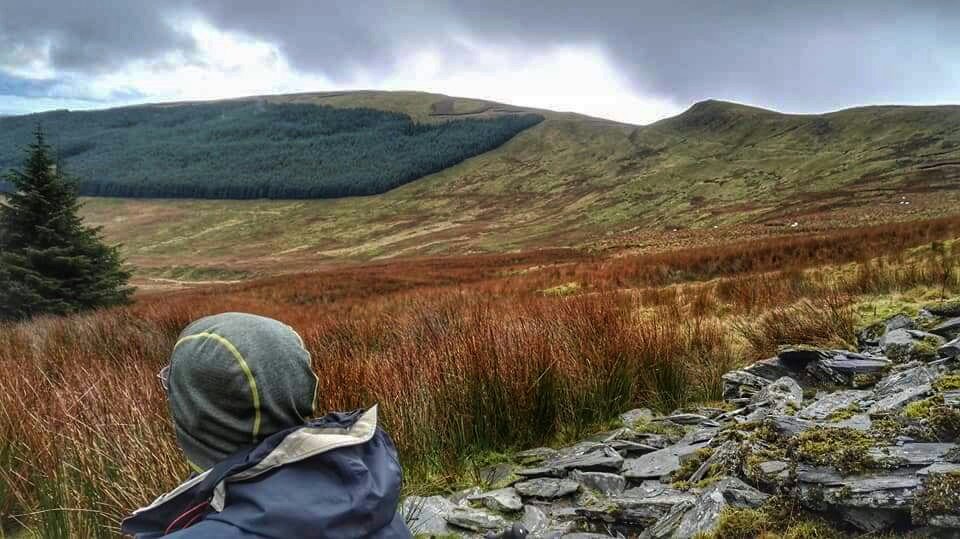
The photo above looks back on the route we came from. Look at the notch in the ridge, we were there. This was our lunch break and we got up to practice confidence ropeing for a while.

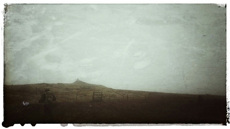
Heading further north onto a spur then turn West into the wind. This spur joins the main Berwyn ridge and is signposted as a Special Site of Scientific Interest. Up here the ground is fairly flat and therefore – boggy. Good stately duckboards ran north-south so the summit Cadair Bronwyn was easy. On top is a large cairn of quartzite. By now, the sky was noticeably dull grey, either rain or coming sunset. We didn’t stop.
I recognised the ridge up to Berwyn from last time even though the weather and visibility were entirely different. We saw no views down the steep scarp slope.​

Carl is always a quicker descender than I am, if fears falling less than I do. His new boots lost their new look when negotiating boggy patches near the fence-line. The worst one swallowed Carl up to the waist in thick black sticky bog gum. I was out of reach and unable to pull him out. He dragged himself out though and checked his kit. Phone, car-keys and compass, all shut inside zipped pockets. Onward.
This point we made to only necessary course correction of the day to get back to the fenceline which marks our route all afternoon.
Around the time the fence ran out, we decided on lighting up. Route finding was still relatively easy if we followed tracks in the long grass. There was such a track in front where our compasses pointed. Off we went into growing darkness.
Carl was using a 1:50k map all day. He wanted to make up for some errors on his recent HML assessment week at Plas-y-Brenin. I used the normal 1:25k that most hill walkers use. That fills in the detail missing on the 50k map. The last few hundred metres led us in error to the top of Pistyl Rheaddr falls. Not far now, after a little back tracking.
Finally, the car number plate glowed in the head-torch lights. 8 hours 35 minutes, a Quality Mountain Day for the log book.

Beach to beach.

2°C, brisk N wind, dry and sunny. Significant wind-chill.
I rode The Jake with MapMyRide+! Distance: 45.80km, time: 02:41:30, pace: 3:32min/km, speed: 17.01km/h.

http://mapmyride.com/workout/2599320025

Today, I reversed the beach route for variety. A strong wind ran along the coast from kid north so I wasn’t deflected as much. The sand does turn to impossible soft patches without much warning. Sometimes easy sometimes you get bogged mown. Some was hidden under a moving veil of drifting sand. Wider tyres would help greatly but for now, lower pressure would too. I fell once and rolled out on the soft sand.
Actually, that’s the first time I’ve fallen in quite a few years. Good that it happened onto sand. Riding along with the drifting sand is a good sensation.
There are interesting structures standing on this beach. Amidst the shifting sand banks are darker shelves of more solid, peaty sand. It’s starting to consolidate into rock. Some of these strata lay in the beach, others were cut from dunes and showed clearly in the banks. Are these evidence of beach raising? Were they darkened by vegetation during interglacial periods when sea-level was lower?

Cycling to recover from injury.

14°C, grey, dry but very strong wind W then SSW.
I rode Arrow with MapMyRide+! Distance: 44.17km, time: 02:06:22, pace: 2:52min/km, speed: 20.97km/h.

http://mapmyride.com/workout/2587362901

Rather slow but there’s a reason for that. Yesterday, I developed a horrible, painful back injury. My lower back went into spasm and locked me into a corkscrew. I’ve had these, from time to time, all my life. I knew what to do.
I went for a bike ride. It was hard at first but I rode on slowly taking care at those times I needed to put a foot down. I headed out with a good tailwind to a cafe for some toast for lunch. During the return stretch, the wind had swung round to the south; again, in my favour. For the rest of the day and evening, the stiffness has gone and normality feels close.
Getting into bed will be slightly tricky, that’s a crucial time if it’s not to flare up again.

Ride on the beach.

9°C, brisk W but dry at least.
Rode The Jake with MapMyRide+! Distance: 43.42km, time: 02:35:16, pace: 3:35min/km, speed: 16.78km/h.

http://mapmyride.com/workout/2580371377

The beach at Formby shelves off at a very shallow angle to the west. It’s firm in parts and very soft in others. A few times I ground to a stop and at other times I struggled with the ripples. These were quite firm but steered the bike along the dominant line of the ripples. I found myself riding in arcs.​

This screen shot of Google Maps shows the track crossing blue sea. I hate to disappoint you, but the blue edge marks the average tide line. In other words, I didn’t really ride in the sea. Sorry.

Creaking Arrow.

9°C, sunny with a light NW breeze.

I rode Arrow with MapMyRide+! Distance: 93.52km, time: 04:09:46, pace: 2:40min/km, speed: 22.47km/h.

http://mapmyride.com/workout/2560931983

This one felt hard. Perhaps the last couple of slack weeks have hit back. Also, heading home meant going West which  means harsh sun in my eyes and a headwind. Too often, I needed to shield my eyes so I could see the road. A parked car could be hidden in that blaze of light.
That bottom bracket creaked enough to be an embarrassment, I avoided riding along with others for that reason. As the day wore on however, the noise abated. I don’t know why it did that.

More of the day casts long shadows in this season. To look away from the dazzling sun is to see vivid colours and sharp contrasts. I expect I’ll be craving that quality in a few month’s time. The photo above looks like mild HDR but it isn’t I did adjust for Curves and crop but that’s all. The sky really was a deep colour.