Arenig Fawr evening

10°C, dry with light high cloud.
I hiked with MapMyRide+! Distance: 13.75km, time: 04:35:00, pace: 20:00min/km, speed: 3.00km/h.

http://mapmyride.com/workout/2142590177

34089341941_2a57e13777_k

At 4pm, I decided to go. I was parked and in a good place to choose from a few options. The weather is very stable right now and it hasn’t rained for weeks. I threw some rude in the rucksack including my stove and supper. That turned out to be a very good idea. Just in case, I packed a spare torch too.
The route started simply, then a possible ascent onto the west of the ridge opened up.
These aren’t massive mountains, so making the first top was easy enough at 700m.
I got my breath back while taking photos and then took the ridge East. The summit is visible all the way. A cairn at the top has very good shelters. There was an ideal spot to get the stove out and make cous-cous. To improve it, I sliced up some cheese and had a very pleasant meal in a rather wonderful place. Familiar mountains were visible in each direction. The Rhinogau, Cnicht, Snowdon and the Gliderau.
Walk to recover.

19°C, bright sun building wind later.
I hiked with a medium pack:  Distance: 16.74km, time: 02:52:01, pace: 10:16min/km, speed: 5.84km/h.

http://mapmyride.com/workout/2114464646

The idea was to walk a few miles across farmland and practice DofE Bronze terrain navigation. Yesterday, I was all aching with a cold and it spread to my chest. Cycling was out of the question on this beautiful day.
Despite a few changed public rights of way, I made no navigation errors. Quite the opposite, the navigation was too easy really.
The ground is solid, soil is all hexagon cracks like in those pictures of deserts.
The route covered land formerly on a WWII airbase.fradBunker

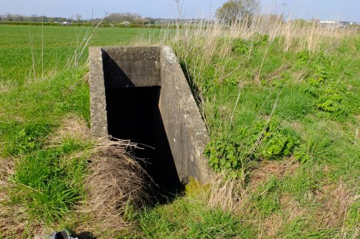
This is some kind of bunker, it has a chimney but no windows or pill-box style slits of any kind. Inside was fairly fresh water full of duck-weed (or something similar).

The next bit involved crossing the old runways by a public right of way. However, something got in the way. There is a new housing estate being built. No signs of the path were visible nor were there notices on lampposts. I dropped in the housing office. The woman there didn’t know where the path was diverted to, but was adamant that I couldn’t pass through the building site. Obviously.
I knew that but she tried to divert me along a road. I didn’t want to do that, lie path must be somewhere. She then said ‘I’d have to say the path is closed’. No it can’t be, that would be illegal.
What home is it if you don’t know but prefer to say something that is wrong.
As it turned out, I found it behind a supermarket, against her advice.
The rest of the route map very nice. There were a few fallen massive trees to clamber by.

The day’s total milage amazed me. More than Ten miles. I had imagined about six. For 2,500 calories, I felt remarkably fresh despite feeling ill yesterday. What am excellent way to recover.

Testing the kettles.

9°C, sunny with showers.
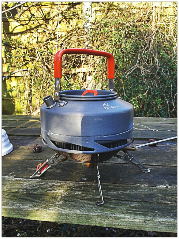
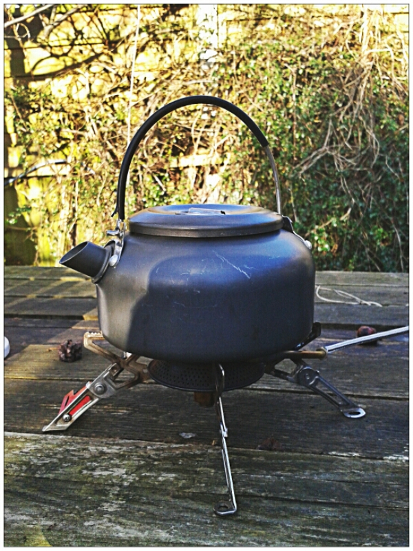
I’ve tested the new kettle today. The new one, with a heat-exchanger on the bottom promises faster boil times. Cold mornings can be a problem on a camp because the low temperature dramatically affects the time it takes to make breakfast. Maybe like me, you really want a coffee first thing to start the day.
To test these pots, I put 400ml of your at the same temperature. I timed each pot to the point when steam appeared when I hit Stop on the stopwatch. The stove is a Primus, the type with a hose and a loop of pipe that is pre-heated by the flames.
Here’s the results:

Plain kettle.
3’10”, 130g.

Heat-exchanger Kettle.
2’40”, 250g

Heat-exchanger Pot.
4’10”. 280g.

I’m a bit worried about the last result. The gas can chilled so much that it froze to the table. Gas pressure drops away dramatically when cold. This may have lengthened the boil time despite the heat sink.
Here is a close-up of the heat sink in case you’re wondering what it means. The idea is to increase the area in contact with the flames. This folded metal has a larger surface area and also channels the hot gas along the pot’s base.

In conclusion, I think the heat-exchange pots are worth having for the boil times. The only disadvantage is the extra weight.

Kinder downfall

10.20am Grey start with hill fog visible above 400m. heavy rain later.kinderdownfall

Walked with Chris along the southern edge of Kinderscout plateau. Once on the plateau, we took a diversion to see a WWII crash site then returned to our main route.

The intention was to see Kinder downfall after a night of rain. We even considered the possibility that the downfall would blow upwards. The waterfall is at the head of quite an angular valley facing the oncoming wind. As it turned out, visibility was so poor, <50m, we could not see any water although heard it clearly.

Rain started around the time we descended becoming quite heavy as we popped out of the cloud base.
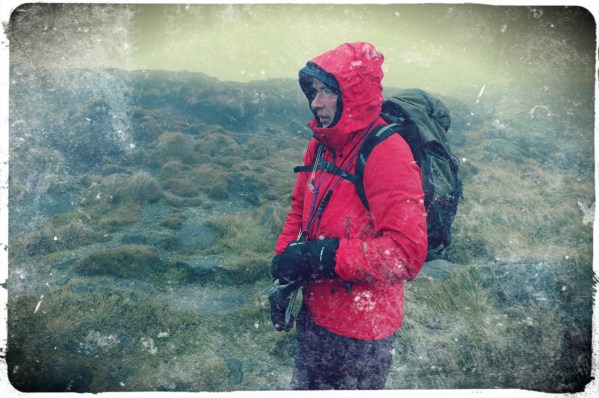
I had a flask of hot water waiting at the car. The choice was soup, coffee or tea in the form of sachets or infusion bags. the kit list was about right. I had normal walking trousers plus thermals under. Even when the rain started, I didn’t feel such a strong urge to put the waterproof overtrousers on.
Note for future: (1),this worked really well. the water had kept hot for 8 hours. If I were to take a flask on the walk, it should be a bit smaller than this one. I’ll keep it for sharing.
(2),I barely used my new camera, but it’s better to take a light camera and not use it rather than a heavy one and not use that. One problem, it has a strong magnetic field. It deflects the compass by a good 30°C. It’s awkward taking compass readings at arm’s length.

3: Carned y Gribeau and broken bridges.:

9°C. fog and no wind, no change from yesterday.

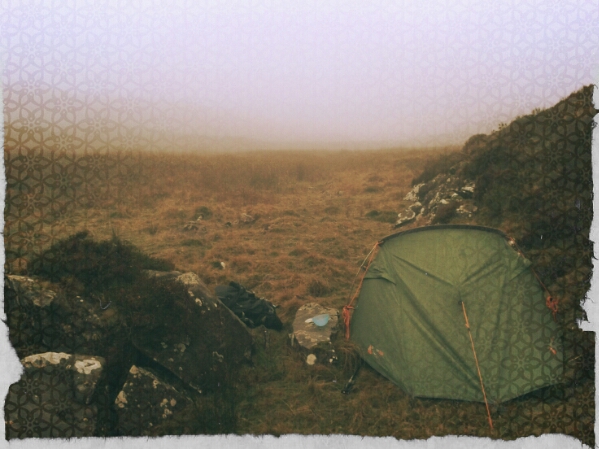
Wild-camp-> end: Woke to more fog and the sound of grouse. The night was utterly silent apart from the gurgling of the spring. Occasional soft drizzle and the odd waft in the calm air.

Back to the fenceline and head north. Back at L. Edno was a big pile of rubbish caught in a fence. The day before, made a note of this and returned to clear as much as possible. My storage was limited because I had my own rubbish, but I got the worst of it.
Next, walk north along the fences again. Net a fell runner heading south who seemed a bit troubled by the navigation. I know the conditions are tricky, but all he has to do is follow the fence line. His route round Edno is unnecessary, and probably slippery.
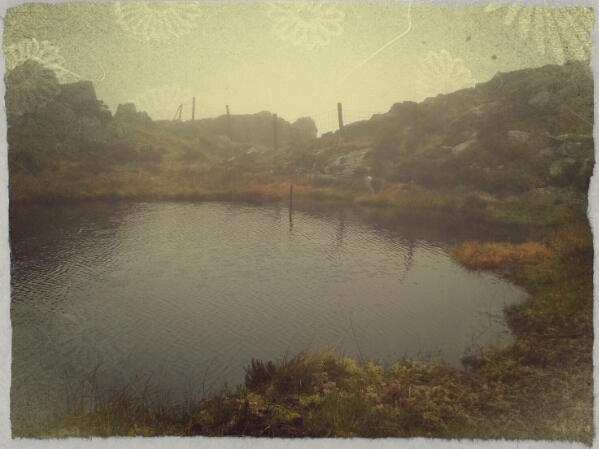
I continued passed the bwlch onto Carned y Gribeau. There was a brief moment of clear air which urged me on. The summit has a nice little lake which made a good place to shelter and eat.​
 For a small lake, it was amazingly deep. Even at the edge, I could plunge a fully extended walking pole.

The descent was aimed for the footbridges at SH673560. the ground in that area was horrible to walk on, lots of plunge holes and hidden streams. It was a struggle to get there only to find the bridges long destroyed and deeply rusted. Take note, they are clearly marked on the OS map, but not on Harvey’s.

Eventually, back at the car, I was glad to get my wet boots off and dip in the lake to wash my feet. You have to treat wet feet as soon as you can to prevent unspeakable problems later.

2:Wild camp in the Molwynion

11°C, hill fog above 300m. Light SW.
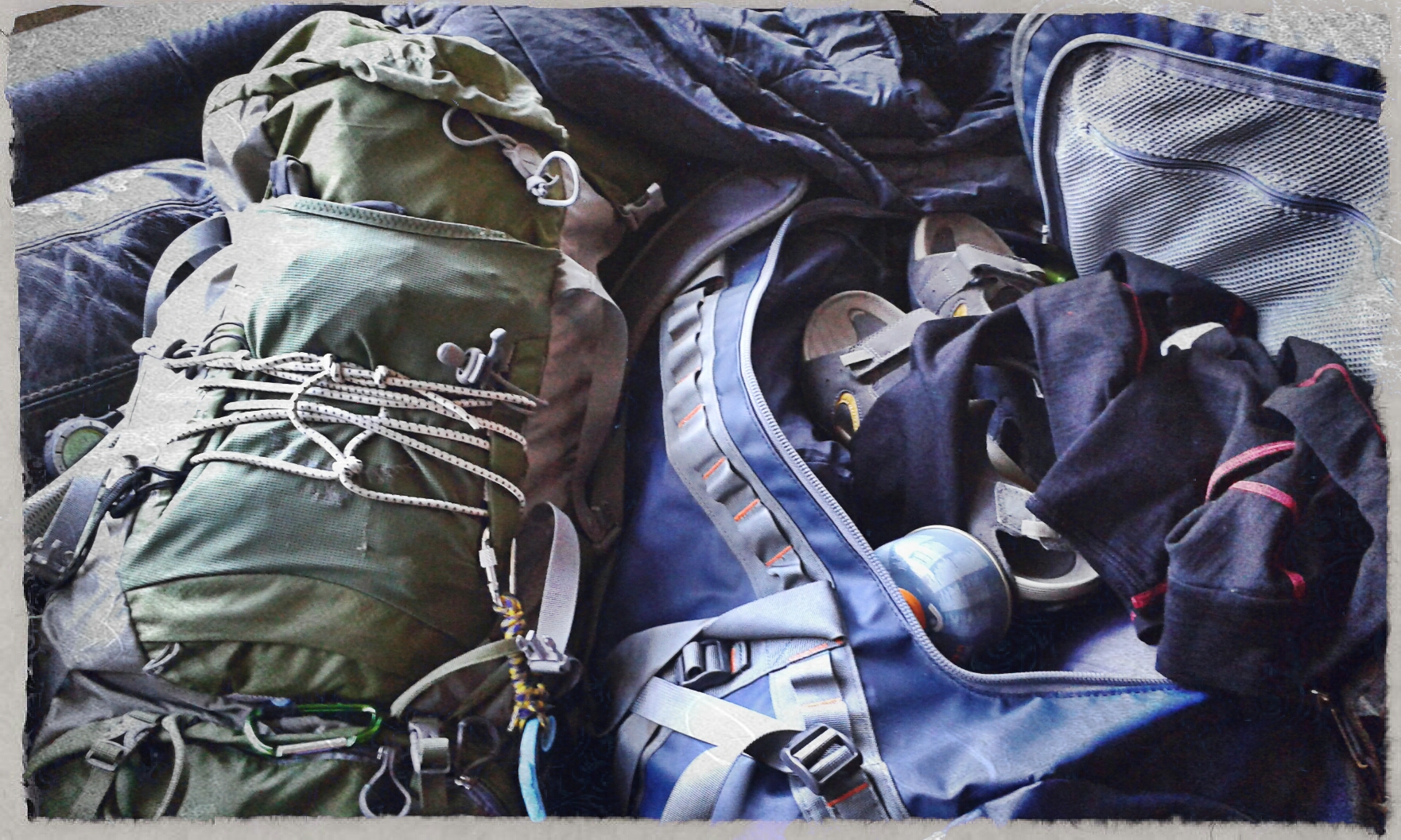
By the time I broke camp at Hadfod y Llan, and re-packing my expedition bag, it was 11am.
I parked by Llyn Gwynant and started the day’s walk. The first part was through dense forest. Autumn looks different here, colours on the ground are very vivid. Even in the forest, bracken was almost fluorescent. I should have stopped to take more photos but the day’s walk is long.
Wild-camp after a 5 ½ hour walk in hill-fog. START: Llyn Gwynant then walk up the woodland to the hills (SE). Hillfog above 300m, no wind so no change.

Pitched at the top of Cwm Edno.

Lots of micro-nav Llyn llagi was invisible though I could hear it. I actually found the turn to make the gully onto the plateau. I missed it last time in clear summer air. I managed to pass Llyn yr Adair without seeing that either. Heading east, eventually I met the fenceline to confirm my position. There is a real complex of hollows, valleys mounds and mountains here. An area worth more exploration.
Northwards eventually, I got to Llyn Edno, my intended camp. To avoid the cool breeze, I headed down to Cwm Edno and found an ideal spot next to a spring.

Looking for a bag.

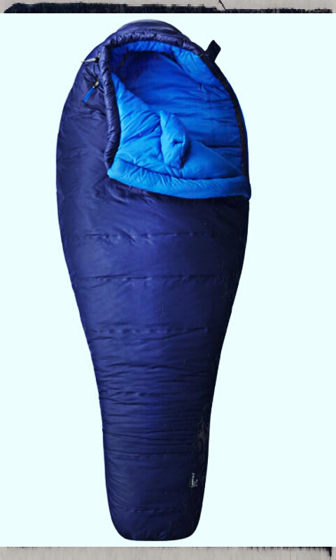
I’m after a winter sleeping. I’m in the Mountain Leader consolidation period where I need more mountain days (and nights). While I’m searching for a new bag, I can’t develop my mountain Dlog.
Why hesitate then? You may ask, but not that many bags meet my requirements:
Long, at least 215cm internal length,
Warm, cosy down to -6°C,
Compression, packed down, it must fit into my expedition rucksack.​

This one is top of my list.

There are a few bags that may suit. Mountain hardwear, Montaine, and Snugpak.

Once equipped, I am free to have adventures. Camp near Llyn Edno, explore Moel Hebog and then the Berwyns. I plan to go in a few weeks, at half-term. At least one wild camp too.

Gold and Silver qualifying expeditions.

One cool and windy week in the black mountains, South Wales.​

On the road to Cafl-y-Ffin

Chris took the Gold group and I did the Silver with Carl.
Silver do 3 nights and Gold 4. Carl took the Silvers home and then I stayed with Chris to cover the Gold’s last day. Most of the Silver girls were carrying heavy bags, up to 16Kg which is a bit much for the smaller ones. It turned out that the excess was clothing. Many brought a change of clothes for each day. The Golds didn’t make that mistake, but conversely, they were cold at night. Mind you, the Gold group complained of cold too. Especially the sole male in the group. He was the only one sleeping alone, (as far as we know).
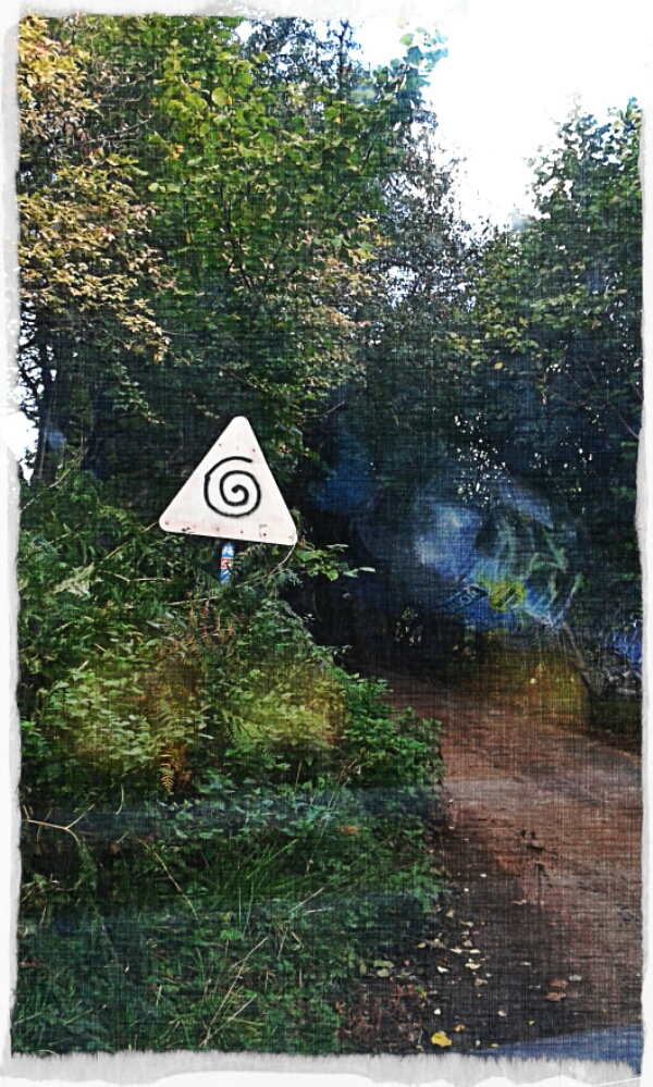
The picture above shows a defaced sign in one of the narrow lanes. Many were so narrow that both sides of the minibus were scratched at the same time by overhanging vegetation.
The staff base, a youth hostel, was up to am hour away from the kids’ camps. In response, Carl and I drove over after supper and pitched in near the gold and silver groups’ site. They were all quiet and inside tents, probably asleep by then, 10pm. It turns out that most nights, they were asleep by 7.30pm. That means nice, long sleeps which can only help their daytime progress.

In the end, they all passed easily. On the return journey, they seemed less tired and generally satisfied. So were we.

Packing for DofE, last expedition of the year.

12°C, rain.
Gold and Silver groups go on qualifying this coming week. I think they’ll be fine, but the conditions are very different to their summer Practice trip. A new terrain, The Black Mountains, earlier sunset and cold nights.​
Staff are staying in a Youth Hostel, but a few of us are taking light camping gear for a planned wild camp. The kids will break camp before dawn and we would like to be on the ridges before the get there. So Carl says, why not camp up there. He wants to bivvy, I will take both a bivvy and the small tent. We both want some mountain days.
It would be nice to appear at the and of a long climb to encourage the kids. Or, help with any problems.
I hope they did some preparation over the summer to keep fitness. Their practice was very good.

Crash sites.

Up to now, I have found air crash sites while hiking. Remote mountainous areas are a threat to low flying military pilots. Our intended camp was confirmed when we found aircraft wreckage by a small lake. We all pitched together by some crags.
On Mull, a Dakota; Dark Peak, a Lancaster and the Carneddeau, a Camberra.

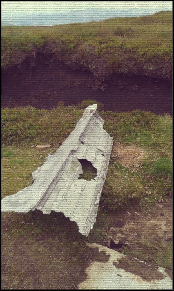
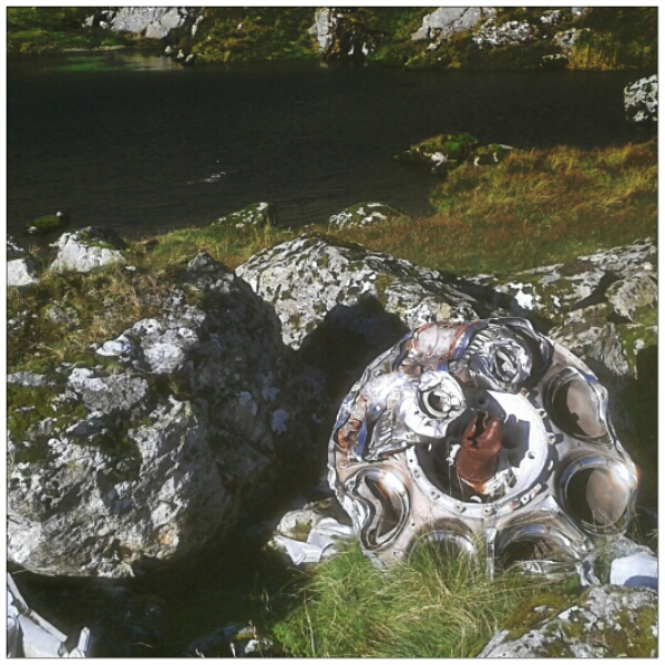
This picture was taken on the Dark Peak near Kinderscout. The plane was well scattered such that I only saw one engine and some pieces of fuselage. The engine was a radial, possibly a Hercules.

RAF Camberra , here is a turbine engine of the type common in early post war jets.​

This next shot shows what I think may be a tail pipe, also from an engine.​