ML training expedition.

12°C, cloud from 50m, strong wind 40mph at 900m.​

Heavy pack was a drag on this climb. But to walk in a group, I was not left behind even though my bag was the heaviest (at 18kg).

We got to Foel Grach and I took the navigation from there to the next summit. 40mph wind and rain was quite a force away from the shelves of a wall. Paths are, however; easy to follow up there. Jenny navigated to the next summit which has a mountain rescue shelter that we recovered in for a while.
Descent to the lake also offered some respite, although the wind dropped, gusts were stronger.
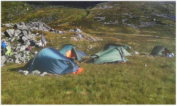
Our intended camp was confirmed when we found aircraft wreckage by a small lake. We all pitched together by some crags.
I was glad to climb in and change into some dry clothes.
Night navigation: u that was hard. Wind, hill fog and bouts of rain made visibility poor at best. We had to figure where we are at any time from the slope of the land in a circle 20m around. Occasionally, you can use a arch as a landmark, or grass but that’s all. But, it is actually enough.
Two obstacles were tiredness and the visibility. If only there was a clear sky above.
I think I did okay.
Mike, the trainer thought so too. However, I have a few problems to solve:
Poor vision in rain,
Keeping warm,
Feeding in the night.
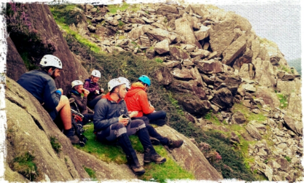
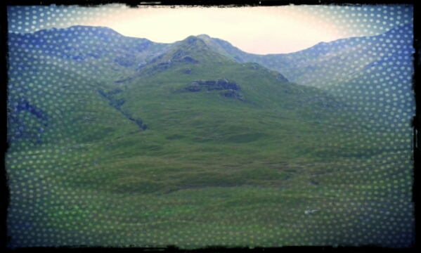
Mountain Leader training.

Day 1; micro-navigation,

Day 2: moving on steep ground. We climbed Pen-yr-ole Wen by the route from Llyn Ogwen. Our tutor demonstrated how a rope could be used on the scrambling section to get a group of novices up.
Day 3: steep ground practicing with ropes. Tried out several belaying types and the Sth African Abseil method. That one could be very useful on solo trips. Then we climbed up to L Tryfan ( the one by the Llanberis track).
Day 4: Confidence roping and river crossing in Nant Gwynant.

Day 5 & 6: expedition. This 36 hours of my life deserves a separate post.

Cluanie Ridge

Creag a’Mhain, (m), 947m,
Druim Shionnach (m), 987m;
Aonach air Crith, (m), 1021m;
Maol Chin-dearg, (m), 981m;
Sgurr an Doire Leatham, (m), 1010m;

Started with cloud at 800m with some breaks. After tricky path finding up Drochaid an Ullit Ghubhais it got easier, though steep. Once on the ridge, paths were easy to find despite no visibility. Concentration was needed to keep a track on location. Ahead lay a string of summits and bealachs. With visibility no more than 30m, other techniques were necessary to keep your position in mind. At 12.30, I pulled the storm-bivvy bag out and climbed in to read the map and eat sandwiches. These things are amazingly warm, even by myself.

On the next summit, a guy appeared out of the mist heading my way. He was James, a real Munro bagger. He had 90 odd and was keen to get as many as possible today. He suggested we walk the whole ridge together to his car and he could drop me back at Cluanie Inn. That’s not much more than my planned walk and I’d get 7 munros ‘ticked off’.​

Part of the ridge, from the road.

Finally, the skies started to break on approach to the last climb. The bonus munro would be free of hill fog. Better than that, the light sharpened revealing fine views south into the deep Glen and even out to sea. Skye could be seen and possibly, Rum.
Feeling tired and thirsty, I hoped for an easy descent. But no, the rounded boulders underfoot would require concentration all the way down from 900m to the river. On another day, that would have been fun. I will have to come back.

Glen Affric return.

Aonach Meadhoin, (m), 1001m;
Ciste Dubhe, (m), 929m;

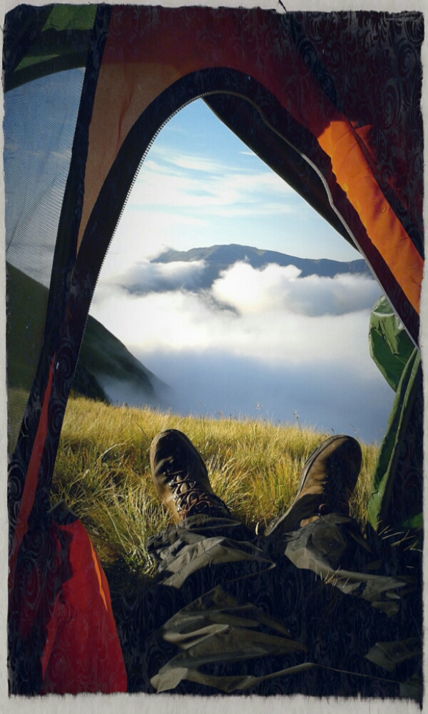
Woke at 6am to an inversion in bright sunshine. Look:

Chilly but what a gorgeous way to wake up. This will be one unforgettable day. The landscape was like a one large white duvet with pointed summits poking out. In places the cloud peeled over ridges and spilled down into hanging valleys. Occasionally, wisps of cloud seemed to pass by at knee level.
Breaking camp and collecting water took nearly 3 hours. I watched the clouds fall over the ridges, as the deer watched me. One solitary antlered head stood on the horizon 200m away. Then it vanished only to reappear leading a herd over the spur to the north.
Not 15 minutes later, another herd split south and downhill. I think I was near their morning watering hole.

Anyway, I set off eastwards to resume my route. A few summits passed easily. Then a big descent into the bealach where I’d planned to spend the night. It was darker down there, under the cloud. Bogs broke out of the grass and looked less appealing that the bealach I left a few hours earlier. This is the place I visited last year on that short walk up Am Bathach from Cluanie. Time for sandwiches before a big climb up the last munro.

I say ‘last’ because I have scrapped the idea of climbing up Beinn Fhada. One guy, yesterday, said that was a 9 hour walk in itself. So a change of plan, head for the SYHA in Glen Affric and then back to Morvic.

I can’t see how the original route could have worked, there was no sign of a river crossing north of Ciste Dubhe. You have ot divert a few km east to reach a little suspension bridge near the Youth Hostel. There, I found a sign offering tea & coffee. People in there was very calm and friendly, nice to chat to as I drank from a large pot of tea. However, they did tell me that the walk to Morvic is five hours. Blimey, five hours! that’s five hours to add onto 18.30pm. That means arriving at the car after 11.30pm, better press on then. Of I went only to stop in a dip to cook some cous-cous.

I did briefly consider stopping the night at the bothy at Camban, 2km west but it was filled with a noisy group. The walk down the glen was wonderful despite the building rain. I wrapped up and eventually passed a steep down-section by a very fine waterfall at the top of Allt Grannda. The cascade itself was only part of it, the falls were framed by majestic and sublime black sharp cliffs. I must go back there, this is no time to stop and take photos.

Eventually, the path wound round to the south and crossed a wooden bridge by a hut- Glanlichd House. A rumbling landrover drove up to the house so I moved on. Then the rumbling came back, was he suspicious of me walking by the house? I stuck out a thumb.

That hitch back saved me hours and hours. We belted along in that landrover, it rattled and ground along a quite a speed, even the cattle had to run out of the way. He was kind enough to drive me right up to my car.

Five sisters, d1

Sgurr nan Saighead , 929m;
Sgurr Fhuaran, (m), 1067m;
Sgurr na Carnach, (b), 1002m;
Sgurr na Ciste Duibhe (m), 1027m;
Sailag, (m), 956m;
Sgurr a’ Bhealaich Dheirg (m) 1036m;

Full kit, the Banshee tent, sleeping bag and food for 3 days. With water, it weighs in at about 16kg. It’s a comfortable bag so walking with it is not really so bad. Going uphill makes it noticeable. The initial climb was hard work. Fortunately, once on the ridge, the day will be easier.
The first summit was in cloud and a light breeze. Some breaks appeared quite soon.
Weight: the bag weighs roughly 16kg, but with water and the camera, considerably more. I felt this weight on the climbs. On the level, that is such comfortable bag that the weight didn’t matter.

Water,  became a real problem on Sailag. This is a more grassy mountain with no visible, or audible springs.Thirst was a serious problem for over 2 hours. Over the spur, a small Lochan and springs in the Glen to the north, not far.
It’s late, 8.30 and I can’t see there being time to make the next summit as planned. So make camp.​

An early picture, the day cleared up brightly by lunch.

Gold, day 4.

I hiked with MapMyRide+! Distance: 10.84km, time: 04:18:00, pace: 23:49min/km, speed: 2.52km/h.

http://mapmyride.com/workout/1624883612

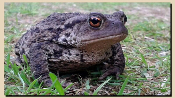
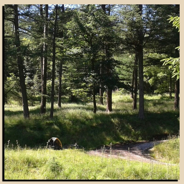
This guy came out from under my flysheet when breaking camp.

Finally, a successful day.. Carl and I hiked up onto the plateau ready to intercept the group. For us, that was lots of micro-navigation across the moorland spur.the northern edge above a scarp would give a good view in binoculars.
The radio reception was clear there too. But, unfortunately, we’d missed them. So quickly, we plotted a cross country route that should take us back to the finish point. From featureless moorland to a path is a harder target to hit. Eventually, a path that was hidden by bracken appeared. Again, our nav. was spot on.
Passed a small reservoir and onto a bridal track then in front, there they were, all finished and relieved.
The girls were patching themselves up, some cleaning legs; others, treating blisters.

They have come a long way, 60km and metaphorically too. I plan to suggest that we add extra training for those participants who skip Silver and go straight to Gold Award.

Gold, day 2. Ferry water.

Very hot day, 31°C, 0 cloud breeze higher up.

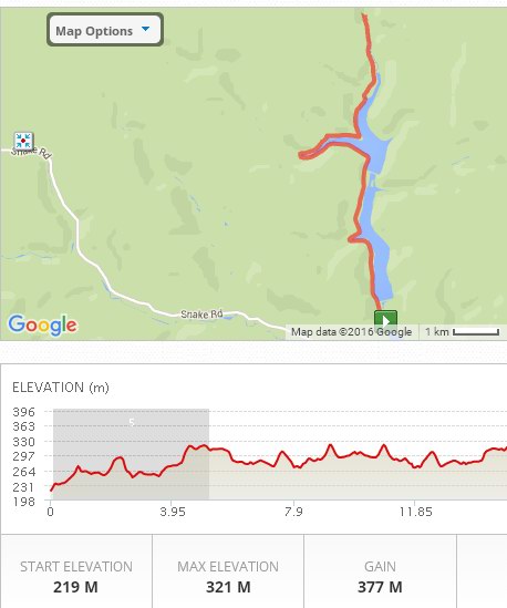
I biked with MapMyRide+! Distance:19.75km, time: 03:20:00, pace: 10:08min/km, speed: 5.92km/h. It was hire bike with a kiddie trailer filled with 20kg of water.

http://mapmyride.com/workout/1624972874

Today’s route is up the side of both reservoirs and then across the moors to Midhope. For water supplies 2 staff came down from the north onto the moors and I hired a bike and rode up the reservoirs to the Slippery Stones.
It was an ordinary mountain bike with a kiddie trailer which we filled with 5litre water bottles and my rucksack.

The group can fill up from my supplies and make the climb to the next checkpoint with water in 5Km. That was the plan anyway.

derwent_mmr

Bike route up the reservoirs’ west banks.

That bike was tremendous fun to ride. I had 4x 5litre bottles in the trailer. When the water started to rock back and forth, the water in all of them synchronised pushing and pulling the whole bike. From the front, the trailer lunged at a constant rate, it was like riding a rocking horse.
I wondered, as I rode, what’s the etiquette for this? If a normal mountain bike overtakes, and I chase him down; is that ethical when he believes I have kids in the back? The ride was hot and sunny and lasted about an hour, nice though.
I set up my checkpoint in the trees, lay down and watched the dragonflies. The sandwiches were good.


The group arrived
about half an hour late. That’s okay.
I led them down into the trees and settled them down to cool them off.
They weren’t in the mood to continue, it was too hot and they couldn’t face the climb. They also feared another evening arriving in camp after 10pm. All group cohesion had gone. Some were game to continue, some were persuadable but that’s no use if the remainder refuse. I tried my best, I really did, but got nowhere.
The clock moved on, the hire bike has to be back at 5pm. I had to move.

In all, I spent about an hour trying to get them to complete the hike. I tried everything I could think of. “Come and wash your feet in the river”, (that didn’t work) but washing hands and forearms in the cold water went down well. They cheered up; well, not all of them.

But had to go soon.

Riding back down, I crossed Chris in the minibus and explained what had gone on. He took the water and drove north.
With the bike returned on time, I relaxed with a nice cup of tea. Another hour passed, and the silver minibus pulled in with the whole group inside.
They had all chickened out.

Gold expedition, d1

I hiked with MapMyRide+! Distance: 14.96km, time: 04:18:00, pace: 17:15min/km, speed: 3.48km/h.

http://mapmyride.com/workout/1624874915

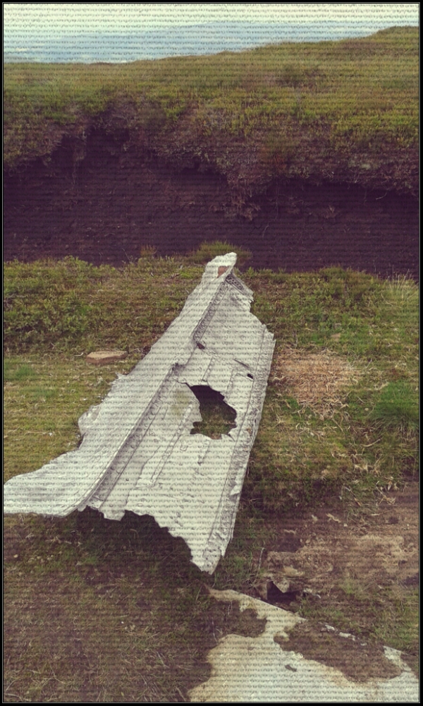
Crash site on the edge of Kinder.


Hot day, our big priority is to take water to the more remote parts of the hill. Today, it’s Kinder Scout. I wanted to meet the groups on the western edge. Here they will have completed the longest dry stretch.
We waited for an hour. Kinder is largely flat on top, so we decided to go up for a better view. The groups’ route was along the southern edge which is well paved. Up some false summits and false headlands we searched. Even better, let’s go to the trig point only half a Km away. Surely a vantage point with binoculars.
This worked, they were on the other trig, about 3Km away. In binoculars, the group were just visible. It was odd though. They were standing about. Why? Then knew we could see them, but not were we were.
A few sharp words over the radio to get them moving. ‘The water isn’t coming to you, and standing there won’t cure your thirst’.
This is a gold expedition, and they expected up to come trotting over to their position.
Both groups arrived after a very long time. Average speed well below 2 Km/hour. This was only checkpoint 2, a long descent was to follow.
We can’t follow the group and had two choices of route, one on the opposite side of the valley they would use. The other was the Pennine Way.
The latter is slabbed so we took that.
What a lovely route it is, slabs all the way across the boggy Moor for at least 5Km. Our speed was fine too, just over 6Km/hour. The sun was striking below angle with a golden light. Utterly beautiful!
Even on reaching the road, Snake Pass was not spoilt by traffic and we sped along in single file, me in front.
A good finish for me. Not so good for the other staff and I’ve groups. They didn’t get down before dark.
These Golds were not prepared for this either, they only had two lights between them, one handheld.
It really shows, that they didn’t do Silver. I really wish they’d come on the silver training days two weeks ago.

Silver Training; day 3.

Day 3:

shorter routes with most kit except tents. Each day we took a different group, today’s were a super-quick team that I worked with on bronze. They were so fast on the descent. Navigation was superb amongst these, my confidence was very high.

Coming out of Castleton, our path off the lane was flooded, the water flowed towards us, muddy and deep. They said, come on, we can do this. They picked a way through the slimy mud and nettles without complaint. That illustrates their whole attitude, they are physically approaching their prime and full of confidence. This group contained all the stars of the recent Sports’ Day.

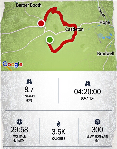
Incomplete route to Mam Tor.

However, on the climb up to Mam Tor, ZK with a recurrent knee injury had it flare up considerably. I could tell she was beyond comfortable. I’ve had knee injuries in the past and know how painful that can be. I carried ZK’s pack up the main climb, despite her reluctance. She clearly wanted to avoid letting the others down when I suggested we get a lift back after the summit. “Z, You don’t have to prove anything, your capability is already clear, we could even start the drive home early if we stop now”. She is a participant who went straight to Silver. Perhaps ZK feels there is more to prove.
Wind at the summit was strong, as it was all along the ridge. They were tired now, at took a break on the ridge.
Immediately, most of them got their phones out. Delighted to have a signal. They buried themselves in pointless online updates. Some had posted videos of talking in silly voices. I can’t understand it myself.

Overall, it’s a big deal for teenagers to walk 7 – 10 miles with a full pack. they find it really hard. They have to maintain the concentration right to the end to avoid navigation mistakes. Mistakes can cost them many hours correcting a wrong direction.

I’m filled with admiration for their determination, their can-do attitude.
Fantastic

Silver Training; day 2.

Low cloud and breezy, rain overnight, 12- 14°C

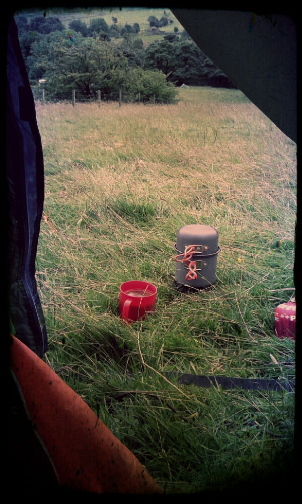
Making coffee from my little hiking tent. About 05.30am.


Day 2: relocate to another camp carrying full packs for about 7 miles over moorland. Staff carried full kit too as we are using the same campsites as the kids. The liked this camp better because of phone signal and no midges.The walk was long though, and galling for the kids I had; it began with a steep climb up Jacob’s Ladder. My 5 were very anxious about it and took several breaks going up.
Once on the Moor, we were in hill fog for most of the way.

Excellent, we can ‘walk on the compass’, pace and get therefore of finding markers on the route. In this case, the markers were lengths of slabbed path between boggy moorland. These girls hit the paths every time, it was working! That cheered me up after the misery expressed on the climb.

Eventually, we started a slow descent and came out of the cloud. Landmarks started to appear and the girls perked up.

On the turn, we encountered that group from a school in Hull. They seemed happy enough despite an error in Nav.causing considerable delay for them.
From this point, the day slowly brightened up and we started to dry out.
The campsite is nice, only marred by the farmer shooting to clear a wood of crows.
Rain blew in on the stiffening wind mid evening. Staff sheltered in the minibus.